Country:

 City:


Park in the Étival Lakes car park.
Yellow markings
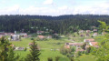
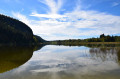
(S/E) Start the walk on the road – closed to traffic from the car park – which runs alongside the Grand Lac. Continue to the right along the road, closed to traffic, which runs alongside this lake.
(1) At the end of the Grand Lac, carry on straight ahead along the road.
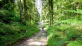
(2) At the bend in the road, carry on straight ahead along the forest track which climbs towards the Molard de la Lière.
(3) Leave the forest track to the right, taking a forest path that continues the climb towards Molard de la Lière.
(4) At the fork in the road, turn left and complete the climb to Molard de la Lière.
End of signposting
(5) Turn left onto a forest track that descends towards the Lison valley. The paths are well marked and there are a few signposts for the cross-country ski trails, making it easy to find your way on the map.
Important note: the descent route shown on the IGN map no longer exists, at least for the first two hundred metres.
(6) Turn right and continue along the forest logging track. Follow the GPS track closely, as there are logging tracks not shown on the IGN map that cross the route.
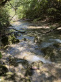
(7) Take the hairpin bend and continue to the left along a forest track that runs alongside the Lison as far as its water intake. Carry on straight ahead, due north, up the Combe du Tour until you reach a Fork in the road.
(8) Turn left onto a forest track that climbs towards a forest road. Turn right and follow it for about 150 m.
(9) Turn left onto a ridge path towards Lac de la Fauge. You’ll come to a fork.
Yellow markings
Turn left and join a road.
(10) Take a sharp right-hand bend and follow the road which runs alongside the magnificent Lac de la Fauge. Continue along the forest road until you reach a path heading off to the left.
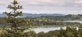
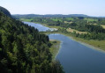
(11) Turn left onto a ridge path heading due north, which offers lovely views over the Étival lakes, and continue to the viewpoint.
(12) Walk back up the road for about 50 metres to the right, turn left and continue towards Étival along the ridge path until you reach the D308.
(13) Turn left and follow the departmental road for about 200 metres.
(14) At the bend, leave the road, turn left and take the path that runs alongside the Petit Lac d’Étival and leads back to the car park (S/E).
 Visorando Member
 Easy

 Tourist office