Country:

 City:


Blue/Yellow signposting
(S/E) From the car park in front of Vernajoul Town Hall, walk alongside the cemetery along Rue de Latière (due south). Just before the end of the road, head up to the right towards the woods and follow the main path.
(1) When the slope levels out, take a narrow path on the left which leads to a ridge at the edge of the woodland along the Ravin du Rec de la Coume. Go round this ravine to return to the woodland. The path passes an old drinking trough (le Grasal) and then a spring (font del buòu). The path then follows a hedge between two meadows, which you emerge from after a short, steep climb.
(2) Then take the path on the left, which begins to descend. Continue through the woods; at the first junction (cairns), head up to the right (blue and purple markings). Leave the woods and arrive at another junction on the slope.
(3) Turn left onto a gently descending path which leads straight to the Croix du Saint Sauveur (a magnificent viewpoint over Foix, the castle, Mont Fourcat, etc.).
(4) From the viewpoint, continue down towards Foix and turn right, heading north-west.
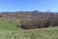
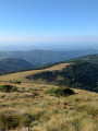
(5) At the first opportunity, after about fifty metres, take a small path that climbs up to the right. You will then reach the ridge overlooking the entrance to the Barguillère valley, offering a panoramic view of the Prat d’Albis ridge. Continue along the southern slope, skirting the edge of the woodland and following the markings until you reach a cairn indicating the path leading uphill to the right. Climb up to the pass, then follow the path to the left along the ridge.
(6) Stay on the ridge path, turning left again at the first three-way junction (cairn, markings on the ground). Stay at the edge of the woodland, leaving it on your left with the meadow on your right, until you reach an oak tree standing slightly apart.
(7) This tree marks the point where the path—which becomes clearly marked—enters the woodland. Follow the cairns and markings until you climb back up onto the ridge. When you reach a large boulder at a small pass (last panoramic view to the south), leave the ridge by crossing the meadow to the north (look out for the large, clearly visible cairns on the other side of the meadow) and take the path that climbs back up towards the woodland, due north. Follow the fence until you reach a gate, which you leave on your right.
(8) Follow the wide path down to the left, towards another gate, which you go through to cross the hamlet of Lizonne.
(9) As you leave the hamlet, take the path on the right to pass in front of the wash house. Then leave the road and continue along the path which descends alongside the enclosure.
(10) Join a wide path on the left, which continues to descend.
(11) At the junction, ignore the path on the left and continue down the slope to the right.
(12) Leave this path only when a well-marked track climbs up to the right; take the Pelade path which, running along the hillside past the old agricultural terraces, leads to a magnificent woodland meadow planted with oak trees. At the junction at the northern corner of this meadow, turn right onto the wide path lined with low walls. Return to the path taken on the way there
(1) Follow the route back to the car park at Varnajoul Town Hall (S/E).


 Visorando Member


 Extremely difficult

 Easy