The Renard circular at La Bastide-Puylaurent

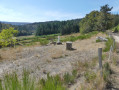
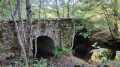
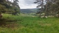
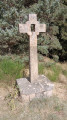
A circular walk above La Bastide, through the Lozère countryside and pine woods.

Details

4095732
Creation:
Last update:
Last review:
  • Walking
    Activity: Walking
  • ↔
    Distance: 3.37 mi
  • ◔
    Average duration: 1h 55 
  • ▲
    Difficulty: Easy

  • ⚐
    Back to start: Yes
  • ↗
    Ascent: + 387 ft
  • ↘
    Descent: - 410 ft

  • ▲
    Highest point: 3,727 ft
  • ▼
    Lowest point: 3,327 ft

Description of the walk

Park in front of the Bastide-Puylaurent Tourist Office.

(S/E) Walk down towards the mini-market and turn left onto the pavement. Cross the River Allier, turn right onto Place de la Gare and cross at the level crossing.

(1) Turn right onto Chemin de Mercoire and immediately ignore the two streets on the right. Follow theGR®7-GR®70signposts along the white track until you reach the top at the five-way junction (elevation 1130).

(2) Turn right at the hairpin bend in the path and continue straight on for approximately 1,600 metres.

(3) Turn right onto the path running alongside the railway line and continue to the tarmac road, the Chemin du Fraisse.
Carry on along this road.

(1) Reach the level crossing by turning left at the end of the street. Continue to Place de la Gare. Turn left, then cross in front of the mini-market to reach the Tourist Office car park (S/E).

Waypoints

  1. S/E : mi 0 - alt. 3,356 ft - Tourist Office car park. Head towards Ponr on the - Allier (rivière)
  2. 1 : mi 0.31 - alt. 3,373 ft - Junction of the circular loop
  3. 2 : mi 1.08 - alt. 3,707 ft - Sharp right-hand bend
  4. 3 : mi 2.11 - alt. 3,340 ft - Turn right
  5. S/E : mi 3.37 - alt. 3,353 ft - Tourist Office car park. Near the - Gare de La Bastide-St-Laurent

Notes

Sturdy shoes, a bottle of water, walking poles.
Convenience shop, restaurants and accommodation in the village.

Worth a visit

Visit to Notre-Dame des Neiges Abbey.

Always be cautious and plan ahead when you're outdoors. Visorando and the author of this route cannot be held responsible for any accidents occurring on this route.

The GR® and PR® markings are the intellectual property of the Fédération Française de Randonnée Pédestre.

Reviews and comments

4.5 / 5
Based on 2 reviews

Reliability of the description
5 / 5
Ease of following the route
5 / 5
Route interest
3.5 / 5
trichosson
trichosson

Overall rating : 4.7 / 5

Date of your route : Sep 29, 2025
Reliability of the description : ★★★★★ Very good
Ease of following the route : ★★★★★ Very good
Route interest : ★★★★☆ Good
Very busy route : No

Beautiful hike, beautiful scenery on the first part, then a very nice pine forest
The only downside is that you can hear the road on the way back. I think I'll do it again one day
Thank you

Machine-translated

JP Nibaudeau
JP Nibaudeau

Overall rating : 4.3 / 5

Date of your route : Aug 30, 2023
Reliability of the description : ★★★★★ Very good
Ease of following the route : ★★★★★ Very good
Route interest : ★★★☆☆ Average
Very busy route : No

A nice little walk, but not particularly interesting

Machine-translated

Other walks in the area

For more walks, use our search engine .

The GPS track and description are the property of this route's author. Please do not copy them without permission.