Country:

 City:
City:


At Chorges, take the D69 leading to the hamlet of Les Andrieux. Pass through it, then follow the small road towards La Montagne and the Col de la Gardette. Park at the Chirouzes car park on the right and take the track opposite to the hamlet of Naune Raze.
(S/E) Follow the track; you will soon reach the GRP® Tour du Lac de Serre-Ponçon trail, marked in yellow and red, and take it to the right to reach the Gontards junction.
(1) Now turn left onto the GR®50, marked in white and red. Follow it slightly uphill, passing through a circular loop at a place called Les Combes. Continue along the GR® to reach the Coste Lébrière crossroads.
(2) Leave the GR® here and turn right onto a pleasant path. Walk past the drinking troughs and enjoy the lovely view from here. Continue uphill until you reach a crossroads near the Torrent de Réallon.
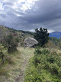
(3) Turn left just before the stream towards the Col de Chorges. Climb up a small grassy path. Continue straight on at the next junction. Then follow the markings of the yellow-painted boundary stones, or the posts or cairns in the mountain pastures. Turn right into the hollow of a small valley and follow the track, which disappears under the grass shortly afterwards. You will reach the edge of a ridge at a place called Pra Gasta.
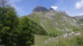
(4) Follow the ridge, then climb up a scree slope which may contain a stream. Move away from it by turning right, following the yellow posts and cairns. Continue across the mountain pasture, then cross another scree slope. Proceed across a series of scree slopes and, via a final difficult ascent, reach the Col de Chorges.
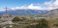
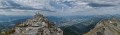
(5) Then take the ridge on the left, proceeding with great care up a final rugged and fairly steep climb to the summit of Piolit.
(6) Retrace your steps along the same route back to the junction on the edge of the Torrent de Réallon, which you passed on the way up.
(3) Head straight ahead and wade across the stream. Go through a cattle gate and continue along the path to the right. Take the small path that goes round a cow pasture. Continue straight ahead at the next junction and follow the track to reach Pré du Clot.
(7) Stay on the track to the right and you’ll soon reach a dirt car park. Go through the gate via the pedestrian archway, then carry on to reach a crossroads shortly after Pré la Font.
(8) Leave the track and take the path that descends to the left, heading due south, which becomes a wide path next to an isolated house. Continue the descent by taking the track on the right. Pass by the Gontards farm and reach the initial crossroads you passed on the way out.
(1) You will then rejoin the road; take it straight ahead to reach the Chirouzes car park (S/E).
 Visorando Member
 Moderate

 Very difficult