From Les Belettes to the Bois de Ban

A walk through the woods, consisting of two circular loops with a return section between them.
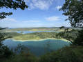
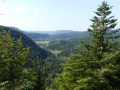
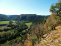
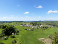
View over the Billaude Valley from the Rocher de la Baume viewpoint. Option to extend the walk by visiting the village of Châtelneuf. The walk ends in the Billaude Valley, where you can see sections of the ‘Ligne des Hirondelles’ from above.
A walk with no major difficulties, though some sections may be muddy due to forestry work. It winds through a pleasant deciduous forest; the paths are marked in yellow and red.

Details

31079225
Creation:
Last update:
Last review:
  • Walking
    Activity: Walking
  • ↔
    Distance: 5.47 mi
  • ◔
    Average duration: 3h 10 
  • ▲
    Difficulty: Easy

  • ⚐
    Back to start: Yes
  • ↗
    Ascent: + 741 ft
  • ↘
    Descent: - 722 ft

  • ▲
    Highest point: 2,779 ft
  • ▼
    Lowest point: 2,326 ft

Description of the walk

Park at the car park in the centre of Pont de la Chaux at the car-sharing area (D75).

(S/E) Walk a few metres uphill towards Châtelneuf along the road.

(1) Turn onto the small path to the left of the road. It looks like a stream bed, but this is indeed the path you need to follow. Join a road, follow it to the left for 100 m, then turn right heading due north. Pass a track on your right and join another at a fork.

(2) At the Bramard sign, cross the stream bed and head up the footpath. You’ll come to another fork.

(3) Turn right, heading north, pass a path on your left and reach a fork a little further on.

(4) Turn right towards the Rocher de la Baume viewpoint.

(5) Turn back.

(4) Turn right and carry on. Pass a path on the left and come to another fork.

(6) Turn left, heading south-east, and return to a fork you passed earlier.

(3) Turn right, heading in the opposite direction to the outward journey, until you reach another fork, which you also passed on the way out.

(2) This time, at the Bramard sign, turn left, heading north, onto the Piste Forestière de Sous la Baume, which goes round Les Belettes. Further on, it turns south-east and joins a tarmac road at Les Noisetiers. You’ll arrive at Rue des Champs Taillards; follow it to the left to reach the car park a little further on (S/E).

Waypoints

  1. S/E : mi 0 - alt. 2,356 ft - Parking: car-sharing area. D75 - Lemme (rivière)
  2. 1 : mi 0.05 - alt. 2,375 ft - Junction of the first circular loop
  3. 2 : mi 0.93 - alt. 2,457 ft - Bramard. Junction of the second circular Les Belettes loop
  4. 3 : mi 1.64 - alt. 2,690 ft - Junction of the 3rd circular loop of the viewpoint trail
  5. 4 : mi 1.93 - alt. 2,766 ft - T-junction (A/R) towards the Belvédère
  6. 5 : mi 1.98 - alt. 2,779 ft - Rocher de la Baume viewpoint
  7. 6 : mi 2.59 - alt. 2,621 ft - Junction, turn left
  8. S/E : mi 5.47 - alt. 2,362 ft - Parking: car-sharing area. D75 - Gare de La Chaux-des-Crotenay

Worth a visit

La Baume viewpoint (view over the valley as far as Champagnole).
A few sections of the Hirondelles line (bridges).

Reviews and comments

4.2 / 5
Based on 4 reviews

Reliability of the description
4.3 / 5
Ease of following the route
3.8 / 5
Route interest
4.5 / 5
User 27204374

Overall rating : 4.3 / 5

Date of your route : Oct 31, 2025
Reliability of the description : ★★★★☆ Good
Ease of following the route : ★★★★☆ Good
Route interest : ★★★★★ Very good
Very busy route : No

Beautiful circular above the Pont de la Chaux
Very pleasant route through the woods with some nice spots to see.
The app's directions are very good.
Due to the rain, we had to cross a stream over rocks.
This hike is rated as easy, but I would rate it as moderate.
There are many fairly steep hills.

Machine-translated

vetophillyon
vetophillyon

Overall rating : 3.7 / 5

Date of your route : Aug 18, 2025
Reliability of the description : ★★★★☆ Good
Ease of following the route : ★★★☆☆ Average
Route interest : ★★★★☆ Good
Very busy route : No

Two concerns:

  • the first concerns the route: since the day before, I had lost access to the IGN maps, even though I am a Visorando member, which made it difficult for me to follow the route correctly. I don't know why, but apparently I was suddenly no longer a registered Visorando member and therefore only had the free version of Visorando on my mobile phone; I was asked to re-enter my email address and access code. i was on holiday and didn't have my code with me (I had forgotten it). Why did Visorando suddenly delete my IGN maps while I was out? At the time, I was furious. I had to wait until I got back to Lyon to enter my email address and code, then reset my account to recover my routes and IGN maps.
  • second point: at the end of the hike, near Les Belettes, the route through the woods is very poorly signposted; at times, there is no path at all. What's more, you come to a housing development under construction, with barriers blocking the way. There is no other route. I therefore had to move two barriers to get through, which was quite difficult.

I look forward to hearing from you
kind regards, Mr Philippe Brachet.

Machine-translated

User 10639807

Overall rating : 4.3 / 5

Date of your route : May 19, 2025
Reliability of the description : ★★★★☆ Good
Ease of following the route : ★★★★☆ Good
Route interest : ★★★★★ Very good
Very busy route : No

Beautiful views of the mountains

Machine-translated

ValB6287
ValB6287

Overall rating : 4.3 / 5

Date of your route : Dec 16, 2023
Reliability of the description : ★★★★★ Very good
Ease of following the route : ★★★★☆ Good
Route interest : ★★★★☆ Good
Very busy route : No

A short, easy walk through the forest – very pleasant on this cold but sunny day. Do take care, however, on the way back from point 2: the (yellow) markings are sparse and we found it a bit tricky to find our way at various junctions.

Machine-translated

Other walks in the area

For more walks, use our search engine .

The GPS track and description are the property of this route's author. Please do not copy them without permission.