Four à Chaux circular walk, from Pointe de Doubidy, starting from Keramenez

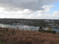
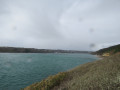
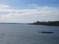
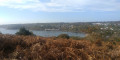
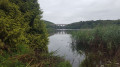
Four à Chaux, 360° panoramic view from Pointe de Doubidy or Pointe de Rozegad. View over Anse de L’Auberlac’h, Lauberlac’h harbour and the valley.

Details

31177040
Creation:
Last update:
Last review:
  • Walking
    Activity: Walking
  • ↔
    Distance: 2.80 mi
  • ◔
    Average duration: 1h 35 
  • ▲
    Difficulty: Easy

  • ⚐
    Back to start: Yes
  • ↗
    Ascent: + 331 ft
  • ↘
    Descent: - 331 ft

  • ▲
    Highest point: 259 ft
  • ▼
    Lowest point: -3 ft

Photos

Description of the walk

Park at the Four à Chaux car park.

(S/E) Head west towards the sailing school, then walk round it to reach the coastal path. Turn left onto the path and follow it. At the junction, turn right to reach Pointe de Doubidy. Enjoy the 360° panoramic view here.

(1) Retrace your steps to the junction and continue to the right until you reach a T-junction.

(2) Turn 90° to the left. At the next junction, turn 90° again, this time to the right, to reach a four-way junction at the entrance to the village of Kéraménez.

(3) Turn left onto the Chemin de Doubidy, then right onto the Chemin de Karreg ar Roz and walk through the hamlet. On leaving the village, walk a few metres along the Route de Bigorn, then turn left to reach the viewpoint on the outskirts of the village.

(4) Head down the path to join the Route du Four à Chaux on the left.

(5) Turn left onto this road to reach the Four à Chaux car park (S/E).

Waypoints

  1. S/E : mi 0 - alt. 36 ft - Four à Chaux car park
  2. 1 : mi 0.97 - alt. 36 ft - Pointe de Doubidy
  3. 2 : mi 1.37 - alt. 207 ft - T-junction
  4. 3 : mi 1.9 - alt. 217 ft - Four-way junction
  5. 4 : mi 2.2 - alt. 259 ft - Viewpoint
  6. 5 : mi 2.35 - alt. 157 ft - Route de Four à Chaux
  7. S/E : mi 2.8 - alt. 36 ft - Four à Chaux car park

Notes

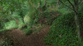
Caution: muddy paths in wet weather.

Worth a visit

Reviews and comments

4.1 / 5
Based on 3 reviews

Reliability of the description
4 / 5
Ease of following the route
4.3 / 5
Route interest
4 / 5
Arzaela
Arzaela

Overall rating : 4.5 / 5

Date of your route : Aug 17, 2026
Reliability of the description : Not used / Not applicable
Ease of following the route : ★★★★★ Very good
Route interest : ★★★★☆ Good
Very busy route : No

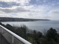
The entire first section of the route, right up to grade 1 or even 2, runs between two walls of very tall ferns. But there are a few gaps that allow you to take in the fabulous view over the Ria. I really enjoyed it.
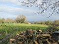
From marker 2 to 5, it’s countryside. Very peaceful.
From marker 5 to the finish, it’s a tarmac road with no shade.
The rest of the route is very shaded.
I only came across two people...

Machine-translated

User 13073202
• Edited:

Overall rating : 3.7 / 5

Date of your route : Jun 01, 2025
Reliability of the description : ★★★★☆ Good
Ease of following the route : ★★★★☆ Good
Route interest : ★★★☆☆ Average
Very busy route : No

Progress over the first 2 km was hampered by numerous ferns and brambles on the very narrow path. We were tempted to turn back. The view of the sea was magnificent, however, on this first section
On the second part of the walk, the path was much wider and therefore more pleasant, with views of the countryside.

Machine-translated

Makevil
Makevil

Overall rating : 4.3 / 5

Date of your route : Feb 03, 2025
Reliability of the description : ★★★★☆ Good
Ease of following the route : ★★★★☆ Good
Route interest : ★★★★★ Very good
Very busy route : No

The ground is very muddy at this time of year.
The terrain is ideal for wild boar. Watch out for hunters’ drives; check before you go.

Machine-translated

Other walks in the area

For more walks, use our search engine .

The GPS track and description are the property of this route's author. Please do not copy them without permission.