Country:

 City:


The walk starts at the Col du Wettstein car park on the D48. Very easy to get to. Plenty of spaces, but also plenty of cars when the weather is fine.
(S/E) From the car park, cross the D48 (take care), ignore the road leading to the farmhouse inn (your return route) and take the wide path that veers to the right (marked with a Yellow Rectangle for the GR®532). Stay on this path heading north-west. When it turns right and heads north, you’ll reach a junction with several paths, where the GR® is joined by the path marked with a Yellow Disc coming from the south.
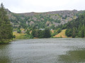
(1) Leave the GR®532, which continues straight on; ignore the path marked with a Yellow Cross on the left and turn left to begin the climb towards Lac Forlet, following the Yellow Disc markings. Further on, ignore the path marked with a Yellow Triangle; the slope becomes steeper. When the slope levels out, pass the Altenkraeh farm and reach Lac Forlet without difficulty.
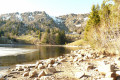
(2) Cross the dam on the left, then walk round the lake on the left, following the Red Triangle signposts. You can take a short break at the farmhouse inn or by the lake.
(3) Pass the farmhouse inn and take the path leading up to the Gazon du Faing (Red Triangle). It’s a slightly steep climb, but the view from the top is well worth the effort.
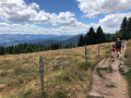
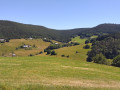
(4) Turn left; a little further on, a path on the left allows youto leave the signposted trail and head downhill. I recommend following this path through the field to enjoy a lovely panoramic view.
The path joins the GR®5 (Red Rectangle) on the ridge. Shortly afterwards, you’ll reach an orientation table.
(5) Take a moment to look at the orientation table, then continue along the cliff edge. Pass the path on your right that descends to the Auberge du Gazon du Faing and head towards the Gazon du Faîte (IGN elevation 1303).
(6) Leave the GR®5 and take its alternative route (marked with Red Rectangles and White Rectangles) along the cliff edge. This offers some lovely views. Further on, it rejoins the GR® at a place called Dreieck, near a car park on the D61.
(7) Pass the forest track on your left which descends to Lac Vert (marked with a Red Disc) and continue along the GR® for about 300 m until you reach a junction.
(8) Leave the GR®5 and head down to the left towards Lac Vert (marked with a Yellow Saltire). This is the Chemin du Lybruck, which is wilder but more challenging than the forest track (Red Disc) starting from the car park.
You’ll arrive at the bottom, level with the road leading to Lac Vert.
(9) Turn left to follow the road and, further on, leave it to the left onto a path (Green Ring), a shortcut to reach Lac Vert at the dam.
(10) With your back to the lake, head back along the road towards a car park. Continue for a few dozen metres until you reach the junction with the Rappenkopf Forest Track (marked with Red Discs).
(11) Turn left. Shortly afterwards, veer right to follow the Red Disc markings; this extends the walk slightly with a long descent until you reach a small tarmac road.
(12) Leave this after a few metres to stay on the Red Disc path; this happens twice more before you reach the junction with the Route de Hirsteren.
(13) Leave the road and turn right onto the Red Disc path. It goes round a house and joins the road leading to Hirsteren. Keep to the right along the road until you reach the bridge over the Ruisseau du Lac Vert. Stay along the road until you reach the junction with a cul-de-sac.
(14) Leave the Red Disc markings and head up to the left, northwards, following the Yellow Disc markings, until you reach a crossroads at IGN elevation 868.
(15) Leave the Yellow Disc markings and head uphill to the right (following the Yellow Saltire markings), heading south-east. After a hairpin bend to the left, followed by another to the right, the path emerges from the forest and reaches the Musmiss farmhouse inn. A great spot for a tasty break (note: if you want to eat there at lunchtime, book well in advance).
(16) Continue downhill for another five minutes to reach the Col du Wettstein (S/E).
 Visorando Member
 Easy

 Tourism professional