Champ du Feu circular tour via Le Howhald and the old dairy farm

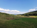
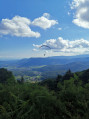
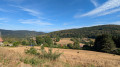
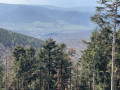
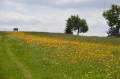
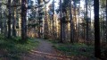
In my opinion, this is the most beautiful route up to Champ du Feu from Hohwald, as it runs through the heart of the forest and there are no busy roads to cross. If you set off early, you might be lucky enough to spot some wildlife. The route passes by the old dairy farm, a peaceful and quiet spot, before descending via the magnificent Chaume des Veaux. Then, enjoy the stunning viewpoint at Breitenbach, where you might just see paragliders in flight. Finish your hike by returning via Grande Bellevue.

Details

60183128
Creation:
Last update:
Last review:
  • Walking
    Activity: Walking
  • ↔
    Distance: 11.65 mi
  • ◔
    Average duration: 7h 10 
  • ▲
    Difficulty: Difficult

  • ⚐
    Back to start: Yes
  • ↗
    Ascent: + 2,067 ft
  • ↘
    Descent: - 2,070 ft

  • ▲
    Highest point: 3,606 ft
  • ▼
    Lowest point: 1,860 ft

Photos

Description of the walk

Start from the small car park (free of charge) on Rue Sainte-Odile (D426), opposite the church in Le Hohwald.

(S/E) Cross Rue Sainte-Odile and turn into Rue de Louisental, directly opposite. Leave the church on your left.

(1) Take the second path on the right, marked with a Red Triangle / Blue Disc, to the stream.

(2) Leave the Petite Ceinture path and follow the trail marked with a Red Triangle.

(3) At this point (alt. 792 m), if you pass by early in the morning and make as little noise as possible, you may spot some wildlife. It is quite possible to see roe deer, or even a stag.
Continue due north until you reach a road at elevation 901.

(4) Cross it and take the steep path directly opposite. You will arrive at the Vieille Dairy Farm crossroads.

(5) Continue straight ahead, following the Red Rectangle-marked path (GR®531), until you reach a junction with another marked path.

(6) Here, there are two options:
- turn right, following the Red Disc to the road, then turn left onto it until you rejoin the GR at a crossroads. This path has its charm, as it allows you to enjoy the view all along the ridge of the Champ du Feu. However, it is in full sun.
- continue straight ahead through the forest. This is the route shown on the map. Red Rectangle (GR®531).

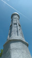
(7) At the crossroads (where the two routes meet), turn right, facing the road. There is a table and some benches on the right (in the sun). Turn immediately left, along the road (D214), to head for the tower.

(8) After visiting the Champ du Feu Tower, retrace your steps to the previous crossroads.

(7) Turn right to enter the forest (south-east). Follow the path on the right, marked with a Blue Saltire, which crosses a vast blueberry field and begins the descent into the forest. Cross a forest track and reach a junction.

(9) Leave the Blue Saltire markings and follow the path on the right, marked with a Blue Triangle, which leads to La Chaume des Veaux.

(10) At the bottom of the path, continue to the right until you reach a track.

(11) At the junction, turn left, then immediately right, at the edge of the forest.

(12) Just before a yurt, take the small path on the left. However, if it is blocked, continue straight on until the next junction, then turn left, following the Yellow Saltire, for a few metres.

(13) Here you’ll find the first viewpoint, with a table and benches. Take the steep path up to the left to enjoy the higher viewpoint and have a rest.

(14) Turn back to the previous fork.

(13) Continue left along this path.

(15) Turn right onto the road.

(16) At the Col du Kreuzweg, cross the road (D425) with care.

(17) At the next fork, follow the path on the right, marked with a Yellow Saltire.

(18) Turn right to reach Grande Bellevue.

(19) Once you reach the Grande Bellevue viewpoint (which offers limited views), continue along the path to rejoin the forest track you left earlier. Turn right and head towards a junction.

(20) Please note, this junction is not very visible, as the path turns sharply left at an acute angle relative to the forest track.
Turn sharply left (north), following the Yellow Disc and Red Rectangle markings, until you reach a junction of paths and roads.

(21) Turn right onto the road and head down Rue du Wittertalhof to the village centre.

(22) On the main road, turn left, then immediately right into Rue Sainte-Odile, which climbs steeply, and turn left at the next street.

Cross over and take the street continuing on the left-hand side.

Then head to the car park (S/E).

Waypoints

  1. S/E : mi 0 - alt. 1,913 ft - Car park: Rue Sainte-Odile
  2. 1 : mi 0.08 - alt. 1,936 ft - Red Triangle / Blue Disc
  3. 2 : mi 0.87 - alt. 2,149 ft - Red Triangle
  4. 3 : mi 1.66 - alt. 2,556 ft - Possibility of encountering wildlife
  5. 4 : mi 2.63 - alt. 2,949 ft - Road
  6. 5 : mi 2.9 - alt. 3,071 ft - Old Dairy Farm
  7. 6 : mi 3.67 - alt. 3,310 ft - Red Disc
  8. 7 : mi 4.61 - alt. 3,527 ft - Champ du Feu junction
  9. 8 : mi 5.06 - alt. 3,606 ft - Tour du Champ du Feu - Refuge du Champ du Feu
  10. 9 : mi 6.24 - alt. 3,232 ft - Blue Triangle
  11. 10 : mi 6.59 - alt. 3,100 ft - Chaume des Veaux
  12. 11 : mi 6.93 - alt. 3,035 ft - Path
  13. 12 : mi 7.1 - alt. 3,061 ft - Yurt
  14. 13 : mi 7.19 - alt. 3,071 ft - Climb to the viewpoint
  15. 14 : mi 7.31 - alt. 3,117 ft - Breittenbach Viewpoint
  16. 15 : mi 8.21 - alt. 2,559 ft - Road
  17. 16 : mi 8.27 - alt. 2,523 ft - Buchbuckel
  18. 17 : mi 8.39 - alt. 2,523 ft - Yellow Saltire
  19. 18 : mi 9.11 - alt. 2,756 ft - Path
  20. 19 : mi 9.22 - alt. 2,812 ft - La Grande Bellevue
  21. 20 : mi 9.62 - alt. 2,674 ft - Chemin de la Grande Bellevue Yellow Disc
  22. 21 : mi 10.89 - alt. 2,070 ft - Rue du Witterthalhof
  23. 22 : mi 11.54 - alt. 1,860 ft - Main Street, after the - Andlau (rivière)
  24. S/E : mi 11.65 - alt. 1,913 ft - Car park: Rue Sainte-Odile

Notes

I’ve rated this hike as difficult because of its length, but apart from that there’s nothing complicated about it; a keen walker should be able to complete it in under 5 hours, excluding breaks.

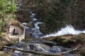
(1) to (5) The climb up to the old dairy farm crosses several rivers.
(3) There is a chance of seeing wildlife
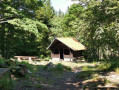
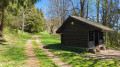
(5) The old dairy farm has a Club Vosgien shelter, but you need to follow the Red Rectangle-White Rectangle-Red Rectangle path to see it on the left. There is also a fountain, but the water is not drinkable.
(7) There is a table and benches at Champ du Feu. However, there is no shade.
(8) If you’re not familiar with the Champ du Feu Tower, do take the time to visit it, especially as it has been completely renovated.
(15) Not only is the view magnificent, but there are tables and benches where you can sit down for a bite to eat. This is the spot I recommend for a lunch break. You might also be lucky enough to see paragliders in action.
(19) The view isn’t spectacular, but it’s still a pleasant spot to stop.

Worth a visit

(5) Former dairy farm, viewpoint
(7) Champ du Feu
(9) Chaume des Veaux
(15) Pelage viewpoint
(20) La Grande Bellevue
(22) You will find bars and restaurants in the centre of Howald
Shortly before the finish, via a detour, you can visit a stone sculptor’s workshop here, on the left, behind the church.

Always be cautious and plan ahead when you're outdoors. Visorando and the author of this route cannot be held responsible for any accidents occurring on this route.

The GR® and PR® markings are the intellectual property of the Fédération Française de Randonnée Pédestre.

Reviews and comments

4.9 / 5
Based on 5 reviews

Reliability of the description
5 / 5
Ease of following the route
5 / 5
Route interest
4.8 / 5
Zeb Myr
Zeb Myr

Overall rating : 5 / 5

Date of your route : Apr 26, 2026
Reliability of the description : ★★★★★ Very good
Ease of following the route : ★★★★★ Very good
Route interest : ★★★★★ Very good
Very busy route : No

A pleasant walk with lovely views over the Alsace plain (on the downhill section, after Champ du Feu).

The difficulty lies more in the distance, as the elevation gain remains relatively low.

Please note: access to the Champ du Feu tower is still not possible (under renovation)

Machine-translated

Papa67
Papa67

Overall rating : 5 / 5

Date of your route : Aug 17, 2025
Reliability of the description : ★★★★★ Very good
Ease of following the route : ★★★★★ Very good
Route interest : ★★★★★ Very good
Very busy route : No

Incredible route!
What a variety of landscapes. The climb is smooth and easy. Forests, meadows, pastures and mountains
Being a poor walker, I covered these 19 km in 4 hours and 20 minutes (not counting breaks) without any real difficulty.
In my opinion, this hike is one of my top 5.
Finally, the path is dotted with picnic tables in the shade, especially on the descent

Machine-translated

Barbara90
Barbara90

Overall rating : 4.7 / 5

Date of your route : May 23, 2025
Reliability of the description : ★★★★★ Very good
Ease of following the route : ★★★★★ Very good
Route interest : ★★★★☆ Good
Very busy route : No

Completed today; no difficulty, a gradual climb up to the Champ du Feu. Unfortunately, the tower is closed. No views from the tower side. We stopped for lunch at Point 14, which offered an amazing view. At Point 13 there are also picnic tables and the paragliding launch site. We found nothing at Point 15.
Plenty of water sources to quench our companion’s thirst. A very pleasant hike completed in 4 hours and 41 minutes without a break. Thank you for this lovely route

Machine-translated

xerocrete
xerocrete

Overall rating : 5 / 5

Date of your route : Oct 11, 2024
Reliability of the description : ★★★★★ Very good
Ease of following the route : ★★★★★ Very good
Route interest : ★★★★★ Very good
Very busy route : No

A lovely walk to do on a hot day as it’s well shaded.
One thing to note: at point 12, the yurts have sprung up like mushrooms...
In fact, as the description states, it’s best to carry on straight ahead and then turn left at the junction to reach point 13.

Machine-translated

mbau
mbau

Hello. Thank you for your review. I’m glad you enjoyed one of my favourite walks and that you had a lovely encounter.

Machine-translated

Nature57
Nature57

Overall rating : 5 / 5

Date of your route : Sep 28, 2024
Reliability of the description : ★★★★★ Very good
Ease of following the route : ★★★★★ Very good
Route interest : ★★★★★ Very good
Very busy route : No

A lovely walk along a beautiful path from Le Howhald to the Champ du Feu tower. We couldn’t see inside the tower as it was closed. The signposting and markings were perfect all along this superb route, offering magnificent views on the way back. We didn’t meet many people on this gloomy Friday in September, but we did spot a beautiful deer shortly after marker No. 4. Thanks to the author for this lovely day’s walk.

Machine-translated

mbau
mbau

Hello,

Thank you for your comment.
Yes, it’s a hike I do very regularly and, indeed, you hardly see anyone, especially on the climb. It’s a real pleasure; I highly recommend it.

Machine-translated

virgule
virgule

Something to do one day. It’s a lovely spot, usually quiet.

Machine-translated

Other walks in the area

For more walks, use our search engine .

The GPS track and description are the property of this route's author. Please do not copy them without permission.