Country:

 City:
City:




The route is signposted with ‘Sources de l’Huveaune’ signs from the car park to the entrance to the Biological Reserve. The return route is not signposted: please download the walk route in advance as there is no mobile phone signal on site.
The walk starts at the Marie-Magdelaine Boyer – Sources de l’Huveaune car park , opposite the Lei Esteleto nursery: signposts are in place at every entrance to the village.
The centre of Nans-les-Pins is accessible via the 92 Zou! express bus service between Aubagne and Brignoles: the “La Ferrage” stop is situated 150 metres from the start of the walk.
(S/E) Leave the car park to the right. As you approach the supermarket, go round it on the left. Cross at the marked pedestrian crossing to reach Place Victor Dedieu.
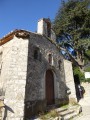
(1) Cross the road again to the left. Walk the entire length of Cours Général de Gaulle, passing the Tourist Office. At the end, turn left up Grand Rue to reach the Chapelle de la Miséricorde, passing the church on the way.
(2) Opposite the chapel, follow the Chemin de l’Orge to the left, passing an oratory and then the old, abandoned buildings of the sanatorium. At the junction, carry on straight ahead. Continue straight on until you reach the Orge, then carry on to Mandelieu. Head down the Chemin Rural des Rois to the left, which runs alongside the stables and leads to the Sermax factory.
(3) Turn right onto the tarmac road.
(4) At the junction, leave the Chemin Rural des Rois and continue to the right onto the main track (S35). Carry on along track S35 – Protection incendie de la Taurelle, ignoring any side tracks. You’ll reach a large clearing to the left of the track, upstream of fire hydrant no. 61.
(5) Cross the clearing diagonally to reach a path that leads into the woodland. Follow it to reach the entrance sign for the Sainte-Baume Biological Reserve. You are in a very fragile area. Please read and follow the instructions to ensure this site remains preserved.
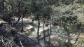
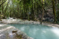
(6) Leave the steps on your right and continue straight on along a path that runs along the river on a balcony-like ledge. Pass a first sign, “Vallon de Castelette”, then a second, “Les tufs calcaires”, before reaching the first viewpoint. Head back up to the main path via the steps.
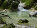
(7) Cross the first footbridge, then head up to the left for a few dozen metres to catch a glimpse of the Huveaune’s resurgence.
(8) Head back down to the first footbridge.
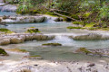
(7) Leave this footbridge on your right and continue along the path, crossing a second footbridge which takes you to the other bank of the river. Head back down to the right to admire the river from the other side, passing a second viewpoint.
(8) At the third footbridge, carry on straight ahead, leaving it on your right, until you reach a wide track. Follow this track to the right until the next junction . Turn right onto the forest track to return to the clearing you crossed on the way out.
(5) Follow the outbound route in the opposite direction to return to the car park (S/E).
 Visorando Member
 Easy
Easy