Country:

 City:


Coming from Châtillon-en-Diois via the D539, pass a picnic area on the right by the river and park on the right 500 m further on.
(S/E) From the car park, walk back up the D539 for 100 m and take the track on the right (signpost). Follow it for 150 m until you reach the ‘Le Relais’ signpost (ruins).
(1) Take the path on the left through the woodland and climb the steep slope via a series of hairpin bends along a well-defined sunken track (old stone walls and traces of the former paving). You’ll emerge onto an old track where the slope levels out.
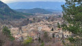
(2) Follow it to the left (view of Châtillon-en-Diois down to the left) to reach a viewing platform very quickly.
(3) Carry on straight ahead uphill until you reach the junction with the old path.
(4) Turn right. The path runs alongside the track for a short while before veering right to go round a small rise in the ground in an anti-clockwise direction. You’ll come out at a hairpin bend on the track (cairn).
(5) Continue uphill for 30 m. From here, there are two options for reaching the hamlet of Le Serre: either carry on along the track, or take the old path running parallel to the right, which is signposted and joins the track a little further up.
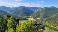
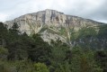
(6) When you reach the hamlet, turn round to enjoy the view of the Trois Becs, the iconic trio of peaks at the eastern end of the Saou Forest, which rise above the horizon over a wooded ridge. Walk past Le Serre (around a hundred inhabitants in 1846) on the right and reach a DFCI water tank (unobstructed view to the right over the hamlet of L’Église). After a right-hand bend, the track climbs and reaches a clearing at a place called Pierre Buffe (signpost at 1,103 m).
(7) Turn right on the descent, staying on the main track, and reach the hamlet of l’Église (signpost).
(8) Leave the hamlet on the descent via the grassy path near an old walnut tree and rejoin the track at a hairpin bend to the right.
(9) Cross the track and take the path opposite (view of Châtillon-en-Diois on the right). Join the track again at a right-hand hairpin bend.
(10) Cross it to begin a good descent via wide hairpin bends, until you reach a lovely stream at the bottom of the Ravin de Moulin Vieux (pools, small waterfall).
(11) Turn left to rejoin the track and follow it to the left until you reach the junction from the outward journey.
(1) Continue on to the D 539 and then turn left towards the car park (S/E).

 Visorando Member
 Difficult

 Very difficult
 Easy