


 Country:

 City:


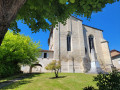
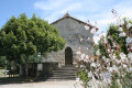
Park in the car park behind Saint-Aquilin Church: signpost for the commune’s walking routes.
(S/E) Walk back up towards the main street, passing the church entrance; follow the pavement on the right, then cross at the pedestrian crossing to take a street consisting of steps. At the top, turn right, then left onto Route du Roc towards “Vigerie haute”. Walk beneath Château du Roc: information boards are on the left, by the side of the road.
(1) A little further up, leave the road and turn left onto the Chemin du Tumulus (sign for “circular tour of castles”). There are several information boards along the path. The one concerning place-names seems to me to contain an error. The place name “Vigerie”, common in the Périgord, derives instead from the term “viguier” (“vigier” in Occitan), referring to an officer appointed by the King of France to administer justice (see “Toponymie occitane du Limousin et de ses confins” by Y. Lavalade, published by La Clau Lemosina) and would therefore have no connection with the French word “vigie”.
(2) On reaching the vicinity of a coaching inn, the path leaves the ridge and descends to the right into the woods, joining a tarmac road which you should follow to the left. Pass through the hamlet of La Vigerie Basse, then turn left onto the Chemin du Belvédère (yellow markings): a viewpoint overlooking Belet Castle, the Salembre Valley and the Étang des Garennes. The path descends to the Route des Moulins.
(3) Follow it to the left for a few dozen metres, then take the D43 to the right: take care, as this is a busy road.
(4) Just after crossing the Salembre, turn left onto the Route de la Forêt des Cailloux. Pass the connecting path to Chantérac, Saint-Vincent de Connezac and Saint-Germain du Salembre on your left.
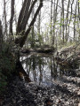
(5) Immediately afterwards, take the path on the right – a very pleasant route that runs alongside a stream. Turn right at a crossroads by a house and carefully make your way back up onto the D43.
(6) Take the path (yellow markings) which climbs steeply up to the hamlet of Seyssac. At the road, turn left. Shortly afterwards, leave the Chemin de la Nauve on your left and take the track opposite. Pass close to the Peyre-Brune dolmen (information sign).
(7) Then leave the junction for Chantérac on your left and continue along the track until you reach a busy road. Follow it to the right. Shortly afterwards, carry straight on along the D109 towards “Mensignac, Tocane”.
(8) At the next junction, turn right onto the Roman road towards Vitrac (sign for “circular route”). In the hamlet, leave the main road and turn left (yellow marker) to join the Route du Four, which goes round a house, then turn right onto the Chemin des Prés.
(9) Pass the sign for “Fontaine de Vitrac” on your right and take the path opposite, which becomes less obvious. Follow the edge of the field and rejoin the path shortly afterwards.
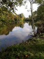
(10) When you reach the valley, do not go straight up but turn right then left (yellow marker) and walk alongside a pond. After a climb, join the Chemin du Bois de Germot.
(11) Follow it to the right until you reach a road; follow this to the right as far as the crossroads at the hamlet of La Barde.
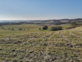
(12) Turn right, then right again just before the houses. Once you reach an open ridge, you can see Moncé Manor below on the left and Belet Castle on the right, which you saw earlier. The path joins a road.
(13) Follow it straight ahead, passing a cul-de-sac on the left, until you reach another, slightly larger road. Follow this to the left and cross the Salembre via a bridge.
(14) At the junction with the D39, head straight on (caution: busy road) along the Route du Muletier towards “Vigerie basse, Ventadour”, then immediately after the junction, turn left onto the path which climbs steeply. At a crossroads, head straight on (yellow signpost) and turn right onto the road you come to.
(15) At the crossroads (see practical information), head left towards Rodas to join the Charroux circular route. Shortly afterwards, take the path on the right (yellow signpost). Then ignore a path on the right and continue straight on (signpost) until you reach a road that descends into a valley at a place called Peyramier.
(16) Then take a path on the right, at the corner of a house: Impasse de Savignac, and you’ll soon reach a road which you’ll follow to the right.
(17) In the hamlet of Charoux, almost at the exit, turn right onto the Chemin des Fontaines and join a road.
(18) Cross it and continue straight ahead towards “Maisonneuve”. Then follow the path that descends to the right of the “Impasse de Bannes” sign and join the D43, which you follow to the right (on the safe pavement) to return to the car park behind the church (S/E).

 Tourist office

 Visorando Member
 Difficult

 Easy

