Saint-Sulpice-de-Roumagnac circular

Starts from a small village 8 km from Ribérac. Suitable for walkers of average fitness. No major difficulties apart from a few steep climbs. Can be done by mountain bike.

Details

n°51775108
Creation:
Last update:
Last review:
  • Walking
    Activity: Walking
  • ↔
    Distance: 5.80 mi
  • ◔
    Average duration: 3h 00 
  • ▲
    Difficulty: Moderate

  • ⚐
    Back to start: Yes
  • ↗
    Ascent: + 394 ft
  • ↘
    Descent: - 390 ft

  • ▲
    Highest point: 640 ft
  • ▼
    Lowest point: 390 ft

Description of the walk

Park in the Foyer Rural car park, located to the north of the village.

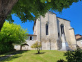
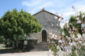
(S/E) With your back to the road, follow Rue Camille Decout, leaving the church on your left and continuing straight ahead down the short cul-de-sac.

(1) Continue along Chemin du Lavoir until you reach the T-junction with the D43. Take the left-hand branch.

(2) Proceed carefully for a few metres to the left, then turn right onto Route des Cèpes. Carry on straight ahead, then turn left with the road to reach the junction with Route des Sarments.

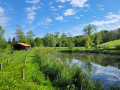
(3) Turn right and follow this road until you reach the first track on the right. Turn onto it, pass in front of the house and arrive at a fork in the road near a small pond.

(4) Turn left to walk alongside it, then carry on straight ahead to rejoin the Route des Sarments.

(5) Cross carefully to rejoin the path opposite. Join the D709 and follow it to the left for about a hundred metres.

(6) Leave the road and take the path on the left, which climbs steeply through the forest. You’ll come out onto a small road; follow it to the left.

(7) Turn right towards Feuillade, then take the path on the left before reaching the hamlet. Then head north-east.

(8) Turn left, rejoin the small road you left earlier and turn right. Ignore the road on the left leading to Lavergne and continue for about 150 metres.

(9) Leave the road and take the track on the left (not shown on the IGN map). Join the Lavergne road again and turn right to reach the D43.

(10) Cross with care and continue along the road opposite, which becomes a track from Le Menaud onwards.

(11) Turn left.

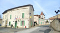
(12) Carry on straight ahead to reach Rue du Calvaire in Saint-Sulpice-de-Roumagnac. Go straight on to return to the car park (S/E).

Waypoints

  1. S/E : mi 0 - alt. 574 ft - Car park
  2. 1 : mi 0.1 - alt. 548 ft - Start of the trail
  3. 2 : mi 0.43 - alt. 627 ft - D43
  4. 3 : mi 0.75 - alt. 623 ft - Route des Sarments
  5. 4 : mi 1.21 - alt. 495 ft - Crossroads, pond, on the left
  6. 5 : mi 2.22 - alt. 410 ft - Route des Sarments
  7. 6 : mi 2.65 - alt. 394 ft - Path on the left
  8. 7 : mi 3.43 - alt. 581 ft - Turn right at the junction.
  9. 8 : mi 4.17 - alt. 591 ft - Crossroads, turn left
  10. 9 : mi 4.45 - alt. 630 ft - Path on the left
  11. 10 : mi 4.93 - alt. 623 ft - D43
  12. 11 : mi 5.38 - alt. 499 ft - Junction, turn left
  13. 12 : mi 5.64 - alt. 554 ft - Three-way junction, straight ahead
  14. S/E : mi 5.8 - alt. 574 ft - Car park

Notes

Essential kit.
Hiking boots, water, a small snack, an umbrella or a waterproof jacket just in case...
There are no shops nearby, so make sure you bring your own snacks and water.

Worth a visit

A lovely walk with varied scenery, including a few steep climbs!

Reviews and comments

5 / 5
Based on 1 review

Reliability of the description
5 / 5
Ease of following the route
5 / 5
Route interest
5 / 5
Bobolavalise
Bobolavalise
• Edited:

Overall rating : 5 / 5

Date of your route : Feb 16, 2025
Reliability of the description : ★★★★★ Very good
Ease of following the route : ★★★★★ Very good
Route interest : ★★★★★ Very good
Very busy route : No

A lovely walk, with plenty of lovely wooded areas. A few good climbs. We did this walk on a Sunday afternoon in glorious sunshine and didn’t come across a single soul. Well worth a go 👍🏻

Machine-translated

Other walks in the area

For more walks, use our search engine .

The GPS track and description are the property of this route's author. Please do not copy them without permission.