


 Country:

 City:
City:


Start from the car park at the entrance to the Azé campsite on the Allée des Grottes.
(S/E) With your back to the campsite gates, take the Sentier des Ours, which branches off to the left just before the first house, running alongside the car park before heading up into the woods.
(1) At the junction just as you emerge from the woods, carry straight on, staying on the Sentier des Ours, which climbs alongside the vineyards.
(2) Before entering the undergrowth, veer slightly to the left to reach the orientation table. Continue along the path that starts just behind it and follow it, ignoring the yellow markings which soon branch off to the left.
(3) Join the yellow markings again and carry on straight ahead along the straight path leading to the D487 or Route des Pâtreux.
(4) Cross it and follow it to the left, then take the first path on the right which follows the yellow route.
(5) At a place called La Brosse, carry on straight ahead towards Mont-Saint-Romain.
(6) At the junction with a path running perpendicular to it, follow the Yellow markings to the left and stay on this path until you reach Charcuble. Pass the first house on the right. At the junction, take Rue de la Fontaine. Go past the washhouse on the left. Walk up Rue de la Chapelle.
(7) Leave this just before the ‘end of built-up area’ sign to take the path on the left, which forms a U-shape and passes in front of the Chapel of Saint-Philippe and Sainte-Jeanne-d’Arc before returning to Rue de la Chapelle; follow this to the left until you reach the junction with the D487, opposite the Mont-Saint-Romain Forest Ranger’s House.
(8) Turn right, then immediately left towards Mont-Saint-Romain.
(9) About 320 metres further on, look out for a tree on the right marked with a large red circle and an arrow pointing to the left. Turn onto the path which branches off to the left shortly afterwards and soon climbs up onto the Chemin du Faitral and the GR®76A (red and white markings).
(10) You can visit the caves by turning right. Otherwise, continue left on the GR®.
(11) Caution! Follow the GR® as it branches off to the left onto a small path just before the start of a descent, and head for the Col de la Croix. Take the D446 carefully to the left until you reach the forest track known as the Chemin du Milieu, which branches off to the right.
(12) Follow it to the end.
(13) At a place called La Verzée, it crosses a track; take this track to the right, then turn left onto the next one, the Chemin du Praty. Then, after the bridge, turn right onto the Impasse de la Tour du Bois.
(14) Ignore the first path leading uphill to the left and follow the second one, the Chemin de l’Étang, which is relatively flat. A few dozen metres further on, before the ‘La Goulouze’ signpost, below the path, is the entrance to a tunnel used to collect water from the Goulouze. It’s not easy to spot… Continue along this Chemin de l’Étang.
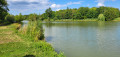
(15) Walk past two private ponds. A little further on, pass a wooden walkway on the right lined with a series of information boards about the wetland bordering the Mouge
(16) At the junction just after this, take the path marked by a gate that allows walkers through. This path leads to the Grottes d’Azé shop, crosses its car park and provides access to the campsite entrance. Enter and turn right opposite reception to exit and reach the car park (S/E).
To get to the swimming pool, turn left opposite reception.


 Visorando Member
 Easy
Easy 
 Difficult
