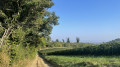
Green Walk: the wild springs at Blanot

Setting out on this walk means following in the footsteps of the men and women of yesteryear; it means experiencing first-hand what daily life was like in this valley. The hard work required to tame this land can still be felt in the places you pass through: the dry-stone walls lining the paths, built with patience; the wash houses weathered by the laundry so regularly scrubbed; the vines forced to take root in the soil…

Details

32400296
Creation:
Last update:
Last review:
  • Walking
    Activity: Walking
  • ↔
    Distance: 5.00 mi
  • ◔
    Average duration: 3h 00 
  • ▲
    Difficulty: Easy

  • ⚐
    Back to start: Yes
  • ↗
    Ascent: + 797 ft
  • ↘
    Descent: - 774 ft

  • ▲
    Highest point: 1,788 ft
  • ▼
    Lowest point: 1,010 ft

Description of the walk

Green walk marked in yellow (BL3), created by the Conseil Général.
Park in the car park in the village of Blanot.

(S/E) From the Place de la Fontaine, take the small path on the left which passes beneath the church. At the road, turn left, then left again at the walnut tree. Cross the D15 and head up the path opposite. At the junction, take the grassy path on the right, marked in blue on a white background.
As you walk, look out for the view of Mont Saint-Romain on your right (see the section ‘During the walk or nearby’).
About one kilometre further on, you’ll reach the hamlet of La Musette, consisting of a group of renovated buildings.

(1) Leave the blue-on-white markings, which head off to the left, and descend to ‘en Beau Cul’, a prime vantage point for enthusiasts of the traditional wash houses. Continue down to the wash house, then head back up the wide path to the D146 road. (You can take the short, steep grassy path marked in yellow).

(2) Turn right and take the small road that climbs immediately to the left. Do not go back down the other side but continue climbing.

(3) Take the tarmac path that branches off to the left before the Stop sign. It soon becomes grassy. Turn off onto the first path on the right, marked in green on a white background. Climb up to the ‘Roussot’ sign to rejoin the blue markings on a white background.

(4) Continue to the right until you reach the road, then follow it to the left for about 200 m.

(5) Before reaching the first houses in Fougnières, leave the blue markings and head back up to the Stop sign. Cross the road and continue straight ahead along this path, which joins a road. Then head slightly uphill to the left and turn right before a recycling centre. Follow this path to Chemin du Verne. Head up it to the left to join the GR®76A, which continues to climb along the edge of the Bois du Chagnot.

(6) Leave it at the junction and turn right. Continue to the junction at the Bois des Brosses.

(7) Turn right onto the path marked with a sign reading ‘No recreational off-road vehicles’. Stay on this track, without turning off, until you reach the Péluzot junction and rejoin the GR®76A.

(8) Follow it to the right as far as L’Épinasse, then turn left towards Blanot and its pottery workshop. On your way down, you’ll pass some Merovingian tombs, the deanery (formerly owned by the monks of Cluny) and Saint-Martin’s Church. This will take you back to the car park (S/E).


Waypoints

  1. S/E : mi 0 - alt. 1,161 ft - Car park: Place de la Fontaine
  2. 1 : mi 0.89 - alt. 1,129 ft - La Musette (hamlet)
  3. 2 : mi 1.11 - alt. 1,033 ft - D146
  4. 3 : mi 1.18 - alt. 1,056 ft - Le Vivier
  5. 4 : mi 1.71 - alt. 1,237 ft - Roussot signpost 
  6. 5 : mi 1.93 - alt. 1,289 ft - Junction
  7. 6 : mi 2.96 - alt. 1,591 ft - Junction
  8. 7 : mi 3.64 - alt. 1,785 ft - Bois des Brosses crossroads
  9. 8 : mi 4.09 - alt. 1,473 ft - Péluzot junction
  10. S/E : mi 5 - alt. 1,161 ft - Car park: Place de la Fontaine - Église Saint-Martin (Blanot)

Notes

Toilets are available in the car park in the village of Blanot and at the caves.
Walking shoes recommended.
Don’t forget to bring water bottles.

Accommodation available in Blanot
Provided by: Les Chambres de Blanot
(Bed and Breakfast) – Tel. 06 11 01 74 94

Worth a visit

As you walk, look out for the view of Mont-St-Romain on your right. This is the highest peak in the Clunisois region. It rises to 579 m and is said to have been a site of Druidic worship. Legend tells of a bitter struggle between the old and new religions on this wooded and rocky site. A chapel was once built here, but it has since disappeared. The site is now private property and features an orientation board. Access is permitted on certain days.

There are several options available to you:
- a visit to the caves and/or their refreshment bar in summer.
- arrange a tasting in advance at the Domaine du Grison wine cellar or at one of the cheese dairies.

Carry on to Mont-Sain-Romain, the highest peak in the Clunisois region, to take in the view from the orientation table.

Always be cautious and plan ahead when you're outdoors. Visorando and the author of this route cannot be held responsible for any accidents occurring on this route.

The GR® and PR® markings are the intellectual property of the Fédération Française de Randonnée Pédestre.

Reviews and comments

4 / 5
Based on 4 reviews

Reliability of the description
4.3 / 5
Ease of following the route
3.8 / 5
Route interest
4 / 5
marielepasteur
marielepasteur

Overall rating : 4.3 / 5

Date of your route : May 01, 2025
Reliability of the description : ★★★★★ Very good
Ease of following the route : ★★★★☆ Good
Route interest : ★★★★☆ Good
Very busy route : No

A pleasant walk offering various views of the village of Blanot

Machine-translated

BCD
BCD

Overall rating : 4 / 5

Date of your route : Sep 11, 2023
Reliability of the description : ★★★★☆ Good
Ease of following the route : ★★★★☆ Good
Route interest : ★★★★☆ Good
Very busy route : No

The first part is very good; the second part has fewer scenic views

Machine-translated

agnes.milcent
agnes.milcent

Overall rating : 3 / 5

Date of your route : Jul 17, 2023
Reliability of the description : ★★★☆☆ Average
Ease of following the route : ★★★☆☆ Average
Route interest : ★★★☆☆ Average
Very busy route : No

The Jarbonnet rocks are very beautiful, but I found it difficult because there were so many climbs

Machine-translated

agnes.milcent
agnes.milcent

Overall rating : 4.7 / 5

Date of your route : Jul 19, 2023
Reliability of the description : ★★★★★ Very good
Ease of following the route : ★★★★☆ Good
Route interest : ★★★★★ Very good
Very busy route : No

A lovely route to explore the village of Blanot

Machine-translated

Other walks in the area

For more walks, use our search engine .

The GPS track and description are the property of this route's author. Please do not copy them without permission.