Country:
 City:


Park in the car park near the town hall in Sainte-Pexine.
(S/E) Leave the car park and turn right towards the centre of Sainte-Pexine. Leave the village and follow the road for about 500 metres until you reach a four-way junction.
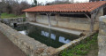
(1) Follow a small path on the left, bordered by a hedge, to an old wash house.
(2) Take a look around and then head back to the road.
(1) Turn left. At the junction with the D19, take the sharp left-hand bend and walk along the verge for 100 metres.
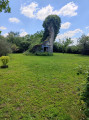
(3) Turn right, cross a small footbridge over the ditch and follow the path to the Chapel of Saint Brice. Take a look at the chapel. Walk to the left of it and continue along the path, which climbs slightly. At a junction, take the small road opposite.
(4) 200 metres further on, turn right onto a path (marked by an arrow) which descends towards Moutiers-sur-le-Lay. Walk past a large community hall and head towards the D19; cross it at a pedestrian crossing and follow Chemin de la Balurie, opposite, for 50 metres.
(5) Turn left into a narrow lane lined with walls. 50 metres further on, turn right and head towards the Place de l’Église Saint-Pierre. To visit the church, you’ll need to ask for the key at the town hall, which is situated on the square.
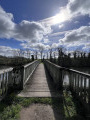
At the far end of the square, turn right onto the D7 until you reach the bridge over the River Lay. Enjoy the view of the river; further upstream, you’ll spot an old mill.
(6) Return towards the centre of Moutiers and follow Rue de l’Ancienne Poste straight ahead, which is lined with beautiful houses. Turn right onto Rue des Ponts, cross the D19 again at a roundabout and continue straight ahead along the pavement. Turn left at thefirst junction to follow Rue Jehan Clémenceau.
(7) On your right, by the side of the road, you’ll see a tall house with a watchtower (the former Clémenceau printing works).
Then turn into the first small road on the right, follow Rue de Beauchêne and turn left at the first junction.
(8) A little further on, on the right, you’ll come across a historic monument: La Motte Orson.
Follow the path uphill to the top of the hill. “To the right, you can see Bessay Castle in the distance (depending on the season). Take a path leading downhill opposite, pass a signposted path on the left and continue to a wide cross-path.
(9) Turn right for 80 metres, then left at the next junction and head up towards the small Bessay wood. Follow the wood on your right.
(10) Enter the woodland on the right via a small forest track. Walk for 150 m until you reach the first junction on the left. Numerous species of flowers (some of which are rare) line the path.
NB: It is advisable to take this path on the left, as the path opposite, which leads downhill, is often flooded in its lower section.
Leave the woods and turn right, walking alongside the woods, until you reach a four-way junction.
(11) Turn left and follow the path which runs alongside fields at the edge of the woodland. You will come to a road.
(12) Turn left and follow this small road. At the next road junction, carry on straight ahead and head straight up the road to the top of the hill (elevation 53).
(13) Then turn right and follow the ridge.
Take in the view of the Lay valley on one side and the Smagne valley on the other.
At the next junction, at elevation 53, turn left and follow a small road downhill to the next junction.
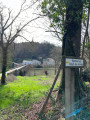
(14) Turn right (a post with an arrow points the way) and head uphill to the next junction. Turn left and head downhill to the D19.
NB: Cross the road (taking care) and follow the road opposite which leads down towards Sainte-Pexine.
(15) When you reach Sainte-Pexine (the path has changed), turn right into a housing estate, walk along the pavement to the end of the street and turn left, between the houses on the left and a hedge on the right bordering a field. You’ll reach the main road.
(16) There are two options at this junction:
- either turn left and head straight back to the starting car park;
- or turn right to walk round the campsite, follow the River Lay and return to the car park (S/E).

 Visorando Member
 Easy

 Tourist office