Sainte-Agnès and Gorbio circular loop via the Col de la Madone

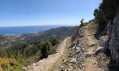
A very scenic route that follows part of the Balcons de la Méditerranée and takes you to Mont Gros and Mont Agel for breathtaking views of the coast.
February 2021: Please note that the section of the path between point 2 and point 3 is currently blocked by a rockslide and is therefore temporarily closed.

Details

1788838
Creation:
Last update:
Last review:
  • Walking
    Activity: Walking
  • ↔
    Distance: 12.93 mi
  • ◔
    Average duration: 8h 20 
  • ▲
    Difficulty: Difficult

  • ⚐
    Back to start: Yes
  • ↗
    Ascent: + 2,779 ft
  • ↘
    Descent: - 2,749 ft

  • ▲
    Highest point: 3,442 ft
  • ▼
    Lowest point: 1,086 ft

Photos

Description of the walk

Park at the crossroads before the final climb up to the village of Sainte-Agnès
in front of the little chapel.

(S/E) Then start by walking down Avenue de l’Orméa towards Menton for a few metres.
Immediately on your left, a path branches off the road and the signpost indicates Menton via the Col de Garde. Take this path, which descends towards the hamlet of l’Orméa until you reach the Route de l’Armée des Alpes a little further down. Pass signpost 451 and arrive on the road at signpost 452.

(1) Turn right towards the south-west, as if you were heading back up to Sainte-Agnès via the road (do not continue along the path directly opposite, which leads back down to Menton). Walk uphill for a few hundred metres until you reach signpost 453 at the bend.

(2) Now turn left onto theGR®51towards Gorbio. You’ll pass under a mast and will soon be able to see the village a little further on.
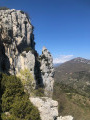
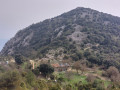
About three-quarters of the way before the chapel at the entrance to Gorbio, some rocks have collapsed and are partially blocking the path; take care as you go round them until you reach marker 455.

(3) Cross the bridge and head up the path to the left until you reach the Chapel of Saint Lazare, which marks the entrance to the village of Gorbio.

(4) Carry on straight ahead towards the village until you reach a road, then turn left.

(5) Before the roundabout at the central square, near the school, turn right onto Avenue de Verdun; pass the post office and the washhouse, where you can quench your thirst – the cool water is safe to drink. Signpost 513 indicates a small path on your right just after the washhouse, which goes round the cemetery. Take this path and carry on towards Mont Gros. You’ll reach signpost 512.

(6) Continue south-west towards Mont Gros until you reach the La Coupière track. Follow this track (GR®51) until you reach La Coupière a little further up at marker 520.

(7) Take the track heading south towards Mont Gros, which is directly in front of you.

(8) At the next junction where the track meets a footpath, leave the track. Take the small path on the left. You’ll see the pretty ruin and an artificial pond. Return to the track and continue your ascent. You’ll soon reach marker 522.

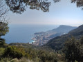
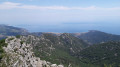
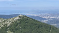
(9) Leave the track again to the left to go round Mont Gros from the south, with a magnificent view of Monaco and Roquebrune.

(10) At marker 525, continue round Mont Gros straight ahead, ignoring the path branching off to the left. Carry on to marker 524 before heading towards the summit of Mont Gros and the paragliders’ launch site. Reach the junction at marker 523.

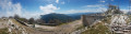
(11) Take a short detour to the summit on the right to see the paragliders, then head back down to the marker to rejoin the path heading north-west towards the Col du Mont Gros. You’ll soon come to a road; turn left onto it and head up towards Mont Agel. Pass marker 544 (the road on this side is a dead end) and continue along the road to marker 545.

(12) Turn right towards the Cime des Cabanelles and the Col de la Madone.
Start the climb along the small path and follow it until you reach marker 508.

(13) Carry on straight ahead, still heading towards the Cime des Cabanelles.

(14) Ignore the path on the right and continue climbing towards the Baisse des Cabanelles until you reach marker 507.

(15) Keep to the left on the path towards the Antennes, which you can see in the distance, and the Col de la Madone.
You’ll come to a track; follow it by turning right towards the north for a few metres.
At the junction, leave the Antennes track on your left. Turn right onto the path towards the Col de la Madone. Descend to marker 506.

(16) Continue down this slope, initially heading north-west towards the pass. Pass beneath the Cime de la Morgelle, above the Ravin du Rank, from where you can see Gorbio below.
You’ll reach the Col de la Madone de Gorbio and its abandoned restaurant at marker 505.

(17) Turn right towards the east onto the D22 road. Stay on this road, passing the junction at marker 456.

(18) Stay on the road, skirting the Cime de Biancon. At the wide bend, head north again to reach the starting point at Sainte-Agnès (S/E).

Waypoints

  1. S/E : mi 0 - alt. 1,975 ft - Car park before the penultimate climb (Sainte-Agnès)
  2. 1 : mi 0.58 - alt. 1,496 ft - Marker 452
  3. 2 : mi 0.93 - alt. 1,601 ft - Marker 453
  4. 3 : mi 1.68 - alt. 1,089 ft - Marker 455. Cross the bridge at the - Gorbio (fleuve)
  5. 4 : mi 1.82 - alt. 1,142 ft - Saint-Lazare Chapel
  6. 5 : mi 2.08 - alt. 1,178 ft - Gorbio School
  7. 6 : mi 2.24 - alt. 1,286 ft - Marker 512 towards the Coupière track
  8. 7 : mi 3.26 - alt. 1,542 ft - Marker 520 - Col de la Coupière
  9. 8 : mi 3.62 - alt. 1,657 ft - Path on the left
  10. 9 : mi 4.09 - alt. 1,827 ft - Marker 522
  11. 10 : mi 4.37 - alt. 1,696 ft - Marker 525
  12. 11 : mi 5.09 - alt. 2,162 ft - Marker 523 - Mont Gros
  13. 12 : mi 6 - alt. 2,497 ft - Marker 545
  14. 13 : mi 7.23 - alt. 2,972 ft - Marker 508
  15. 14 : mi 7.86 - alt. 3,173 ft - Turn left
  16. 15 : mi 8.32 - alt. 3,415 ft - Descent via Les Cabanelles. Marker 507
  17. 16 : mi 8.72 - alt. 3,438 ft - Marker 506
  18. 17 : mi 9.69 - alt. 3,031 ft - Col de la Madone de Gorbio (926m)
  19. 18 : mi 11.29 - alt. 2,392 ft - Marker 456
  20. S/E : mi 12.93 - alt. 1,975 ft - Car park before the penultimate climb (Sainte-Agnès)

Notes

Drinking water is available just after (5) at the Gorbio washhouse.
It took us 5 hours and 30 minutes of actual walking to complete the full circular loop.
Alternative route
(17) The more adventurous, however, can bypass the restaurant and head for the summit of Baudon at marker 557; the return route brings you right back to the car park where you left your car.

Always be cautious and plan ahead when you're outdoors. Visorando and the author of this route cannot be held responsible for any accidents occurring on this route.

The GR® and PR® markings are the intellectual property of the Fédération Française de Randonnée Pédestre.

Reviews and comments

4.4 / 5
Based on 3 reviews

Reliability of the description
5 / 5
Ease of following the route
3.5 / 5
Route interest
4.7 / 5
PhilippeC06
PhilippeC06

Overall rating : 4 / 5

Date of your route : Feb 22, 2026
Reliability of the description : ★★★★★ Very good
Ease of following the route : ★★★☆☆ Average
Route interest : ★★★★☆ Good
Very busy route : No

A very beautiful hike, but with two or three points to clarify.
-Firstly, just before arriving in Gorbio, the path has been and remains closed to traffic. You can clearly get through, but it's really at your own risk.
- At marker 12, if you turn right, you walk along a private property fence for 500 metres. The only problem is that it is forbidden and impossible to reach the path located on private property, so you have to juggle between walking through the bushes and walking along the fence. Eventually, you will manage to get back on the path, but 600 metres further on, it's the same story.
- The route has to go around (no choice, it's private property, which adds 1km and 150m of elevation gain to the trip.
Finally, I can confirm that the descent from the Col de la Madone to Ste Agnes by road is of no interest... unless you are caught out by the weather or nightfall... or both.
In short, I do not recommend this hike, which was a nightmare, not because of the difficulty, but because the route needs to be optimised by cutting off before Mont Gros.
In short, beware of danger! :!(!)!(!)!(!)!(!)!(!)!

Machine-translated

• Edited:

The user account associated with this content has been deleted.

crilou06
crilou06
• Edited:

Overall rating : 4.7 / 5

Date of your route : Mar 22, 2019
Reliability of the description : ★★★★★ Very good
Ease of following the route : ★★★★☆ Good
Route interest : ★★★★★ Very good

I completed this route starting from Gorbio via the Col de la Madone (the same route as when starting from Sainte-Agnès). I returned via the old Sainte-Agnès path to Gorbio. It should be noted that this section of the route is still closed by the General Council (I had already walked it in 2015) due to a rockslide. Although the ‘No Entry’ signs have since been removed, the GR markings have been erased from the route and crossed out on the signposts. The rockfall can be easily bypassed via an alternative route of around 50 metres. A crowd barrier has been erected at the end of the path to prevent access from the direction of Gorbio.

Machine-translated

Other walks in the area

For more walks, use our search engine .

The GPS track and description are the property of this route's author. Please do not copy them without permission.