Saint-Manvieu circular walk

Starting from the old church of Saint-Manvieu, explore the Caen plain to the west of the town, discover the architectural heritage of the commune of Cheux, walk along the River Mue and, as you pay your respects at the graves in the British military cemetery at Saint-Manvieu, remember that the freedom we enjoy today is largely due to the sacrifice of the Allied soldiers who died on our soil in 1944.

Details

n°16854907
Creation:
Last update:
Last review:
  • Walking
    Activity: Walking
  • ↔
    Distance: 6.62 mi
  • ◔
    Average duration: 3h 10 
  • ▲
    Difficulty: Moderate

  • ⚐
    Back to start: Yes
  • ↗
    Ascent: + 98 ft
  • ↘
    Descent: - 98 ft

  • ▲
    Highest point: 325 ft
  • ▼
    Lowest point: 200 ft

Photos

Description of the walk

Parking is available in the car park of the former church of Saint-Manvieu, on Rue de l’Église in Saint-Manvieu.

(S/E) With your back to the church and the road, turn left and walk along the fence of the pavilion; at the end of this, take the narrow path through the hedge on the right. Continue along the fence of the house, then carry on straight ahead for about 200 metres along the landscaped lane which crosses Rue de l’Europe and the housing estate until you reach Rue de Beaumont. Ignore Rue du Clos du Colombier opposite, but turn left onto Chemin de Beaumont and follow it until you reach Rue de Bouliesse (D147a).

(1) Turn left, keeping to the left-hand pavement, and follow this street for about 500 metres until you reach Rue du Colonel Baker (D83).

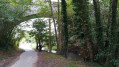
(2) Cross Rue du Colonel Baker (D3) with care and take the path opposite, to the left of a large fodder shed. Pass between the stud farm’s paddocks, follow the path for about 2 km, during which you’ll pass under power lines and cross two junctions. In its final section, the track runs through woodland and curves to the left.

(3) At the end of the path, turn left (south) onto the Route du Mesnil-Patry, then follow it for about 1.2 km – during which you will pass an enormous silo – until you reach the D9.

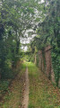
(4) Take the utmost care when crossing the D9 and continue straight on along the Route du Mesnil-Patry towards Cheux. Walk for about 400 m, turn onto the path on the right, then 300 m further on, turn onto the path on the left between the fields. Note the yew tree, which helps to pinpoint the entrance to the path. Follow the track for about 700 m until you reach the first houses in the village of Cheux.

(5) At the Fork in the road, do not continue straight on along Chemin du Pont Collin but turn right before the wall and follow the tree-lined lane to go round the residential area on your left. At the end of the tree-lined avenue, take the left-hand Fork in the road, pass between the housing estates and join Rue de la Londe, then Rue du Val Doré. Turn left onto this road (D173a) and follow it to the next junction.

(6) Turn right towards Aunay-sur-Odon and Noyer-Bocage (D83) onto Rue du Bocage and follow it to the next junction. When you reach the equestrian centre, turn left onto Rue du Nid de Chien and follow it until you reach Rue des Portes (D170). Turn left and follow the road to the end, near the church.

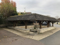
(7) Turn left into Rue de la Baronnie (D89), ignore the road on the right and continue to the crossroads and the washhouse on the left-hand corner. Turn right into Rue Robert Couteheuse (D83), then right again into Rue Saint-Vigor until you reach Rue des Dentelières between the town hall and the church. Turn left and follow this street until you reach the first street on the left.

(8) Turn left into Rue du Tripot and follow it until you reach Rue du Bessin (D83). Turn right onto it, walk for about a hundred metres, pass the health centre, ignore the road on the right and continue slightly to the right along Chemin de la Mue. Follow the Chemin de la Mue for about 2 km until you reach the D9 at La Bouille. Turn left and follow the D9 along its left-hand verge for a good hundred metres until you reach the car park on the other side of the road.

(9) Cross the D9 with the utmost care and visit the British military cemetery. Once you have finished your visit, leave the cemetery, take the path and return to the car park by the side of the D9, then turn left. Follow the D9 along its left-hand verge for a good hundred metres until you reach Rue de la Bouille (D83).

(10) Turn left towards Bretteville-l’Orgueilleuse and follow the D83 for about 700 metres until you reach Rue de l’Église. Turn right, walk past the cemetery on your right-hand side and carefully cross Rue de l’Église to reach the car park (S/E).


Waypoints

  1. S/E : mi 0 - alt. 226 ft - Car park - Vestiges de l'église de Saint-Manvieu
  2. 1 : mi 0.29 - alt. 233 ft - Rue de Bouliesse
  3. 2 : mi 0.55 - alt. 203 ft - Rue du Colonel Baker (D83)
  4. 3 : mi 1.98 - alt. 243 ft - La Fosse Noire
  5. 4 : mi 2.69 - alt. 272 ft - D9 road between Le Mesnil-Patry and Cheux
  6. 5 : mi 3.55 - alt. 302 ft - Junction on a tree-lined path
  7. 6 : mi 3.87 - alt. 276 ft - Rue du Bocage (D83)
  8. 7 : mi 4.23 - alt. 282 ft - Church
  9. 8 : mi 4.55 - alt. 276 ft - Rue du Tripot
  10. 9 : mi 5.63 - alt. 240 ft - D9 Road – La Bouille - Cimetière Militaire Britannique (Saint-Manvieu-Norrey)
  11. 10 : mi 6.04 - alt. 233 ft - Rue de la Bouille - Mue (rivière)
  12. S/E : mi 6.62 - alt. 226 ft - Car park - Vestiges de l'église de Saint-Manvieu

Worth a visit

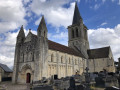
The former church of Saint-Manvieu
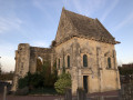
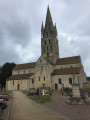
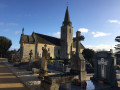
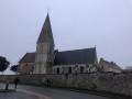
The remains of the old church of Saint-Manvieu are situated to the south-west of the village, near the D83, within its cemetery. The seigneurial chapel, with an elongated plan, faces west and comprises two bays. The chapel is single-storey and is topped by a gable roof. It also features a cornice with modillions. The semi-circular windows are mullioned and surmounted by a triangular pediment. The chapel is punctuated by buttresses, separating the windows. Furthermore, the south façade of the chapel features an opening surmounted by a tympanum. As on the exterior, the semicircular windows are surmounted by a triangular pediment. A double cornice marks the first level of the roof. This building was constructed in the 13th and 17th centuries. The seigneurial chapel, to the south of the chancel, has been listed as a historic monument since 24 January 1918. The bell tower and the chancel, almost entirely destroyed in 1944, had been listed on 16 May 1927. Today, all that remains of the building is the seigneurial chapel, now in a state of ruin.

The Church of Saint-Vigor in Cheux
This building, surrounded by its cemetery, is situated to the south-east of the village of Cheux, near the D 170.
This church, with a Latin cross plan, has eight bays and is oriented (that is to say, facing east). The nave is flanked by two side aisles. The transept provides access to the chancel. A bell tower with a pavilion sits above the transept. The nave is topped by a gable roof, the side aisles by a lean-to roof and the chancel by a hipped roof. The chancel and transept are in the Romanesque style (12th century). In the 19th century, during reconstruction, the appearance was altered and the windows were enlarged. In the nave, the wooden vault dates from the 1860s. In the apse, excavations carried out during the church’s restoration revealed the foundations of pillars. It was on the basis of this discovery that the Department of Fine Arts decided to reconstruct them, even though they had not existed prior to 1944. As for the bell tower, its roof was originally made of timber covered with slate; today, the roof is tiled.
“The church at Cheux is very large and reflected the former importance of this market town, the chief town of a sergenterie within the Caen election; it consists of a long nave flanked by side aisles, transepts and an apse, as well as two chapels attached to either side of the apse, to the east of the transept.” (Arcisse de Caumont 1-215)
The church was partly destroyed during the bombings of 1944. The chapels mentioned by Arcisse de Caumont have disappeared.

British military cemetery
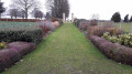
The cemetery is situated between Caen and Caumont-l’Eventé, on the edge of the D9 road, between Saint-Manvieu to the north and Cheux to the south. The cemetery contains 2,183 graves, including 1,623 British, 3 Canadians and 1 Australian, as well as 556 Germans, who account for more than a quarter of the graves. These men lost their lives during the bloody fighting in June and July 1944 to the west of Caen, mostly during Operation Epsom, which began on 26 June: the Battle of Tilly-sur-Seulles, the Battle of the Odon and the capture of Carpiquet. A long grass-lined path leads to the cemetery entrance, flanked by two columns. The shelter and the Memorial Stone face the eighteen blocks of headstones arranged on either side of the Cross of Sacrifice. Every year, when the flowers are in bloom, perennials and flowers breathe new life into the rows of headstones.

Reviews and comments

4.5 / 5
Based on 2 reviews

Reliability of the description
4.5 / 5
Ease of following the route
5 / 5
Route interest
4 / 5
Jean-yves A.
Jean-yves A.

Overall rating : 4.3 / 5

Date of your route : Sep 03, 2026
Reliability of the description : ★★★★☆ Good
Ease of following the route : ★★★★★ Very good
Route interest : ★★★★☆ Good
Very busy route : No

Move the starting point to the church car park, which is larger

Machine-translated

Jean-Paul BUTEAU
Jean-Paul BUTEAU

Hello Alinese,
I’m delighted to hear that the description was accurate and that you thoroughly enjoyed the hike; I find that very encouraging. Thank you for taking the time to post your review.

Machine-translated

Alinese
Alinese

Overall rating : 4.7 / 5

Date of your route : Dec 12, 2021
Reliability of the description : ★★★★★ Very good
Ease of following the route : ★★★★★ Very good
Route interest : ★★★★☆ Good
Very busy route : No

Clear and precise directions – it’s easy to find your way round. The mention of the yew tree in point 4 is a good idea, as it’s easy to miss the path if you’re walking a bit too fast. The detour via the British cemetery makes for a pleasant little break during the walk.

Machine-translated

Other walks in the area

For more walks, use our search engine .

The GPS track and description are the property of this route's author. Please do not copy them without permission.