Circular walk around the Moulin-de-Vert Nature Reserve from the Verbois dam

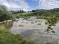
Explore a former circular bend in the Rhône which has become a nature reserve since the river was straightened in 1938.

Details

4919063
Creation:
Last update:
Last review:
  • Walking
    Activity: Walking
  • ↔
    Distance: 4.98 mi
  • ◔
    Average duration: 2h 40 
  • ▲
    Difficulty: Easy

  • ⚐
    Back to start: Yes
  • ↗
    Ascent: + 446 ft
  • ↘
    Descent: - 453 ft

  • ▲
    Highest point: 1,427 ft
  • ▼
    Lowest point: 1,155 ft

Description of the walk

Park at Les Cheneviers, before the Verbois dam.

(S/E) Walk down the left bank of the Rhône and enter the nature reserve. It is signposted with green signs.
Pass the Étangs Hainard and Étangs des Isles on your left.

(1) When you come to a water outlet ahead of you, turn left and follow the old circular loop of the Rhône which used to flow along the Cartigny cliffs
At the end of the circular route, return to the riverbank and walk round the western pond.
Continue across the meadow which leads to the foot of the cliff.

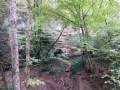
(2) Once you’ve caught your breath, climb up the Cartigny cliff.
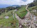
The steps run close to the cliff, following its ridge (a lovely viewpoint). Be careful not to get too close , as the moraine cliff is crumbly. Carry on until you reach a stretch of road (Chemin des Roches).

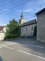
(3) Turn left onto Rue du Trabli to reach a roundabout. Go round it on the left to continue along Route du Moulin de la Ratte.

(4) On leaving Cartigny, turn left onto Chemin du Moulin Vert, pass the ruins of Moulin Dufour and continue along the same path, which curves to the right.

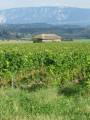
(5) At the bottom, where the path opens out onto the fields, turn right towards the Cheminée des Cheneviers. In the middle of the fields, head up to the right to reach a white shed with a small garden.
Take the barely visible track that runs alongside it on the right. After 30 m, it becomes a wider path that climbs towards the Bois de la Dronde. It veers sharply to the right towards Cartigny.

(6) Take the muddy path on the far left which leads into the Bois de la Dronde until you reach the exit, where you’ll come out onto a road.

(7) Follow it to the right, then turn left to join another road.

(8) Head back down towards Aire-La-Ville and make your way to the Cheneviers car park (S/E).

Waypoints

  1. S/E : mi 0 - alt. 1,217 ft - Les Cheneviers car park
  2. 1 : mi 1.12 - alt. 1,158 ft - Start of the old Rhône circular route
  3. 2 : mi 1.9 - alt. 1,224 ft - Path climbing the Cartigny cliff
  4. 3 : mi 2.28 - alt. 1,414 ft - Rue du Trabli
  5. 4 : mi 2.61 - alt. 1,417 ft - Chemin du Moulin Vert
  6. 5 : mi 3.32 - alt. 1,161 ft - Fields
  7. 6 : mi 3.71 - alt. 1,388 ft - Junction in the Bois de la Dronde
  8. 7 : mi 4.24 - alt. 1,276 ft - Road
  9. 8 : mi 4.49 - alt. 1,237 ft - On the left, access to Aire-la-Ville
  10. S/E : mi 4.98 - alt. 1,217 ft - Les Cheneviers car park

Notes

General store in Aire-La-Ville

Worth a visit

Spot wildlife in the nature reserve

Reviews and comments

4.6 / 5
Based on 3 reviews

Reliability of the description
4.5 / 5
Ease of following the route
4.5 / 5
Route interest
4.7 / 5
Crideva
Crideva

Hello,

Did you follow your GPS? I was surprised by your comment, as the path is fairly easy, except for point 5, which should not be missed as it is not very visible (as indicated in the description). This must have been particularly the case at the end of this rainy spring, during which the vegetation proliferated without the paths being used much. But once you've taken this junction, there are no real difficulties.
Maybe try it again in the summer ;-)

Machine-translated

toinede5974
toinede5974
• Edited:

Overall rating : 4 / 5

Date of your route : May 17, 2025
Reliability of the description : Not used / Not applicable
Ease of following the route : Not used / Not applicable
Route interest : ★★★★☆ Good
Very busy route : No

It could have been a lovely walk, but it's very poorly signposted, even on the description.
Too bad

Machine-translated

Lolo0174
Lolo0174
• Edited:

Overall rating : 5 / 5

Date of your route : Feb 03, 2025
Reliability of the description : ★★★★★ Very good
Ease of following the route : ★★★★★ Very good
Route interest : ★★★★★ Very good
Very busy route : No

Superb walk, passing through a nature reserve, so if you have a dog, be careful! On the other hand, it took me 1 hour 40 minutes instead of the advertised 2 hours 40 minutes.

Machine-translated

Sylvie R.
Sylvie R.

Overall rating : 4.3 / 5

Date of your route : Apr 30, 2023
Reliability of the description : ★★★★☆ Good
Ease of following the route : ★★★★☆ Good
Route interest : ★★★★★ Very good
Very busy route : No

A pleasant stroll along the Rhone and through the Geneva countryside.

Machine-translated

Other walks in the area

For more walks, use our search engine .

The GPS track and description are the property of this route's author. Please do not copy them without permission.