


carrera.david

 Visorando Member
Sign up:
Published route(s)
 Puy-Saint-Pierre circular

 6.74 mi
 +1,621 ft
 -1,624 ft
 4h 30
4h 30
 Moderate
 Departure from Briançon (Hautes-Alpes)
Suburban walk.
A few steep sections but no real difficulties.
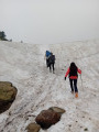
From Orlu to the Refuge d'en Beys
 9.91 mi
+2,887 ft
-2,861 ft
7h 05
9.91 mi
+2,887 ft
-2,861 ft
7h 05
 Difficult
Departure from Orlu (Ariège)
Difficult
Departure from Orlu (Ariège)
Hiking along the Oriège River to the Refuge d'En Beys.
⚠️ You are entering the Orlu National Hunting and Wildlife Reserve, where regulations must be observed. See practical information.
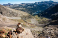
Pic d'Estaragne
 4.02 mi
+2,956 ft
-2,956 ft
4h 25
Difficult
Departure from Aragnouet (Hautes-Pyrénées)
4.02 mi
+2,956 ft
-2,956 ft
4h 25
Difficult
Departure from Aragnouet (Hautes-Pyrénées)
Looking for a 3,000-metre peak? An accessible summit? The Pic d’Estaragne awaits you! Beautiful scenery and breathtaking colours.
Please note: although it is relatively accessible, it is still a 3,000-metre peak. There are difficult sections and the climb is steep.