Country:

 City:


''Route provided by ‘La Thébaïde’ in Blanot
(Bed and Breakfast) – 06 11 01 74 94
(S/E) From the car park in the village of “Blanot”, cross the road to reach “l’Étape”, the former hotel and restaurant that has become the community bar “le Coing”.
It was here, following an informant’s tip-off, that five villagers who were members of the Resistance were arrested and deported on 23 January 1944. Their names, along with five others, are inscribed on the war memorial erected to the left of the premises.
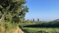
Walk alongside the building, past the bakery, and continue along the tarmac path lined with houses on the left. At the junction, carry straight on along the grassy path, which is closed to unauthorised vehicles and marked in blue on a white background.
As you walk, note the view of Mont-St-Romain on your right. This is the highest peak in the Clunisois region. It rises to 579 metres and is said to have been a site of Druidic worship. Legend tells of a relentless struggle between the old and new religions on this wooded and rocky site. A chapel was once built here, but it has since disappeared. The site is now private property and features an orientation board. Access is permitted on certain days.
(1) About 1 km further on, you’ll reach a place known as La Musette, a group of renovated buildings set in wooded grounds featuring wooden viewing platforms. Turn left into the open field before the descent begins.
At the edge of the field, ignore the steep path leading down to the right and continue straight on. At Les Échats Loups, turn right.
(2) At the next junction, continue to the right, heading down towards Nouville (a hamlet of Blanot) via the Combe du Seuil.
Before reaching the transformer, turn left onto the path leading to the recycling centre, then left again onto the tarmac road overlooking the D146. Continue to Cour Bouillard. There, head downhill to the right.
Further down, you can see a beautifully restored leat that holds back the water from the Grison.
The waterfall and the location of the mill wheel, situated underground, are not visible from the road. This mill is thought to have had a dual purpose: grinding wheat, but also crushing hemp and bark for the tannery*.
Cross the D146 and walk past the building.
As you pass the Grison diversion channel, note the covered washhouse (1878) and its fountain on the left. Continue along the path which climbs to the left of the house. At the road, turn left.
(3) Take the path (still marked in blue on a white background) which leads uphill to the right at the carpentry workshop/sawmill.
(4) 600 m further on, leave the blue markings on a white background and follow the green markings which branch off to the right. At the ‘V’ junction, continue to the right. Take care: roots and small stumps may make walking difficult on this section of the route.
Follow the markings, skirting the rock without getting too close (risk of scree) to take a steep slope on the left (slippery in wet weather). Once at the summit, cross an open area before heading back into the woods. Descend, following the markings, to a valley, then climb back up the path opposite (here, too, rain can make the ground slippery).
Head slightly to the right at the top of the slope to soon reach a wide path. Follow it uphill to the left.
(5) At Les Teppes (fallow land), head towards Blanot Bourg on the right.
Continue along this path. At the junction with Les Grottes and Vivier, follow the green markings on a white background.
(6) When you reach the Roussot signpost, leave this route and turn right towards Blanot.
(7) When you reach the road, cross it and follow the path straight ahead through the vineyards.
(8) At the next crossroads, turn right. Follow this path, marked in blue on a white background, until you reach the start of the Chemin de Mazelet. Head down to the right towards the town hall, then turn left towards the centre of the village to return to the starting point.
You can take a short tour of the village by following the bat symbol…

 Visorando Member

 Difficult
 Moderate