Montchauvet to Dammartin-en-Serve circular loop

A short walk starting from Dammartin town centre, followed by a detour to Monchauvet before returning to Dammartin.

Details

n°25901577
Creation:
Last update:
Last review:
  • Walking
    Activity: Walking
  • ↔
    Distance: 4.22 mi
  • ◔
    Average duration: 2h 05 
  • ▲
    Difficulty: Easy

  • ⚐
    Back to start: Yes
  • ↗
    Ascent: + 190 ft
  • ↘
    Descent: - 190 ft

  • ▲
    Highest point: 440 ft
  • ▼
    Lowest point: 233 ft

Photos

Description of the walk

Park opposite the town hall in the car park with seven to eight spaces.

(S/E) Take the lane between the town hall and the church, then head right into Rue François Coent. Turn left into Rue de la Corderie and then right into Rue des Pincevins to reach Rue de Pacy-sur-Eure.

(1) Turn right, go round the roundabout on the right and continue straight ahead onto Rue du Clos de l’Abbaye. Then carry on along Chemin de Paris.

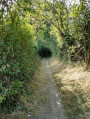
(2) Take the small path on the right, turn left at the junction and carry on straight ahead to the end of the path. Then turn right to join the road (D11).

(3) Cross carefully and head straight ahead onto the steep, stony path leading down to Montchauvet. At the bottom of the path, keep left to reach Rue de la Côte Lainée. Turn right, then turn right again onto the Grande Rue, which you should follow for just over 150 metres before turning onto the small dirt track on your right.

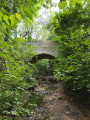
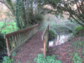
(4) At the first junction, take the path on your right to the small stone bridge over the Vaucouleur; cross it, then take the first path on the left, which leads to Rue de la Côte aux Amants.

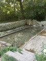
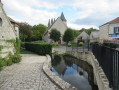
(5) Turn left, passing the sewage treatment works, and cross the bridge: on your right, you’ll see an old wash house currently being restored. Continue along the path, then turn right at Château les Trois Fontaines.

(6) At the next junction, turn right, cross a stream (dry in summer) and you’ll come out onto a tarmac road which you should follow, keeping in the same direction. You’ll reach the junction with Rue de Tilly at the small car park in front of the cemetery.

(7) Turn right. Stay on Rue de Tilly, which becomes Rue de la Halle after the left-hand bend. You’ll return to the car park where you started (S/E).

Waypoints

  1. S/E : mi 0 - alt. 423 ft - Car park opposite the town hall and the post office
  2. 1 : mi 0.39 - alt. 440 ft - Rue de Pacy-sur-Eure
  3. 2 : mi 0.98 - alt. 427 ft - Path on the right
  4. 3 : mi 1.92 - alt. 354 ft - Cross the D11. Near the - Vaucouleurs (rivière)
  5. 4 : mi 2.55 - alt. 266 ft - Junction, turn right
  6. 5 : mi 3.03 - alt. 269 ft - Rue de la Côte aux Amants
  7. 6 : mi 3.51 - alt. 282 ft - Junction, turn right
  8. 7 : mi 3.87 - alt. 381 ft - Cemetery car park
  9. S/E : mi 4.22 - alt. 423 ft - Car park opposite the town hall and the post office

Notes

(5) In winter, the stream after WP (6) may be impassable. In this case, head up Rue de la Côte aux Amants and then turn left onto the path known as Rue de la Côte aux Ormes to rejoin the route described before (7).

Reviews and comments

4 / 5
Based on 2 reviews

Reliability of the description
4.5 / 5
Ease of following the route
3.5 / 5
Route interest
4 / 5
laetipay
laetipay

Overall rating : 3.7 / 5

Date of your route : Jun 10, 2024
Reliability of the description : ★★★★☆ Good
Ease of following the route : ★★★☆☆ Average
Route interest : ★★★★☆ Good
Very busy route : No

A lovely walk through villages, countryside and woods.
A tricky stretch after the first bit of the country path. You cross a road and there’s nothing but undergrowth everywhere...
We pushed on along an unmaintained path. The plan was to go through the field next to it, but in late spring the plants seem to be blocking the way everywhere...
It added a touch of adventure ...

Machine-translated

Fabetnet
Fabetnet

Overall rating : 4.3 / 5

Date of your route : Jan 29, 2024
Reliability of the description : ★★★★★ Very good
Ease of following the route : ★★★★☆ Good
Route interest : ★★★★☆ Good
Very busy route : No

An enjoyable route, with good signposting apart from one section where the route was unclear

Machine-translated

Other walks in the area

For more walks, use our search engine .

The GPS track and description are the property of this route's author. Please do not copy them without permission.