Country:

 City:
City:


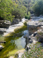
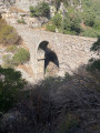
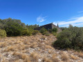
The village of Minerve is accessible by car in about thirty minutes from the A61 motorway (Toulouse–Narbonne), taking the Lézignan Corbières exit. Two pay-and-display car parks (approximately €6 per day in 2025) are clearly signposted in the village; one is near the bridge on the D10, the other is at the top of the village, which is the starting point for the walk. If you’d prefer to stop for lunch or a visit to Minerve halfway through the walk, you can park for free on the D147 at this point (8) (elevation 331 on the IGN map); in this case, it’s advisable to walk the route in the opposite direction.
(S/E) Head towards the far end of the car park (payment terminal) then turn right onto the road leading towards the village centre. Please note: the path that runs along the north bank of the Brian is dangerous and is now closed: do not use it as a ‘shortcut’ on this route. Walk down into the village as far as the Cesse.
(1) Carry on straight ahead, following the banks of the Cesse, until you reach the footbridge that takes you across it.
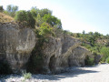
(2) Access is via a small ford which can normally be crossed without getting your feet wet thanks to a few stones. Note the reconstructions of medieval war machines on both banks (note: alternative access is possible from the ramparts at this point). Cross the footbridge. Follow the yellow markings from this point. Climb the cliff via a flight of steps, then follow the narrow, winding path until you reach a wide path at the top of the cliff.
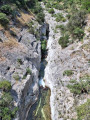
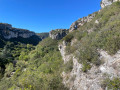
(3) Follow this path along the cliff top. As you approach the edge cautiously, take in the view of the Gorges du Brian. Don’t miss an old Carignan vineyard on the right, with an information sign from the winegrower.
(4) You’ll reach a junction before the houses at La Courrounelle. Follow the well-signposted path to the left. After a detour southwards, it heads north again, running along a ledge overlooking the gorges until you reach another junction. Please note: various ledge paths on the left bank of the Brian are dangerous and off-limits; stay on the signposted route.
(5) At this junction, follow the yellow-marked path to the left. A lovely little cave, connected to a karstic cave, is worth a visit just off the path. You will then reach the bottom of the gorge at the pretty Pont de Daniel.
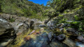
(6) Cross the bridge and continue along the path which descends the gorge on the right bank, following the river. There are places to stop by the water’s edge. Pass an old reservoir and continue to the pumping station.
(7) Follow the tarmac path up the cliff to the D147 road (altitude 331).
(8) (Parking available along the road. Possible alternative starting point for the circular walk.) Cross the D147 and follow the yellow markings on a long descent towards the south-west.
(9) Leave the yellow markings, which head back towards Minerve, and take a wide path heading west, which forms part of the Hérault crossing. Please note: there are no further markings from this point onwards. Pass two small paths on the right, then one on the left. Walk up the left bank to the top of the Brunan Canyon, which you will need to go round.
(10) You’ll reach a track at the top of the canyon; follow it to the left, heading west.
(11) There is a possible detour to some dolmens (off the main route). Take the path that descends south then south-west, cross the Ruisseau de Brunan, then continue the descent southwards.
(12) Follow the path that branches off to the right, heading west, then south again.
(13) Follow the path branching off to the right, heading south-west, to reach the edge of the cliff.
(14) Stunning views over the Gorge de la Cesse and the Moulin d’Azam. Follow the path which descends steeply to the bottom of the gorge.
(15) Ford the Cesse at the foot of the Moulin d’Azam. The water is usually shallow, but you will still need to take off your shoes. You can stop by the water’s edge. There is a covered shelter by the mill. Head back up the path behind the mill towards the south. Pass the junction on the right leading to the Balme Rouge and the Grotte d’Aldène (possible detour off the main route).
(16) Return to the car park at Moulin d’Azam and the D10E1 road. Follow this road to the left, heading east towards Minerve. Views of the Gorge de la Cesse and vineyards on the right.
(17) Turn left onto the road leading back to the car park (S/E).



 Visorando Member