Around the Ruisseau de Coupiat canyon

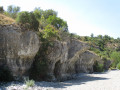
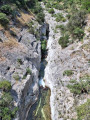
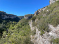
Far less well-known than the Brian, its close neighbour, the Ruisseau de Coupiac has also carved out impressive gorges that are well worth discovering. After a rather gruelling climb up onto the causse, the route offers beautiful views of the Minervois, the Corbières and the Pyrenees. The descent along the canyon leads to the small village of La Caunette, where a stop for a break will be most welcome. Finally, the return journey along the dry bed of the Cesse offers a unique experience.

Details

25206036
Creation:
Last update:
Last review:
  • Walking
    Activity: Walking
  • ↔
    Distance: 9.36 mi
  • ◔
    Average duration: 5h 25 
  • ▲
    Difficulty: Moderate

  • ⚐
    Back to start: Yes
  • ↗
    Ascent: + 1,312 ft
  • ↘
    Descent: - 1,329 ft

  • ▲
    Highest point: 1,572 ft
  • ▼
    Lowest point: 423 ft

Photos

Description of the walk

From Minerve, follow the D10 towards Aygues Vives. Leave the D10 and turn left onto a small road towards Mayrannes, which crosses the Cesse via a very narrow bridge where it is impossible for two vehicles to pass each other. Park in the bend about a hundred metres further on, in a small space at the side of the road that can accommodate two vehicles.

No signposting

(S/E) Follow the road, heading roughly north, towards Mayranne. Pass through the hamlet and, at the last house, turn right onto a stony track that goes round a farm building. You’ll come to a fork.

(1) Navigate the hairpin bend to the left, staying on the same track, and begin a steady climb up the Causse de Coupiat. Keep to the right at the fork further up. The low vegetation typical of the heath offers a view, on the right, of the tops of the rocky cliffs of the Ruisseau de Coupiat. Continue along the wide path which now crosses the Causse de Mayranne and reaches a junction marked by a large cairn.

(2) Continue straight ahead. Ignore a wide path on the right which does not appear on the IGN map and, shortly afterwards, you’ll come out onto a cross-country track opposite a sign marked ‘AVV3’.

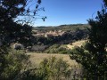
(3) Turn right. The view opens up to the south over the rolling hills of the Minervois and, beyond that, the Corbières and the Pyrenees. Carry on straight ahead until you reach a dry meadow on your left after a gentle descent: there is another “AVV3” sign here.

(4) Turn right. Reach another junction (Contadis on the map) and turn right again. The path that branches off to the right earlier on the IGN map no longer exists on the ground. As you proceed, the path becomes increasingly narrow and then enters dense woodland. This section requires care as the trail on the ground becomes difficult to follow in places beneath the thick carpet of leaves.

(5) Keep to the right and continue on the almost level path, which leads out into open ground further on. When you reach a junction, go straight on and join a tarmac road, which you should follow in the same direction.

(6) About ten metres before the county road, turn right onto a wide dirt track: signposted ‘Transit AVV3’. Ignore a track branching off to the right and continue southwards until you reach a four-way junction marked by an ‘AVV4’ sign.

(7) Turn right and continue to the end of the track to enjoy the view over the gorges of the Ruisseau de Coupiat: please note, the area is not secured.

(8) Turn back.

Blue signposting

(7) Continue to the right along a gentle slope. At a junction that is not very clearly marked on the ground (signposted “AVV4”), keep to the right and you will reach another fork with a vineyard in the background.

No markings

(9) Keep to the right. The path runs alongside the Ruisseau de Coupiat gorge on your right. Feel free to veer off to the right to get closer and enjoy the views upstream and downstream. Be careful, however, as the edges of the gorge are not secured and require caution: this section is strongly not recommended with young children.

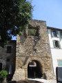
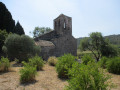
(10) Carry on straight ahead, walking alongside the vineyards on your left. The path gives way to a small tarmac road which you should follow straight down to the junction with the road leading to La Caunette, just before the bridge over the River Cesse. Head towards the village to see the small Romanesque church and carry on to the square.

(11) Turn back towards the bridge and cross it.

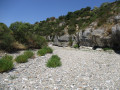
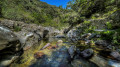
(12) Take the small flight of steps on the left leading to a grassy area. Continue to the left to reach the dry riverbed of the Cesse. Cross under the bridge and follow the river upstream, favouring sandy sections or those with small pebbles to make progress easier. However, take care not to twist your ankles. Follow the meandering course of the river in its deep gorge, pass under the bridge you crossed at the start before parking, then veer slightly to the left to come out onto a dirt track. Follow it to the right until you reach the concrete ford.

(13) Cross the ford and head back up to the car park (S/E).

Waypoints

  1. S/E : mi 0 - alt. 545 ft - Car park on Route de Mayrannes
  2. 1 : mi 0.55 - alt. 715 ft - Junction, turn left
  3. 2 : mi 2.1 - alt. 1,371 ft - Crossroads, cairn, straight ahead
  4. 3 : mi 2.48 - alt. 1,519 ft - Track, on the right
  5. 4 : mi 2.82 - alt. 1,549 ft - Junction, turn right
  6. 5 : mi 3.42 - alt. 1,457 ft - Junction, turn right
  7. 6 : mi 4.06 - alt. 1,362 ft - Turn right
  8. 7 : mi 4.58 - alt. 1,227 ft - Crossroads viewpoint
  9. 8 : mi 4.84 - alt. 1,191 ft - Viewpoint
  10. 9 : mi 5.44 - alt. 1,122 ft - Junction, turn right
  11. 10 : mi 6.06 - alt. 896 ft - Junction, go straight on
  12. 11 : mi 7.31 - alt. 459 ft - The Caunette
  13. 12 : mi 7.51 - alt. 453 ft
  14. 13 : mi 9.11 - alt. 472 ft - Ford
  15. S/E : mi 9.36 - alt. 541 ft - Car park on Route de Mayrannes

Notes

No water sources have been identified. You must carry a sufficient supply, especially in summer.

Hiking boots are recommended due to the numerous stony sections.

The section between (4) and (5) requires careful attention. After Contadis, the undergrowth becomes dense and the trail disappears in places beneath a carpet of leaves. Take the time to orientate yourself properly: the GPX track will be very useful.

(8) Unsafe view over the gorges. Take great care.

Between (9) and (10), the path runs alongside the canyon. You can get closer to admire the wooded valley floor and the cliffs. A faint trail serves as a guide, but the edges are dangerous and unsecured. Avoid this section if you are not comfortable with heights and, in any case, if you are accompanied by young children.

The climb up the Cesse is no easy feat. You’ll need to choose your route carefully to avoid sections with large boulders, making the climb easier. This section should be avoided in very hot weather, as the sun’s glare off the stones turns the riverbed into a veritable furnace.

Worth a visit

Between (1) and (2), do take a moment to look back and enjoy the view of the Minervois, the Corbières and the Pyrenees.

Don’t miss a visit to Minerve.

Nearby is the wine-growing village of Saint-Jean-de-Minervois, renowned for its famous Muscat.

Reviews and comments

4 / 5
Based on 3 reviews

Reliability of the description
4.3 / 5
Ease of following the route
4 / 5
Route interest
3.7 / 5
biboubilipop
biboubilipop

Overall rating : 3.3 / 5

Date of your route : Oct 14, 2025
Reliability of the description : ★★★★☆ Good
Ease of following the route : ★★★☆☆ Average
Route interest : ★★★☆☆ Average
Very busy route : No

I did half of this route. I started at No. 5 in Baroubio, a very pretty hamlet. The beginning of the route is quite nice, but once you reach No. 7, it's better to have a GPS. The undergrowth at 6 p.m. hadn't been cleared, and I admit I wasn't very confident😬, but it was preferable to the forest paths, which were a bit tedious and not very interesting for the most part. Fortunately, I was treated to the sunset when I arrived at the hamlet of Baroubio. When you arrive in the valley, I must admit, you expect better in terms of scenery. I didn't see any signposts until the last section, No. 12.

Machine-translated

bergpaden
bergpaden

Overall rating : 5 / 5

Date of your route : Nov 06, 2023
Reliability of the description : ★★★★★ Very good
Ease of following the route : ★★★★★ Very good
Route interest : ★★★★★ Very good
Very busy route : No

We completed the 15 km walk in 5 hours, with 450 m of elevation gain, instead of the
the 587 metres stated.
Please note: At point 11, the instructions say “do not cross the bridge; head down to the right”. There is a gate.
On our way back from the village of La Caunette, we found a path on the left well before the bridge, where we were able to head down into the bed of the River Cesse. Bear in mind that there’s a 3 km stretch to cover along this riverbed, which is covered in pebbles. We set off from the village of La Caunette, so the section through the riverbed is at the start of the walk.

We found the walk to be very scenic and full of interest. There were views of the canyon, the Corbières and the Pyrenees. We thoroughly enjoyed it. Thank you!!
Bea

Machine-translated

frank beauvais
frank beauvais

Overall rating : 3.7 / 5

Date of your route : Aug 09, 2023
Reliability of the description : ★★★★☆ Good
Ease of following the route : ★★★★☆ Good
Route interest : ★★★☆☆ Average
Very busy route : No

Hello, I did the walk on 9 August 23. I found it fairly average, mainly because of the first half of the route (which was very monotonous). The second half is more interesting.
A word of warning, however, for future walkers:
1: I completed the circular route in 3 hours 15 minutes instead of the 5 hours 55 minutes stated on the route description.
2: At point 11, it says: “Do not cross the bridge; go down to the right....” This is private property with a gate. You must therefore cross the bridge; on the left there is a small flight of steps leading to a grassy car park. Cross this and you’ll find, at the far end on your left, another access point to the riverbed. The detour adds less than 10 minutes to the journey compared with the original route.
Thanks for the route, J. Jacques
Frank Beauvais

Machine-translated

Other walks in the area

For more walks, use our search engine .

The GPS track and description are the property of this route's author. Please do not copy them without permission.