The ‘Vierge and the Nied’ circular route starting from Colligny

A short walk to explore the countryside east of Metz, taking in field paths, a greenway and a few points of interest.
Please note that, depending on the season, part of the route may be muddy.

Details

6038250
Creation:
Last update:
Last review:
  • Walking
    Activity: Walking
  • ↔
    Distance: 4.20 mi
  • ◔
    Average duration: 2h 05 
  • ▲
    Difficulty: Easy

  • ⚐
    Back to start: Yes
  • ↗
    Ascent: + 180 ft
  • ↘
    Descent: - 190 ft

  • ▲
    Highest point: 876 ft
  • ▼
    Lowest point: 715 ft

Photos

Description of the walk

Park in the car park at Colligny City Stadium.

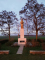
(S/E) Take the path through the fields, heading roughly south. Passing through pleasant rolling countryside and past a small pond at the bottom of the valley, you’ll reach the statue of the Virgin Mary; continue on and, a few metres further on, you’ll come to a Y-shaped junction.

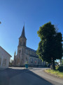
(1) Carry on, taking the right-hand branch; you’ll soon reach a large farmhouse where an enormous chestnut tree stands, with a bench beneath it. After the farmhouse, cross a small bridge, go uphill, and at the top of the slope you’ll find a church and a monument to the village of Villers Laquenexy. At the crossroads, rejoin theGR®5G.

(2) Continue straight ahead, following the red and white markings, until you reach the departmental road. Turn left onto it for a few metres, then turn right off it to take the Chemin du Gué de Villiers. You’ll then come to a right-angled junction on the banks of the River Nied; this is also the Voie Verte.

(3) Turn left onto this path and continue following the markings until you reach the equestrian centre at the junction of the D70 and D67.

(4) Cross this junction and take the field path opposite to return to the original junction you passed on the way out.

(1) Follow the route back in the opposite direction to return to the car park at the Colligny City Stadium (S/E).


Waypoints

  1. S/E : mi 0 - alt. 863 ft - Colligny City Stadium car park
  2. 1 : mi 0.85 - alt. 856 ft - Crossroads at the end of the circular loop
  3. 2 : mi 1.43 - alt. 794 ft - Villers-Laquenexy
  4. 3 : mi 1.9 - alt. 715 ft - Nied Française (rivière)
  5. 4 : mi 2.58 - alt. 725 ft - Equestrian centre
  6. S/E : mi 4.2 - alt. 863 ft - Colligny City Stadium car park

Notes

Between (S/E) and (1) on this country lane, depending on the season, you’ll see fields of wheat, barley, maize or rapeseed.

Worth a visit

Always be cautious and plan ahead when you're outdoors. Visorando and the author of this route cannot be held responsible for any accidents occurring on this route.

The GR® and PR® markings are the intellectual property of the Fédération Française de Randonnée Pédestre.

Reviews and comments

4.3 / 5
Based on 3 reviews

Reliability of the description
5 / 5
Ease of following the route
5 / 5
Route interest
3 / 5
MmtAkh
MmtAkh

Overall rating : 3.7 / 5

Date of your route : Apr 27, 2026
Reliability of the description : ★★★★★ Very good
Ease of following the route : ★★★★★ Very good
Route interest : ★☆☆☆☆ Very disappointing
Very busy route : Yes

There were loads of people on the route (which is hardly surprising given the route).
There’s nothing of interest as there’s nothing to see (just an empty path), useful only for getting back into shape or going for a daily jog, for example.
Nothing to report.

Machine-translated

Kingo
Kingo

Overall rating : 4.7 / 5

Date of your route : May 01, 2025
Reliability of the description : ★★★★★ Very good
Ease of following the route : ★★★★★ Very good
Route interest : ★★★★☆ Good
Very busy route : No

A short but effective walk

Machine-translated

Waltoo
Waltoo

Overall rating : 4.7 / 5

Date of your route : Apr 25, 2021
Reliability of the description : ★★★★★ Very good
Ease of following the route : ★★★★★ Very good
Route interest : ★★★★☆ Good
Very busy route : No

A short walk around my neighbourhood, sticking to the ten-kilometre rule.
At the moment the paths are dry, but some get muddy as soon as it rains.

Machine-translated

Other walks in the area

For more walks, use our search engine .

The GPS track and description are the property of this route's author. Please do not copy them without permission.