Country:
 City:
City:


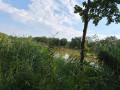
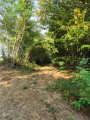
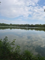
Park in the car park at the Salle des Fêtes in the village of Lent.
(S/E) Join the road (Montée de la Vierge) and head left towards Saint-Paul-de-Varax, walking alongside the football pitch.
(1) Turn left at the corner of the football pitch, cross the housing estate and continue straight on along the path through the fields. You’ll come to a crossroads.
(2) Take the road on the right towards Longris and continue to the bend after the farm.
(3) Carry on straight ahead along the path, which immediately veers to the left and winds through the countryside before reaching Étang Bouvent.
(4) Turn right, then left to follow the southern shore of the lake and carry on straight ahead along the path at the edge of the woods. You’ll reach the Route des Gagères.
(5) Turn left onto this road towards Les Gagères and Bresse.
(6) At the road sign and behind the houses, take the path on the right: please note, there is no signpost at this point. Go straight on at the junction after the 90° bend and keep going in the same direction, straight ahead, ignoring the adjacent paths. Follow the left-hand side of the Étang Francheret and you will come out onto a tarmac road.
(7) Turn right onto this road towards Longris.
(8) Carry on straight ahead at the junction where the possible shortcut is (see Practical Information), and walk along the right-hand side of the Étang Rebouton. When you reach Longris, take the road on the right and return to the bend by the farm that you passed on the way there.
(3) Stay on the road, taking the left-hand bend in the opposite direction to the outward journey, and return to another junction you passed on the outward journey.
(2) Carry straight on and join the D22 (Route de Chalamont).
(9) Cross it carefully and take the path opposite. Just before the Veyle, take the path on the left to follow the river and reach an industrial estate, which you’ll need to cross.
(10) Take the road on the left towards the Salle des Fêtes. Cross the D22 again with the same caution and follow the street opposite to return to the car park (S/E).
 Tourist office

 Visorando Member
 Moderate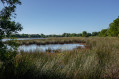
 Association / Club / Walk leader