The Cup-marked Stones

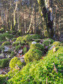
Erratic boulders transported by the Rhône Glacier to the foot of the Jura.

Details

58137
Creation:
Last update:
Last review:
  • Walking
    Activity: Walking
  • ↔
    Distance: 3.46 mi
  • ◔
    Average duration: 2h 20 
  • ▲
    Difficulty: Easy

  • ⚐
    Back to start: Yes
  • ↗
    Ascent: + 814 ft
  • ↘
    Descent: - 810 ft

  • ▲
    Highest point: 2,297 ft
  • ▼
    Lowest point: 1,617 ft

Photos

Description of the walk

Park near the Town Hall in Saint-Jean-de-Gonville.

(S/E) From the car park, turn right onto Rue du Bourg, which becomes Rue Saint Jean. Follow it up to the junction with Rue de la Louvatière.

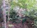
(1) Continue straight on along Rue du Gachet. Further on, take the path branching off to the right; a sign, somewhat hidden by the trees, marks the start of the Pierres à Cupules trail. At the next junction, take the path leading uphill opposite to reach “La Pierre de Neyret”, a large erratic boulder, in the woodland.
Continue along the path to reach a flat area.

(2) From there, head down to the right. At the next fork, turn left and walk back up alongside a low stone wall to “Maison Driset”. Follow the wall to the right until you reach the next crossroads.

(3) Turn left to reach the clearing where you will find "La Pierre du Paray" on the left, which is actually two large boulders. From here, you can also see the ridge line of the Upper Jura range.
Go behind the boulders and head down the path on the right (spring) back to the previous crossroads.

(3) Turn left onto a wide path to the hamlet of Mornex. Turn right, then left, then right again onto Rue de la Louvatière to return to the junction you passed on the way out.

(1) Turn left to return to the car park (S/E).

Waypoints

  1. S/E : mi 0 - alt. 1,617 ft - Town hall car park
  2. 1 : mi 0.36 - alt. 1,696 ft - Crossroads of the circular loop
  3. 2 : mi 1.28 - alt. 2,211 ft - To the right
  4. 3 : mi 1.79 - alt. 2,215 ft - Crossroads of the short circular loop
  5. S/E : mi 3.46 - alt. 1,617 ft - Town hall car park

Notes

Beautiful clearings and stunning views throughout the route.

Worth a visit

This is a fairly short walk that can be combined with a stroll to Fort l’Écluse.

Reviews and comments

4.2 / 5
Based on 9 reviews

Reliability of the description
4.3 / 5
Ease of following the route
4 / 5
Route interest
4.1 / 5
Sakn01
Sakn01

Overall rating : 5 / 5

Date of your route : May 04, 2026
Reliability of the description : ★★★★★ Very good
Ease of following the route : ★★★★★ Very good
Route interest : ★★★★★ Very good
Very busy route : No

Thank you for this lovely walk. The paths are very well marked, and with the app, they’re very easy to follow.

Machine-translated

toinede5974
toinede5974

Overall rating : 4.7 / 5

Date of your route : Apr 11, 2026
Reliability of the description : ★★★★★ Very good
Ease of following the route : ★★★★★ Very good
Route interest : ★★★★☆ Good
Very busy route : Yes

A lovely, easy walk

Machine-translated

cgarrido
cgarrido

Overall rating : 4 / 5

Date of your route : Jun 02, 2025
Reliability of the description : ★★★★☆ Good
Ease of following the route : ★★★★☆ Good
Route interest : ★★★★☆ Good
Very busy route : No

It was my first time hiking on my own, and I really enjoyed it. That said, it’s true that there are no signposts along the entire route, so the app was a real help in guiding me.

Machine-translated

YannDSF
YannDSF

Overall rating : 4.3 / 5

Date of your route : Jul 28, 2024
Reliability of the description : ★★★★★ Very good
Ease of following the route : ★★★★★ Very good
Route interest : ★★★☆☆ Average
Very busy route : No

An easy, quick walk; I was disappointed not to find the famous rocks without a thorough search… is it a lack of signposting or a lack of interest on the part of the local council? …..a lovely walk all the same 😉

Machine-translated

Kg
Kg

Unable to complete the route due to a section being inaccessible.
A shame
The signposts aren’t visible; perhaps it would be a good idea to put up signs with directions to make it easier to find your way at the junctions (I only saw one) and the path running alongside a stone wall was blocked by a tree trunk lying across it.
I had to do my best to find my way back to the Driset house

Machine-translated

grandin
grandin ★

kg
Could you please specify where you encountered problems and what they were?
Thank you

Machine-translated

Kg
Kg

Overall rating : 3 / 5

Date of your route : Jul 24, 2023
Reliability of the description : ★★★☆☆ Average
Ease of following the route : ★★☆☆☆ Disappointing
Route interest : ★★★★☆ Good
Very busy route : No

Unable to complete the route due to a section being inaccessible.
What a shame

Machine-translated

tjov
tjov
• Edited:

Overall rating : 5 / 5

Date of your route : Mar 06, 2021
Reliability of the description : ★★★★★ Very good
Ease of following the route : ★★★★★ Very good
Route interest : ★★★★★ Very good
Very busy route : No

A short, very pleasant walk.
Took 2 hours at a very leisurely pace with plenty of short breaks.
The first section really took us by surprise.
The stone wall was absolutely beautiful!
The car wreck was the talk of the town.
The GPX track is very useful as it’s easy to take a wrong turn.

Machine-translated

emm
emm

Overall rating : 4.3 / 5

Date of your route : Sep 19, 2020
Reliability of the description : ★★★★★ Very good
Ease of following the route : ★★★★☆ Good
Route interest : ★★★★☆ Good
Very busy route : No

A pleasant walk through the woods and part of the way through the pretty village of Saint-Jean-de-Gonville.
No major difficulties, but a bit of a climb nonetheless
Faster than the 2 hours 20 minutes predicted.

Machine-translated

liesbeth
liesbeth

Overall rating : 4.7 / 5

Date of your route : Mar 02, 2020
Reliability of the description : ★★★★★ Very good
Ease of following the route : ★★★★★ Very good
Route interest : ★★★★☆ Good

A lovely walk at the end of the day. A magnificent view of Mont Blanc.
On the way back down, the wreck of an old car with trees growing inside it – rather magical.

Machine-translated

gazok54
gazok54 ★

Thank you, lolo0607
The author’s account is no longer active, so the only way for us to update it would be for hikers to provide us with details to include in the description.
So please do feel free to send us your suggestions. ...

Machine-translated

lolo0607
lolo0607

Overall rating : 2.3 / 5

Date of your route : Jan 22, 2018
Reliability of the description : ★★☆☆☆ Disappointing
Ease of following the route : ★☆☆☆☆ Very disappointing
Route interest : ★★★★☆ Good

It’s very difficult to find the path – in fact, it’s almost impossible.
However, we managed to find another route which is the same circular route but longer.
Perhaps, as the description dates from 2014, the signposts have disappeared?

Machine-translated

Other walks in the area

For more walks, use our search engine .

The GPS track and description are the property of this route's author. Please do not copy them without permission.