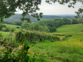
The ‘Échelle des 16 écluses’ circular loop

From the Activital leisure centre, set off on a 20 km circular route that will reveal the hidden treasures to the east of the Étang de Baye. This route takes you to the impressive arches of La Collancelle, runs alongside the 16 locks, and takes you cycling along the peaceful Canal du Nivernais.

Easy and suitable for everyone, this route stands out for the diversity of its landscapes: farm tracks, forest paths and cycle paths – there’s something for everyone. With a moderate elevation gain of 140 metres, a bit of fitness is helpful, but nothing insurmountable for those who enjoy a brisk ride.

It’s the ideal outing to combine the joy of cycling, exploring the heritage of the Nièvre region, and a breath of fresh air in the heart of the countryside!

Details

n°72889658
Creation:
Last update:
Last review:
  • Mountain biking
    Activity: Mountain biking
  • ↔
    Distance: 12.51 mi
  • ◔
    Duration according to the author: 2 hrs 
  • ▲
    Difficulty: Moderate

  • ⚐
    Back to start: Yes
  • ↗
    Ascent: + 436 ft
  • ↘
    Descent: - 436 ft

  • ▲
    Highest point: 971 ft
  • ▼
    Lowest point: 735 ft
  • ⚐ Country: France
  • ⚐
    Area: Morvan
  • ⚐ City: Bazolles (58110)
  • ⚑
    Start/End: N 47.176174° / E 3.619493°
  • ❏
    IGN map(s): Ref. 2723SB

  • ◶
    Type of surface:
  •  
     
     
    ■ 30% Road ■ 50% Byway ■ 20% Path
  • ⇧
    Bike carrying: Not specified
  • ▲
    Difficulty: Moderate
  • Hour-by-hour weather

Description of the route

Park in the car park at the Activital leisure centre.

(S/E) Starting from the hire area, follow the Ruisseau de Venin towards the Cercle Nivernais de la Voile. Carry on straight ahead until you reach the end of the campsite. At this point, take the bridge on your left.

(1) Once on the bridge, carry on straight ahead until you reach the road. At the junction, turn right and take the cycle path on your left.

(2) Once you’re on the cycle path, follow it until you reach a stone bridge on your left and a footpath ahead of you.

(3)Cross the bridge, follow the signposts and turn immediately right after passing the building. Continue along the cycle path, following the 16 locks, until you reach the junction with the D297. 

(4) Carry on to the left, over a small pass, which involves an uphill climb for most of this section. After these 2 kilometres, pass through the hamlet of Mondain and arrive at a Fork in the road, with the departmental road continuing to the left and a farm track straight ahead. 

(5) Take the farm track straight ahead until you reach a junction with a road. 

(6) Carry on straight ahead along the farm track. You’ll cometo a signpost indicating you should continue along the track to the left, a few metres before a road – do not take this road.

(7) Turn left and continue along a forest track, signposted by markers. You’ll reach the edge of the forest, with a private property on your left and a stretch of road on your right. 

(8) Take the road on the right, which goes downhill, and, atthe end of it, you’ll join the D135.

(9) Turn left, taking the wooden footbridge on the right-hand side of the road, the ‘Sentier de la Libellule’. Continue along this path until it ends. 

(10) At the end of the path, take the road on the left, then turn right and enter the car park. Once you’ve crossed it, carry on until you reach a red platform overlooking the stream. Turn immediately left and follow this path to the finish point, in front of the hire centre (S/E).

Waypoints

  1. S/E : mi 0 - alt. 863 ft - Equipment hire: Activital Leisure Centre
  2. 1 : mi 0.32 - alt. 863 ft - Alnain Bridge
  3. 2 : mi 0.57 - alt. 879 ft - Track, Les Poujats junction
  4. 3 : mi 2.79 - alt. 860 ft - Port Brulé Bridge
  5. 4 : mi 4.97 - alt. 745 ft - D297 junction
  6. 5 : mi 6.28 - alt. 843 ft - Chemin de Loumot junction
  7. 6 : mi 7.68 - alt. 892 ft - D958 junction
  8. 7 : mi 9.35 - alt. 846 ft - Left-hand bend on the farm track
  9. 8 : mi 10.94 - alt. 948 ft - End of the forest trail
  10. 9 : mi 11.24 - alt. 876 ft - D135 junction
  11. 10 : mi 11.99 - alt. 876 ft - End of the Dragonfly Trail
  12. S/E : mi 12.51 - alt. 863 ft - Equipment hire: Activital Leisure Centre

Notes

Parking is available in the car park at the Activital leisure centre. This is a walk suitable for everyone, whether on foot or by mountain bike. The route is signposted as a mountain bike route, so please ensure you follow these specific signposts.

Worth a visit

The main highlight of this route is that it takes you along a variety of paths, offering a changing landscape throughout the walk. Whether you’re more at ease on cycle paths or on farm tracks – which can sometimes be tricky to navigate – this route is fascinating for its diversity.

In terms of heritage, it offers views of the small surrounding villages, the Voûtes de la Collancelle and the Échelle des 16 écluses.

In terms of wildlife, you’ll be able to spot herons, coypu, egrets, buzzards and even storks along this route.

Reviews and comments

5 / 5
Based on 1 review

Reliability of the description
Not used
Ease of following the route
5 / 5
Route interest
5 / 5
User 4044112

Overall rating : 5 / 5

Date of your route : Sep 01, 2026
Reliability of the description : Not used / Not applicable
Ease of following the route : ★★★★★ Very good
Route interest : ★★★★★ Very good
Very busy route : No

It’s magnificent, running alongside the Nivernais Canal with its locks set very close together at this point, and the Yonne water channel, a structure that supplies water to the canal. These are ingenious and fascinating engineering feats. The route is relatively shaded.

Machine-translated

For more walks, use our search engine .

The GPS track and description are the property of this route's author. Please do not copy them without permission.