

Chassy Route

Just a stone’s throw from the Nevers conurbation, come and discover the village of Sauvigny-les-Bois, its forests, its many lakes and 35 km of signposted walking trails!

Details

n°45563944
Creation:
Last update:
Last review:
  • Mountain biking
    Activity: Mountain biking
  • ↔
    Distance: 5.19 mi
  • ◔
    Duration according to the author: 45 mins 
  • ▲
    Difficulty: Easy

  • ⚐
    Back to start: Yes
  • ↗
    Ascent: + 328 ft
  • ↘
    Descent: - 312 ft

  • ▲
    Highest point: 866 ft
  • ▼
    Lowest point: 679 ft
  • ⚐ Country: France
  • ⚐ City: Sauvigny-les-Bois (58160)
  • ⚑
    Start/End: N 46.965733° / E 3.275292°
  • ❏
    IGN map(s): Ref. 2624SB, 2625SB

  • ◶
    Type of surface:
  •  
     
     
    ■ 30% Road ■ 50% Byway ■ 20% Path
  • ⇧
    Bike carrying: Not specified
  • ▲
    Difficulty: Easy
  • Hour-by-hour weather

Photos

Description of the route

Parking is available in the car park at Saint-Étienne Church in Sauvigny-les-Bois (40 spaces).

(S/E) Head towards Rue de la Cure, just above the church car park. Take Route de l’Étang (D18) south-east for about 60 metres, and cross it carefully.

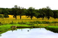
(1) Turn left before the pond and walk past the restaurant. Follow the signposted path at the bottom of the valley for about 1 km.

(2) Cross the Ruisseau du Magny and follow the forest track for 1 km.

(3) Take the tarmac road, heading due east, for 500 m, then take a path on the left, heading due north, into a deciduous woodland. Descend to the Ruisseau de Magny.

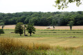
(4) Cross it and continue along a path running between two meadows until you reach the woods. Turn left, heading due west, for about 1 km, until you reach the hamlet of Chassy.

(5) Turn left and walk for 100 m; just after house number 4, take the path on the right. Continue for 1 km to reach the roundabout (elevation 225).

(6) Turn left, heading south-east, onto the first lovely forest lane, and follow it for 1 km. When you reach a large tree, turn right onto the path which descends for 300 m, then continue uphill to the entrance to Sauvigny-les-Bois.

(7) Turn left, cross the village, then turn right onto the D209, Route du Lavoir, and head towards the church (S/E).


Waypoints

  1. S/E : mi 0 - alt. 679 ft - Car park - Eglise Saint-Etienne (Sauvigny-les-Bois)
  2. 1 : mi 0.1 - alt. 692 ft - Junction - Etang des Roses
  3. 2 : mi 0.97 - alt. 719 ft - Magny Stream
  4. 3 : mi 1.42 - alt. 827 ft - Tarmac road
  5. 4 : mi 2.17 - alt. 751 ft - Magny Stream
  6. 5 : mi 2.99 - alt. 758 ft - D209. Chassy Farm
  7. 6 : mi 3.72 - alt. 741 ft - Multi-way junction in the forest
  8. 7 : mi 4.65 - alt. 735 ft - D18
  9. S/E : mi 5.19 - alt. 679 ft - Car park - Eglise Saint-Etienne (Sauvigny-les-Bois)

Notes

Facilities on site: car park, picnic areas, catering, toilets, fitness trail.

Worth a visit

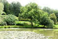
The partly listed Saint-Étienne Church, the Étang des Roses and its various facilities, the Étang du Moulin, the Amognes State Forest and many other attractions will make your outing a pleasure.

Reviews and comments

5 / 5
Based on 1 review

Reliability of the description
5 / 5
Ease of following the route
5 / 5
Route interest
5 / 5
Arsene  Lupin
Arsene Lupin

Overall rating : 5 / 5

Date of your route : Apr 23, 2024
Reliability of the description : ★★★★★ Very good
Ease of following the route : ★★★★★ Very good
Route interest : ★★★★★ Very good
Very busy route : No

Hello,
A lovely walk through the woods – a bit of road unfortunately, but I’d highly recommend it.
Best regards.
Guillaume.

Machine-translated

For more walks, use our search engine .

The GPS track and description are the property of this route's author. Please do not copy them without permission.
