From Athée to the Brinjame

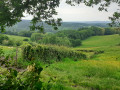
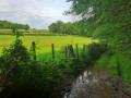
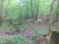
A shaded, cool route through meadows and woodland, leading to the Brinjame where children can splash about. You can compare the landscapes and undergrowth created by different types of forestry. A beautiful view on the way back, particularly of Vézelay. Passes through the pretty hamlet of Athée.
Very interesting on a mountain bike, with lovely descents, a few good climbs and technical sections.

Details

3205403
Creation:
Last update:
Last review:
  • Mountain biking
    Activity: Mountain biking
  • ↔
    Distance: 4.26 mi
  • ◔
    Duration according to the author: 30 mins 
  • ▲
    Difficulty: Moderate

  • ⚐
    Back to start: Yes
  • ↗
    Ascent: + 466 ft
  • ↘
    Descent: - 459 ft

  • ▲
    Highest point: 1,230 ft
  • ▼
    Lowest point: 784 ft
  • ⚐ Country: France
  • ⚐
    Area: Morvan
  • ⚐ City: Saint-André-en-Morvan (58140)
  • ⚑
    Start/End: N 47.372721° / E 3.849356°
  • ❏
    IGN map(s): Ref. 2722ET

  • ◶
    Type of surface:
  •  
     
     
     10% Road  20% Byway  70% Path
  • ⇧
    Bike carrying: Not specified
  • ▲
    Difficulty: Moderate
  • Hour-by-hour weather

Photos

Description of the route

Start from the main crossroads in Athée.

(S/E) Head west down the Chemin de l’Huis Gaudin. Turn right after the last houses and enter the deciduous forest. Continue down until you reach meadows, then reach the edge of the forest again.

(1) Turn left into the woods, then left again after a few dozen metres. Pass a few forestry tracks on your right.

(2) After the descent, turn left. Continue through the deciduous trees, pass a muddy section (a stream in the path), cross through conifers and reach a crossroads.

(3) Head down to the right through deciduous and coniferous trees until you reach the valley floor.

(4) Turn left before the river onto a faintly marked path (the Brinjame is a few dozen metres further on). Cross a stream and reach a meadow. Head up to the left after the meadow, through the coniferous trees, to reach a forest track.

(5) Take this track, turning right. Pass a path on the left to reach a second one, still on the left.

(6) Head up to the meadows (stream in the path), then reach the D141.

(7) Turn left and, after about 300 m, take Rue de la Chaume aux Ouailles on the left to return to Athée (S/E).

Waypoints

  1. S/E : mi 0 - alt. 1,207 ft - Main crossroads in Athée
  2. 1 : mi 1.01 - alt. 873 ft - Edge of the woods
  3. 2 : mi 1.34 - alt. 883 ft - At the bottom of the descent, on the left
  4. 3 : mi 1.71 - alt. 906 ft - Crossroads
  5. 4 : mi 1.85 - alt. 791 ft - Valley floor - Brinjame (cours d'eau) - Affluent de la Cure
  6. 5 : mi 2.15 - alt. 945 ft - Forest track
  7. 6 : mi 2.68 - alt. 945 ft - Leave the track and head up to the left
  8. 7 : mi 3.67 - alt. 1,194 ft - D141, turn left
  9. S/E : mi 4.26 - alt. 1,207 ft - Main crossroads in Athée

Notes

A few muddy sections in winter.
Possible shortcuts.

Worth a visit

Old public weighbridge at the starting point, where livestock used to be weighed. Horse dealers would visit the farms to negotiate directly with the farmers. Today it serves as a bus shelter for the children of the hamlet.
Wash house at L'Huis Gaudin.

The River Brinjame is just a few dozen metres away (4), where you can cool off in summer or watch the wildlife.

View of Vézelay to the north-north-east on the way back before reaching the D141.

Reviews and comments

5 / 5
Based on 1 review

Reliability of the description
5 / 5
Ease of following the route
5 / 5
Route interest
5 / 5
MichelBonnefoy
MichelBonnefoy
• Edited:

Overall rating : 5 / 5

Date of your route : Aug 17, 2022
Reliability of the description : ★★★★★ Very good
Ease of following the route : ★★★★★ Very good
Route interest : ★★★★★ Very good
Very busy route : No

We did this route and really enjoyed the hike. I’d recommend it.

Machine-translated

For more walks, use our search engine .

The GPS track and description are the property of this route's author. Please do not copy them without permission.