Ayguessou Circular Route

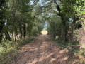
A walk starting from Singleyrac offering lovely scenery along paths, through woodland and along a few stretches of quiet roads.

Details

n°19079976
Creation:
Last update:
Last review:
  • Walking
    Activity: Walking
  • ↔
    Distance: 4.49 mi
  • ◔
    Average duration: 2h 20 
  • ▲
    Difficulty: Easy

  • ⚐
    Back to start: Yes
  • ↗
    Ascent: + 282 ft
  • ↘
    Descent: - 269 ft

  • ▲
    Highest point: 577 ft
  • ▼
    Lowest point: 315 ft

Description of the walk

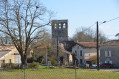
Park in the church car park.

(S/E) From the car park, walk down the street for 30 metres, then turn right towards Flaugeac via the D15. Walk for 500 metres and leave the road at the bend.

(1) Take the path on the left and continue to a junction.

(2) Turn right and follow the path due north until you reach the D15. Cross the road and continue along the road opposite, towards the hamlet of Le Maine.

(3) In the hamlet, take the track on the right and, at the end, turn left, passing a fenced-off property on your right. Walk downhill for 50 m, take the road on the left for 50 m and turn onto the first track on the right. Follow this track, passing the hamlet of Le Castel where you’ll join a road, and arrive at a fork.

(4) Turn right towards the hamlet of Clapier Haut. Walk through the hamlet and follow the road to the D107.

(5) Turn right and follow the road until you reach the first track on the left.

(6) Take this track, passing a turn-off to the right for the hamlet of La Coste, and continue to a junction.

(7) Turn onto the track on the right, pass the cemetery and continue along the cul-de-sac until you reach a crossroad.

(8) Turn left onto this road towards Singleyrac and return to the starting point, passing the town hall (S/E).

Waypoints

  1. S/E : mi 0 - alt. 466 ft - Church car park
  2. 1 : mi 0.33 - alt. 502 ft - Morillères junction
  3. 2 : mi 0.73 - alt. 574 ft - Junction
  4. 3 : mi 1.4 - alt. 446 ft - Le Maine hamlet
  5. 4 : mi 2.48 - alt. 397 ft - Junction towards the hamlet of Le Clapier
  6. 5 : mi 3.24 - alt. 407 ft - D107
  7. 6 : mi 3.47 - alt. 394 ft - Bois de la Dame crossroads
  8. 7 : mi 3.96 - alt. 463 ft - Junction
  9. 8 : mi 4.34 - alt. 492 ft - Cemetery junction
  10. S/E : mi 4.49 - alt. 466 ft - Church car park

Worth a visit

(S/E) Town hall: 13th-century building.

Reviews and comments

4.7 / 5
Based on 1 review

Reliability of the description
5 / 5
Ease of following the route
5 / 5
Route interest
4 / 5
didou24
didou24
• Edited:

Overall rating : 4.7 / 5

Date of your route : Nov 24, 2025
Reliability of the description : ★★★★★ Very good
Ease of following the route : ★★★★★ Very good
Route interest : ★★★★☆ Good
Very busy route : No

Really lovely walk... a bit muddy in places... but that's okay, it's probably better in dry weather.

Machine-translated

Other walks in the area

For more walks, use our search engine .

The GPS track and description are the property of this route's author. Please do not copy them without permission.