Dalhem circular route via Mortroux and Bombaye

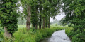
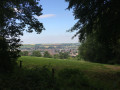
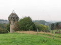
A lovely little walk around Dalhem, through countryside and woodland with very few roads.

Details

n°34510564
Creation:
Last update:
Last review:
  • Walking
    Activity: Walking
  • ↔
    Distance: 5.38 mi
  • ◔
    Average duration: 2h 45 
  • ▲
    Difficulty: Easy

  • ⚐
    Back to start: Yes
  • ↗
    Ascent: + 322 ft
  • ↘
    Descent: - 335 ft

  • ▲
    Highest point: 469 ft
  • ▼
    Lowest point: 269 ft

Photos

Description of the walk

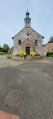
Park in the very small car park on Rue Gervais Soldat Toussaint.

(S/E) Head to the right, go round the wall and climb up the path on the right: a steep climb but not too long; there will be three such climbs along the route.

(1) After the climb, turn left onto the small road, continue for about 200 m and take the path on the right at the bend. Follow the path to the meadow, go through the two gates and you’ll come out onto a small road.

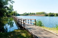
(2) Turn left and follow it straight on, crossing the bridge over the Berwinne.

(3) Just after crossing the small bridge, take the RAVeL (formerly the ‘Chemin du Train Bleu’) and follow it until you reach the junction with a road near Mortroux.

(4) Take the road to the left until you reach the next junction.

(5) Turn left, then quickly veer right towards La Sauvenière. The small road becomes a track and heads due north, taking you to the Chapelle de la Tombe in Bombaye.

(6) Turn left, pass the car parks and continue to a crossroad.

(7) Turn right onto it, pass through an amphibian tunnel and take thesecond path on the left. Head down through the woods and a meadow until you reach the village of Crowé. Turn left towards a small playground, cross it diagonally to the corner, then go up the small path on the left to the N604.

(8) Turn right and, after about 150 m, take the first street on the left, Rue de la Richelle. Take the path on the left just before the cemetery, follow it to the junction and turn left.

(9) At the crossroads, head left for 200 m, follow the path branching off to the left and go downhill. You’ll come to a meadow; head to the far right until you reach the small bridge, which is almost directly opposite the finish car park (S/E).

Waypoints

  1. S/E : mi 0 - alt. 331 ft - Small car park on Rue Gervais Soldat Toussaint
  2. 1 : mi 0.16 - alt. 407 ft - Road junction
  3. 2 : mi 0.63 - alt. 328 ft - Road junction. Towards the bridge at the - Berwinne (rivière) - Belgique
  4. 3 : mi 0.83 - alt. 322 ft - Junction with the RAVeL
  5. 4 : mi 1.61 - alt. 344 ft - Junction on the road
  6. 5 : mi 1.77 - alt. 377 ft - Crossing route
  7. 6 : mi 2.75 - alt. 463 ft - Chapelle de la Tombe
  8. 7 : mi 3.03 - alt. 433 ft - Junction
  9. 8 : mi 4.12 - alt. 335 ft - N604
  10. 9 : mi 4.82 - alt. 440 ft - Crossroads
  11. S/E : mi 5.38 - alt. 331 ft - Small car park on Rue Gervais Soldat Toussaint

Reviews and comments

4.3 / 5
Based on 2 reviews

Reliability of the description
4.5 / 5
Ease of following the route
4.5 / 5
Route interest
4 / 5
alain deville
alain deville

Overall rating : 4 / 5

Date of your route : Apr 14, 2025
Reliability of the description : ★★★★☆ Good
Ease of following the route : ★★★★☆ Good
Route interest : ★★★★☆ Good
Very busy route : No

An easy walk, at any rate in dry weather, with few roads to cross. A lovely walk through the Hervien-style countryside.

Machine-translated

DomGary
DomGary

Overall rating : 4.7 / 5

Date of your route : Aug 17, 2024
Reliability of the description : ★★★★★ Very good
Ease of following the route : ★★★★★ Very good
Route interest : ★★★★☆ Good
Very busy route : No

A really lovely walk. Watch out for the tree branch 30 metres from the finish... I split my scalp open!!!

Machine-translated

Other walks in the area

For more walks, use our search engine .

The GPS track and description are the property of this route's author. Please do not copy them without permission.