Country:

 City:
City:



Park behind the church in a small car park.
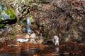
(S/E) Walk past the church, following the yellow markings towards Mas de la Barque, and cross the village to the wash house.
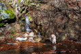
(1) Take the small uphill path on the left and continue following the yellow signposting towards the Rocher des Fées and the Mas de la Barque. Follow the small road for about 1 km and leave it by taking a path that climbs up to the left. Walk past the marker for the Rocher des Fées.
(2) Continue uphill and cross the Route Forestière du Rocher Communal for the first time. Continue the climb along a lovely path, still stony in places, and arrive at the Jalon des Besses on the Route Forestière du Rocher.
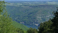
(3) Turn right onto this track (GR®68) towards the Mas de la Barque and walk past the Rocher Communal: you can venture out onto the rock , taking great care, to enjoy the panoramic view.
(4) Cross a stream and arrive at the Col du Marquet
(5) Continue along the track until you reach a Fork in the road with a water tank.
(6) Take the left-hand track, which climbs north-west, and head for the Col de Rabusat.
(7) Follow the track to the left towards the Mas de la Barque, where you’ll find dual yellow and red/white markings (GR®72). Arrive at the Mouniau marker.
(8) Leave the track and take a path that climbs to the right. Follow the path as it enters the beech forest towards the Mas de la Barque. Follow the red and white (GR®72) or yellow (PR®) markings. Please note that the path may be obscured by leaves or hidden by rocks; you must remain vigilant and follow the markings closely, which are consistent and frequent.
After a fairly steep climb through the woods, you’ll reach a well-marked track leading to the Route de Villefort (D66) at the Bois des Armes marker.
(9) Turn left and follow the road for 400 m to the Lou Felzillas marker (elevation 1,380).
(10) Leave the road and follow theGR®72, which climbs alongside the road on the right towards the Pré de la Dame. You’ll reach the Route du Mas de la Barque at an elevation of 1,450 and follow it to the left for about 200 m
(11) Leave the road and follow theGR®72through the woods on the right to the Roche Fendue marker.
(12) Turn left towards the Bouos d’Hommes and the Dentau de la Quartalade to the south-east, following the forest track (marked in yellow).
(13) Leave thePR® and turn left towards the Dentau de la Quartalade, staying on the forest track marked in yellow.
(14) Turn right and continue on thePR® towards Concoules, cross the Ruisseau de l’Homol and arrive at a junction at elevation 1403.
(15) Continue to the right on the same forest track, still marked in yellow, and follow these markings towards Concoules to reach the Route de Génolhac (D362).
(16) Turn right and follow the road for about 300 m until you reach the Diou Gracias marker (elevation 1347).
(17) Turn left onto the Tour de Malmontet forest track towards Concoules and follow it to elevation 1301.
(18) Leave the track and head down to the right into a small clearing beneath some ruins. Take care here, as there are no signposts and the path disappears: follow the GPS track and the IGN base map closely for about 250 m towards Valat de la Vernède. You’ll come to a lovely, steeply sloping path. The path is not signposted but is clearly visible and regularly marked by small granite cairns. The slopes can be steep: take care on the descent and watch out for rocks that may become slippery in the rain. This path leads to the Jalon des Besses.
(3) Then retrace your steps along the same route you took on the way there, heading back towards Concoules (S/E).



 Visorando Member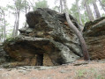
 Moderate
 Local authority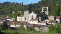
 Easy
Easy