Pont du Tarn Circular Route

Explore Mas Camargues and the Pont du Tarn, returning via the Bois du Commandeur.

Details

53092159
Creation:
Last update:
Last review:
  • Walking
    Activity: Walking
  • ↔
    Distance: 10.39 mi
  • ◔
    Average duration: 5h 15 
  • ▲
    Difficulty: Moderate

  • ⚐
    Back to start: Yes
  • ↗
    Ascent: + 502 ft
  • ↘
    Descent: - 499 ft

  • ▲
    Highest point: 4,744 ft
  • ▼
    Lowest point: 4,347 ft

Description of the walk

Park at the Mas de la Barque car park.

(S/E) Follow theGR® 72 towards Bellecoste.

(1) Stay on theGR®, leaving the path on your right (which you will take on the return journey), until you reach a four-way junction.

(2) Carry on straight ahead to reach the hamlet of Bellecoste.

(3) Leave theGR® and carry on straight ahead along the track towards Mas Camargues. Reach the hamlet.

(4) Keep going straight on; you’ll soon reach a small dirt car park. Continue along the track, ignoring the path that branches off to the right, and head towards L’Hôpital. Before reaching the hamlet, you’ll come to the junction with theGR®7.

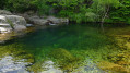
(5) Turn left and head for the Pont du Tarn, an ideal spot for a picnic if you fancy one.

(6) Take the forest track on the left after the bridge, following theGR®72. Enter the Bois du Commandeur.

(7) Leave theGR®72, keeping to the track which continues through the woods.

(8) Pass the footbridge on your left – which leads back tothe GR®72– and carry on straight ahead, following the signs for “Mas de la Barque”.

(9) Carry on straight ahead, ignoring the track branching off to the right, and return to the four-way junction you passed on the way out.

(2) Ignore theGR®, head straight ahead and follow a path running parallel to the track you took at the start, which eventually joins it.

(1) Carry on straight ahead to return to the car park (S/E).

Waypoints

  1. S/E : mi 0 - alt. 4,665 ft - Le Mas de la Barque
  2. 1 : mi 0.2 - alt. 4,682 ft - Junction. Round trip
  3. 2 : mi 0.8 - alt. 4,698 ft - Junction of the circular loop
  4. 3 : mi 2.59 - alt. 4,485 ft - The hamlet of Bellecoste
  5. 4 : mi 3.42 - alt. 4,459 ft - Mas Camargues
  6. 5 : mi 4.58 - alt. 4,491 ft - Junction with the GR°°®°°7. Towards the - Pont du Tarn (Mont Lozère)
  7. 6 : mi 5.92 - alt. 4,357 ft - GR°°®°°72. After the - Tarn (rivère)
  8. 7 : mi 6.71 - alt. 4,449 ft - Leave the GR°°®°° trail; go straight on
  9. 8 : mi 7.58 - alt. 4,554 ft - Junction at the footbridge: straight ahead
  10. 9 : mi 8.52 - alt. 4,698 ft - Junction, go straight on
  11. S/E : mi 10.39 - alt. 4,665 ft - Le Mas de la Barque

Worth a visit

Places of interest: the hamlets of Bellecoste and L’Hôpital, and the Pont du Tarn.

Always be cautious and plan ahead when you're outdoors. Visorando and the author of this route cannot be held responsible for any accidents occurring on this route.

The GR® and PR® markings are the intellectual property of the Fédération Française de Randonnée Pédestre.

Reviews and comments

4.6 / 5
Based on 3 reviews

Reliability of the description
4.3 / 5
Ease of following the route
4.7 / 5
Route interest
4.7 / 5
Hironde
Hironde

Overall rating : 4.7 / 5

Date of your route : Aug 03, 2026
Reliability of the description : ★★★★☆ Good
Ease of following the route : ★★★★★ Very good
Route interest : ★★★★★ Very good
Very busy route : No

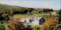
A lovely walk taking in the old hamlet of Bellecombe and the impressive Mas Camargues estate.
An ideal spot for a picnic is at the first bridge over the Tarn, just after Mas Camargues.
As the circular loop was too long for us, we turned back here and took a rough shortcut across the fields along the Tarn near Mas Camargues. However, this is not recommended: you’ll have to climb over fences and navigate marshy areas!
It’s better to head back to just before Bellecoste and reach the Bois du Commandeur via this decent track.

Machine-translated

User 29601332

Overall rating : 4 / 5

Date of your route : Jul 06, 2026
Reliability of the description : ★★★★☆ Good
Ease of following the route : ★★★★☆ Good
Route interest : ★★★★☆ Good
Very busy route : Yes

It went very well, thank you.

Machine-translated

André Semence
André Semence

Hello, is it possible to get from "Mas Camargues" by taking a path (visible on OpenStreetMap) heading south, which runs alongside the Tarn, to reach the Bois du Commandeur? I see that I would need to cross a stream (a tributary of the Tarn), "la Vérié". Is this easy to do?
thank you for your replies

Machine-translated

Laurent elbtz
Laurent elbtz

Overall rating : 5 / 5

Date of your route : Jul 30, 2024
Reliability of the description : ★★★★★ Very good
Ease of following the route : ★★★★★ Very good
Route interest : ★★★★★ Very good
Very busy route : No

An easy walk, with no significant elevation gain, offering plenty of options for shortcuts or detours. A lovely way to explore the Lozère highlands, passing some impressive granite buildings along the way.
Suitable for all fitness levels!

Machine-translated

Other walks in the area

For more walks, use our search engine .

The GPS track and description are the property of this route's author. Please do not copy them without permission.