Circular Pic de Cassini from the Mas de la Barque

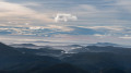
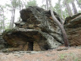
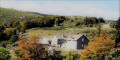
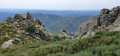
In the heart of the Cévennes National Park, this beautiful circular walk starting from the Mas de la Barque takes you on a journey of discovery through superb high-altitude landscapes. The route alternates between shaded woodland and open stretches across the stubble fields, offering sweeping 360° panoramic views as you pass by the Pic de Cassini and the Col de l’Aigle. An ideal hike for enjoying the great outdoors and the magnificent Cévennes terrain.

Details

105833921
Creation:
Last update:
Last review:
  • Walking
    Activity: Walking
  • ↔
    Distance: 6.52 mi
  • ◔
    Average duration: 3h 45 
  • ▲
    Difficulty: Moderate

  • ⚐
    Back to start: Yes
  • ↗
    Ascent: + 830 ft
  • ↘
    Descent: - 830 ft

  • ▲
    Highest point: 5,505 ft
  • ▼
    Lowest point: 4,675 ft

Description of the walk

Park in the Mas de la Barque visitor car park.

(S/E) From the car park, take the forest track that climbs northwards towards the Bois de Bellecoste.

(1) Continue along the forest track on the right, which climbs steadily in the shade of the trees, following the sign for Sous la Tête de Bœuf.

(2) Continue climbing along the edge of the woodland on the left to reach the Col de l’Aigle.

(3) At the pass, take in the first unobstructed panoramic view. Continue along the well-marked ridge path towards Pic Cassini.

(4) Reach the highest point of the route. The view extends 360° across the whole of the Cévennes. Then follow a narrower, less well-marked path, still heading north-west, towards the Ravin de la Levade.

(5) Begin the descent to the left, on the western slope along the ravine, staying on the main path which then turns south.

(6) Continue along the path opposite, which descends gently before veering eastwards and returning to the wooded area. You’ll reach a stream.

(7) Turn sharply right onto the main forest track, following the signs for Mas de la Barque.

(1) Turn right towards the south, still heading towards Mas de la Barque, and return to the car park (S/E).

Waypoints

  1. S/E : mi 0 - alt. 4,675 ft - Le Mas de la Barque
  2. 1 : mi 0.54 - alt. 4,902 ft - Bois de Bellecoste
  3. 2 : mi 0.64 - alt. 4,941 ft - Below the Tête de Bœuf
  4. 3 : mi 1.83 - alt. 5,266 ft - Col de l'Aigle (1604m)
  5. 4 : mi 2.41 - alt. 5,495 ft - Pic de Cassini (1680m)
  6. 5 : mi 2.67 - alt. 5,387 ft - Ravin de la Levade
  7. 6 : mi 3.3 - alt. 5,075 ft - Below Pic Cassini
  8. 7 : mi 4.53 - alt. 5,030 ft - Malpertus
  9. S/E : mi 6.52 - alt. 4,675 ft - Le Mas de la Barque

Notes

You may need to fit special equipment to your car (snow chains, snow socks or tyres approved under mountain regulations) to access the car park. There are two electric car charging points in the car park if required.

Worth a visit

At the Col de l’Aigle (3), you can take a very short path on the right (about 50 m) to reach a magnificent viewpoint.

At Pic Cassini (4), do take a moment to look out for the landmarks of the various peaks. From here, you can see Mont Lozère, Mont Aigoual, Pic Saint Loup and Mont Ventoux; and if the weather is clear, you might even spot the Mediterranean Sea, the Plomb du Cantal, La Barre des Écrins and Mont Blanc.

Other walks in the area

For more walks, use our search engine .

The GPS track and description are the property of this route's author. Please do not copy them without permission.