Circular route in the Ingwiller–Lichtenberg–Rothbach triangle

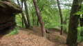
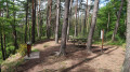
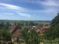
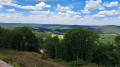
A lovely, undulating walk, mostly through woodland and brightened by the abundance of broom. Several points of interest mark this circular route: the botanical and ‘Poets’ trails showcase the forest, the high-perched Château de Lichtenberg offers a striking silhouette, whilst at the other end of the route the large sandstone boulders of the Scheibenberg remind us of the geology of the Northern Vosges.
The GPX track will certainly be very useful.

Details

49242127
Creation:
Last update:
Last review:
  • Walking
    Activity: Walking
  • ↔
    Distance: 10.22 mi
  • ◔
    Average duration: 6h 10 
  • ▲
    Difficulty: Moderate

  • ⚐
    Back to start: Yes
  • ↗
    Ascent: + 1,699 ft
  • ↘
    Descent: - 1,729 ft

  • ▲
    Highest point: 1,253 ft
  • ▼
    Lowest point: 633 ft
  • ⚐ Country: France
  • ⚐
  • ⚐ City: Ingwiller (67340)
  • ⚑
    Start/End: N 48.891684° / E 7.488585°
  • Accessible from the train station Gare de LICHTENBERG (EGLISE).
  • ❏
    IGN map(s): Ref. 3714ET
  • Hour-by-hour weather

Photos

Description of the walk

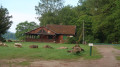
On leaving Ingwiller, take the D28 towards Rothbach, then, at the bend, turn left onto Rue de la Promenade to reach the car park at the Ingwiller Club Vosgien chalet. (You can also park a few hundred metres further on, near the Seelberg Forest House.)

(S/E) With your back to the chalet, turn left onto the tarmac roadGR®531towards “MF du Seelberg, Lichtenberg”, also signposted as the “botanical trail”.

Blue Rectangle

(1) After a few hundred metres, you’ll pass the Seelberg Forest House. 100 m further on, leave the tarmac road and continue left onto the forest track, which climbs gently up to the Wimmenau Forest Track.

(2) Cross this and continue to the junction with the “poetry trail”.

Red Ring

(3) Continue to the left along the narrow path lined with numerous panels displaying poems.
Reach the highest point of the “Le Seelberg” trail and continue downhill to the crossroads near a picnic area and its chalet (accessible).

(4) Turn right onto the wide forest track, still following the “poetry trail”, and carry on. After 500 m, turn left to reach a viewpoint overlooking Lichtenberg Castle.

(5) Retrace your steps and continue left along the wide forest path, “the poets’ trail”.
After a wide bend, walk for about 200 m, then head towards “Le Tierkirchlein” on the left.

Yellow Ring, Blue Rectangle with a White Cross

(6) Reach the modest ruins of “Tierkirchlein Castle” and walk round them, heading down to the right along the narrow path.

Blue Ring

The path joins the forest track below at a very large rock, the hollow of which can serve as a shelter. Turn left and continue to the junction with the Bruderthal Forest Road.

Blue Ring, Yellow Ring and Green Ring

(7) Cross the Winebachel Stream via the wooden footbridge, then turn right.
The path, which is very damp in places, runs alongside several ponds and leads to a wide, open crossroads.
Take the forest path which climbs to the left up the valley towards the heights of the Rothbach Wood (a few damp sections). At the junction, take the path on the left after climbing for about 500 metres.

Red Ring

(8) Continue the climb to the wide crossroads and follow the path on the left towards Lichtenberg. At the Fork in the road, turn right and rejoin theGR® 531 Blue Rectangle.

(9) Carry on straight ahead along the forest track until you reach the crossroads.

Blue Ring

(10) Take the path leading up to the plateau signposted ‘le chemin des châtaigniers’. Reach the Schaenzel plateau: viewpoint and picnic area.

Blue Rectangle, Blue Ring

(11) Continue towards Lichtenberg Castle through woodland and meadows. Reach the Carrefour du Calvaire after following the stony path to the first houses of the village of Lichtenberg.

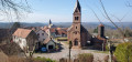
(12) Take the tarmac road opposite the castle, then head up to the right along Rue des Jardins. Turn right and reach the entrance to Lichtenberg Castle via the cobbled ramp (open to visitors). Walk around the castle’s watchtower via the path running alongside the moat (panoramic views of the village and surrounding area).
After your visit, leave the grounds on the left and head towards Rue des Cochers. After 100 m, turn right (Green Ring) and head towards the Carrefour du Calvaire.

(12) Take the road on the right for 100 m.

Blue Ring

(13) Turn left onto the Sentier des Châtaigniers, which runs below the Schaenzel plateau, and continue to the junction of the circular route you passed on the way out.

Blue Rectangle

(9) Continue straight ahead along theGR®531to the Buchwalderkopf Pass (picnic).

(14) Head towards Rothbach via Buchwalderkopf and Schneibenberg.

Yellow Ring, Red Disc, Red Triangle

(15) Climb to the summit of the Buchwalderkopf via the winding path (or go round it via the path on the left). Descend the winding path and turn left towards the junction with the bypass 150 m away.

Blue Rectangle, Red Ring

(16) Continue the descent, turning right to join theGR® 531 towards Rothbach, until you reach a crossroads.

Yellow Disc

(17) Turn right, leaving theGR®531towards Rothbach, passing through former quarries and a picnic area. The forest path runs past the old quarries to reach the Scheibenberg viewpoint.

(18) Descend the Scheibenberg via a narrow path lined with rocks towards Winkelberg. The path passes close to the active sandstone quarry.

Blue Ring and Green Ring

Continue along the path which descends to a fork in the road formed by two forest tracks.

(19) Take the Bruderthal Forest Road and, after 50 m, turn left towards Magdalenethal via the “Seelberg Botanical Trail”.
The path winds its way uphill through the woodland and joins a forest track; cross this and take the forest track opposite towards “Rebhiesel Steige” for 200 m.

Blue Ring and Yellow Ring

(20) Turn left towards “Seelhof spring via the vineyard path”. Continue to the S’Rabhiesel vineyard guard’s cottage.

(21) Walk round the front of the small shelter and turn left, then follow the narrow path through the orchards to reach a junction of forest tracks.

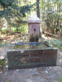
(22) Follow the forest track straight ahead and walk past the Seelhof Fountain. Continue until you reach the Wimmenau Forest Track.

Blue Rectangle with a white cross

(23) Carry on to the left until you reach the junction with theGR® 531 (botanical trail), which you have already passed on the way there.

Blue Rectangle

(2) Follow the route back along the same path as on the way there, heading down to the Seelberg Forest House and on to the car park at the Club Vosgien chalet (S/E).


Waypoints

  1. S/E : mi 0 - alt. 735 ft - Car park at the Ingwiller Club Vosgien chalet
  2. 1 : mi 0.29 - alt. 732 ft - Seelberg Forest House
  3. 2 : mi 0.64 - alt. 889 ft - Junction with the Wimmenau forest track
  4. 3 : mi 0.94 - alt. 1,047 ft - Junction with the Poets’ Trail
  5. 4 : mi 1.7 - alt. 1,063 ft - Picnic area and chalet on the Poets’ Trail
  6. 5 : mi 2.04 - alt. 1,017 ft - Viewpoint overlooking Lichtenberg Castle
  7. 6 : mi 2.53 - alt. 797 ft - Junction at the Tierkirchlein ruins
  8. 7 : mi 2.93 - alt. 656 ft - Wooden footbridge over a stream
  9. 8 : mi 3.34 - alt. 830 ft - Red Ring junction
  10. 9 : mi 3.72 - alt. 1,060 ft - Junction with the Litchtenberg circular loop
  11. 10 : mi 3.85 - alt. 1,102 ft - Chestnut Tree Trail. Blue Ring
  12. 11 : mi 3.97 - alt. 1,194 ft - Picnic area at the Schaenzel viewpoint
  13. 12 : mi 4.51 - alt. 1,142 ft - Calvaire crossroads
  14. 13 : mi 5.36 - alt. 1,148 ft - Junction with the Chestnut Tree Trail
  15. 14 : mi 6.41 - alt. 997 ft - Buchwalderkopf Pass
  16. 15 : mi 6.52 - alt. 1,040 ft - Junction. Ascent to the - Buchwalderkopf
  17. 16 : mi 6.97 - alt. 1,056 ft - Rothbach junction
  18. 17 : mi 7.44 - alt. 797 ft - Junction for Rothbach via the old quarries
  19. 18 : mi 7.86 - alt. 807 ft - Scheibenberg viewpoint
  20. 19 : mi 8.44 - alt. 636 ft - Fork in the road at the junction of the two forest tracks
  21. 20 : mi 8.77 - alt. 850 ft - Junction
  22. 21 : mi 8.84 - alt. 860 ft - S'Rabhiesel vineyard keeper’s cottage, dating from 1764
  23. 22 : mi 9.16 - alt. 820 ft - Path in front of the Seelhof fountain
  24. 23 : mi 9.26 - alt. 827 ft - Junction after the Seelhof Fountain
  25. S/E : mi 10.22 - alt. 735 ft - Car park at the Ingwiller Club Vosgien chalet

Notes

(4) Picnic area and shelter on the Poets’ Trail.

(14), (18) Picnic spot.

(21) S’Rabhiesel vineyard warden’s house: shelter available.

Plenty of benches along the route.

Worth a visit

Lichtenberg Castle (open to visitors).

The Schaenzel plateau – Chestnut Tree Trail.

The botanical and poetry trails.

The sandstone rock formations of Scheibenberg.

Always be cautious and plan ahead when you're outdoors. Visorando and the author of this route cannot be held responsible for any accidents occurring on this route.

The GR® and PR® markings are the intellectual property of the Fédération Française de Randonnée Pédestre.

Reviews and comments

4.7 / 5
Based on 3 reviews

Reliability of the description
5 / 5
Ease of following the route
4.7 / 5
Route interest
4.3 / 5
Djef57
Djef57

Overall rating : 5 / 5

Date of your route : Jul 21, 2026
Reliability of the description : ★★★★★ Very good
Ease of following the route : ★★★★★ Very good
Route interest : ★★★★★ Very good
Very busy route : No

Another wonderful discovery – stunning forests, a perfect hike in this sweltering heat,
Thanks to the trail planner.
We also set off from the forest lodge.
I’d highly recommend it.

Machine-translated

TVP67
TVP67
• Edited:

Overall rating : 4.3 / 5

Date of your route : May 01, 2026
Reliability of the description : ★★★★★ Very good
Ease of following the route : ★★★★☆ Good
Route interest : ★★★★☆ Good
Very busy route : No

A pleasant walk with some lovely views.
You need to pay close attention to the route, as it’s easy to go the wrong way. This happened to us twice, but we realised quickly.
The route is lovely in hot weather as it’s very shaded.
Took 6 hours to cover 19km

Machine-translated

jema67
jema67

Overall rating : 4.7 / 5

Date of your route : Mar 09, 2025
Reliability of the description : ★★★★★ Very good
Ease of following the route : ★★★★★ Very good
Route interest : ★★★★☆ Good
Very busy route : No

A walk I did today on a lovely day. This route, which is very wooded, becomes even more interesting when the deciduous trees haven’t yet put on their leaves: more sunshine and better views! It’s a lovely walk, with beautiful views, a pleasant break at Lichtenberg Castle (closed until 29 March) and a rural finish that adds to the variety of the whole experience. Well done on the description – no real problems with the route-finding (plus my GPS beeps at every waypoint, just when you’re starting to wonder). The only snag is that, on the descent from the Buchwalderkopf, you need to realise that you have to ignore the Yellow Ring, Red Disc and Red Triangle markings and turn left to rejoin the GR 150 metres further on. Also, at the old quarry, the markings aren’t quite right, so you mustn’t get it wrong – make sure you take the correct path (keep to the left).

We set off from the forest lodge to shorten the route slightly. The walk took 6 hours 30 minutes, including breaks, at a leisurely pace (we’re 65 years old, after all). On arrival, my GPS recorded an elevation gain of 598 metres over 16 km.

Machine-translated

Other walks in the area

For more walks, use our search engine .

The GPS track and description are the property of this route's author. Please do not copy them without permission.