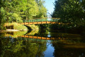
Circular route in the Yon Valley starting from Nesmy

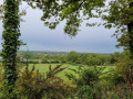
The Yon Valley offers lovely walks in all seasons, allowing you to explore the rural heritage.
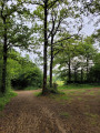
There are several routes through this wooded valley.
Important note: During periods of high water, this walk can be difficult and should therefore be avoided.

Details

8442602
Creation:
Last update:
Last review:
  • Walking
    Activity: Walking
  • ↔
    Distance: 6.78 mi
  • ◔
    Average duration: 3h 20 
  • ▲
    Difficulty: Moderate

  • ⚐
    Back to start: Yes
  • ↗
    Ascent: + 236 ft
  • ↘
    Descent: - 207 ft

  • ▲
    Highest point: 253 ft
  • ▼
    Lowest point: 98 ft
  • ⚐ Country: France
  • ⚐ City: Nesmy (85310)
  • ⚑
    Start/End: N 46.606228° / W 1.393666°
  • Hour-by-hour weather

Photos

Description of the walk

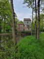
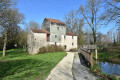
Park at Rambourg, north of Nesmy, opposite the mill.

(S/E) Cross the Yon either via the ford or the bridge. Continue along the road, which is also part of theGRP® Tour du Pays Yonnais route, signposted in red and yellow. Then walk past a farm and arrive at a Y-junction.

(1) Turn right onto the dirt track and head down through the meadows. You’ll reach a crossroads directly beneath a power line.

(2) Head right, cross the stream and climb slightly to the left; this muddy, slippery path climbs straight up to the hamlet of La Blinière.

(3) Turn right at the large stone until you reach the hamlet of Les Vallées.

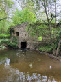
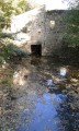
(4) Facing the houses, head down to the right and make your way to the Moulin du Furet, which lies in ruins.

(5) Cross the river via the footbridge and you’ll soon reach the junction with a stony track.

(6) Leave theGRP® here and turn right onto this path. Follow it as it runs alongside the woodland until you reach Rue des Mottines at the edge of the woods. You will then reach the districts of Petite and Grande Laudière in the village of Chaillé-sous-les-Ormeaux.

(7) At the end of the street, head straight ahead onto the path that climbs slightly and continue until you reach the Route de Nesmy (D36).

(8) Cross it carefully and take the path opposite which goes uphill. Then turn onto the first path on the right, continuing to keep to the right along the grassy path until you rejoin the Route de Nesmy D36.

(9) Turn left onto it, taking great care, and walk on the left-hand verge for about a hundred metres until you reach the recycling centre. Cross the road again with great care. Take the Chemin du Rocher. Pass the hamlet of La Jonchère to reach the Fichardière rest area further on.

(10) Turn left at the picnic area and continue along the pavement.

(11) Turn right along the stadium, onto Rue Gilbert Prouteau. Continue along the path to La Balangerie.
Go down the left-hand side twice, then walk straight through the village of Rambourg to arrive behind the mill and reach the Rambourg Mill car park (S/E).

Waypoints

  1. S/E : mi 0 - alt. 108 ft - Car park at the Rambourg Mill
  2. 1 : mi 0.49 - alt. 148 ft - Dirt track
  3. 2 : mi 1.02 - alt. 128 ft - Directly beneath a power line
  4. 3 : mi 1.69 - alt. 203 ft - La Blinière
  5. 4 : mi 2.41 - alt. 141 ft - The Valleys
  6. 5 : mi 2.63 - alt. 98 ft - Footbridge over the - Yon (rivière) à finaliser
  7. 6 : mi 2.75 - alt. 108 ft - GRP junction
  8. 7 : mi 3.24 - alt. 180 ft - Laudière neighbourhoods
  9. 8 : mi 3.6 - alt. 207 ft - D36 road
  10. 9 : mi 4.13 - alt. 246 ft - D36 road
  11. 10 : mi 5.07 - alt. 213 ft - Designated rest area
  12. 11 : mi 5.59 - alt. 213 ft - Stadium
  13. S/E : mi 6.78 - alt. 108 ft - Car park at Rambourg Mill

Notes

There are no water points along the route.
(S/E) At Rambourg Mill and in Nesmy, there are water points and toilets during the summer months, as well as a campsite.
Between (2) and (3) Caution: muddy and slippery path.
(7) and beyond (10).
There are shops in the villages of Chaillé and Nesmy.

Worth a visit

(S/E) The Rambourg Mill museums.
(7) The Dragonfly House in Chaillé.
La Domangère golf course.

Reviews and comments

4.3 / 5
Based on 2 reviews

Reliability of the description
4 / 5
Ease of following the route
4 / 5
Route interest
5 / 5
catpat sarrazin
catpat sarrazin

Overall rating : 4.3 / 5

Date of your route : Mar 01, 2023
Reliability of the description : ★★★★☆ Good
Ease of following the route : ★★★★☆ Good
Route interest : ★★★★★ Very good
Very busy route : No

Apart from the start – we set off in the wrong direction – everything else was fine.
Beautiful scenery and plenty of variety.

Machine-translated

josiane cousin
josiane cousin

Overall rating : 4.3 / 5

Date of your route : Jul 19, 2021
Reliability of the description : ★★★★☆ Good
Ease of following the route : ★★★★☆ Good
Route interest : ★★★★★ Very good
Very busy route : No

A lovely walk with plenty of shade; nothing to report.

Machine-translated

Other walks in the area

For more walks, use our search engine .

The GPS track and description are the property of this route's author. Please do not copy them without permission.