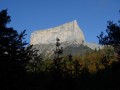
Esparron circular loop via the Col du Prayer

A pleasant walk through a cool, shady setting, perfect for enjoying on hot summer’s days. This route takes you to the Esparron hermitage, a key site in local history.

Details

40707384
Creation:
Last update:
Last review:
  • Walking
    Activity: Walking
  • ↔
    Distance: 8.21 mi
  • ◔
    Average duration: 5h 10 
  • ▲
    Difficulty: Moderate

  • ⚐
    Back to start: Yes
  • ↗
    Ascent: + 1,647 ft
  • ↘
    Descent: - 1,624 ft

  • ▲
    Highest point: 3,983 ft
  • ▼
    Lowest point: 2,644 ft

Photos

Description of the walk

Approach via the RD 1075, then take the Chemin de Casseyre and park at the entrance to the hamlet of Casseyre.

(S/E) Do not enter the hamlet but take the track that branches off to the right of the château towards the SNCF viaduct.

(1) Before a left-hand bend and the bridge over the Rif Perron, take the path on the right, pass under the Casseyre SNCF viaduct and head up to the junction with theGR® 965 (signpost).

(2) Follow it to the left for 1.4 km until you reach a ford. Cross it to come out immediately onto a track.

(3) Follow this track to the right until you reach the signpost marked ‘sous l’ermitage’.

(4) Take the path on the right leading to the hermitage buildings. After exploring the site, leave via the upper section (Resistance Memorial) and rejoin the signposted path, which veers north to take you to a wayside shrine.

(5) Stay on the north-bound path, cross the Ruisseau du Prayet and walk past the ruins of the Balme Farm. Leave the forest (ruins of the Chrétien Farm on the left) and reach the Col du Prayet.

(6) Take the RD7 on the left for 550 metres, until you reach the junction with a track on the left.

(7) Leave the RD7 and follow this old track for just under 2 km.

(8) At the junction with the forest track, take the track on the left for 1.5 km.

(9) Shortly after crossing the Ruisseau d’Esparron at a hairpin bend to the left, leave the main track via a path on the right which leads directly to the unmanned refuge at the Esparron farm: water point, accommodation.

(10) Head towards the Esparron Bridge (signpost) and rejoin the route you took on the way there.

(4) Head straight on along the track, in the opposite direction to the outward journey, following the Esparron Stream.

(3) Do not turn left to cross the ford again, but stay on the forest track that runs along the right bank of the Rif Perron. Pass under the SNCF viaduct once more, negotiate the next hairpin bend to the left, ignoring the path that branches off to the right, and cross the bridge.

(1) Turn right, following the route back in the opposite direction to the way out, towards the car park (S/E).

Waypoints

  1. S/E : mi 0 - alt. 2,644 ft - The hamlet of Casseyre
  2. 1 : mi 0.56 - alt. 2,795 ft - Crossroads of footpaths
  3. 2 : mi 0.89 - alt. 3,153 ft - GR 965 junction
  4. 3 : mi 1.74 - alt. 3,360 ft - Junction with the A/R road
  5. 4 : mi 2.01 - alt. 3,517 ft - Signpost ‘below the hermitage’
  6. 5 : mi 2.54 - alt. 3,734 ft - Oratory
  7. 6 : mi 3.22 - alt. 3,930 ft - Col de Prayet
  8. 7 : mi 3.55 - alt. 3,957 ft - Junction of the RD 7 and the track
  9. 8 : mi 4.73 - alt. 3,799 ft - Forest road junction
  10. 9 : mi 5.65 - alt. 3,543 ft - Leave the track, take the path on the right
  11. 10 : mi 5.84 - alt. 3,497 ft - Esparron Farm Refuge
  12. S/E : mi 8.21 - alt. 2,648 ft - The hamlet of Casseyre

Worth a visit

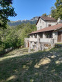
The sanctuary at Esparron has been home to monks since 1740. Its origins are much older, dating back to the 13th century, when the Virgin Mary is said to have appeared there to children and mule drivers from Die. In 1943, Esparron was one of the Vercors Resistance camps; it was attacked by the Germans at dawn on 3 February 1944. A memorial recounts these events in the upper part of the hermitage.

Always be cautious and plan ahead when you're outdoors. Visorando and the author of this route cannot be held responsible for any accidents occurring on this route.

The GR® and PR® markings are the intellectual property of the Fédération Française de Randonnée Pédestre.

Reviews and comments

4.1 / 5
Based on 4 reviews

Reliability of the description
4.3 / 5
Ease of following the route
4 / 5
Route interest
4 / 5
geai47
geai47

Overall rating : 4.3 / 5

Date of your route : Aug 19, 2026
Reliability of the description : ★★★★★ Very good
Ease of following the route : ★★★★☆ Good
Route interest : ★★★★☆ Good
Very busy route : Yes

Walk completed on 18 August 2026. The route is largely sheltered from the sun, which is a real bonus this summer!

At point 7, the route along the “old track” is, in places, completely obscured by vegetation, but you can quickly find it again by following the route on Visorando and changing the scale...

The return journey along the forest road is very interesting as it offers views of the deep ravine of the Esparron stream and, as the gradient is gentler, your knees will thank you for it.

Machine-translated

Bab13
Bab13

Overall rating : 4.3 / 5

Date of your route : Jul 15, 2026
Reliability of the description : ★★★★★ Very good
Ease of following the route : ★★★★☆ Good
Route interest : ★★★★☆ Good
Very busy route : No

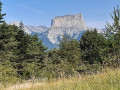
A 4-hour walk (including a 15-minute break), perfect for very hot weather as it’s very shady. I didn’t come across a single soul. That doesn’t stop you from enjoying beautiful views and walking along a wide variety of paths. There was water in the streams, which isn’t all that common given the time of year – it was lovely (a beautiful wooden footbridge between points 5 and 6). The icing on the cake: a view of Mont Aiguille as you reach the Col du Prayet.
Two points to note:
- the old track marked at 7 is indeed old. It becomes very overgrown with grass and harder to follow after a small detour caused by a fallen tree. The trail helps you find your way back, and you should keep to the right where the path is unclear.
- The track for the last 4 km, although very pleasant and shaded by trees, is a bit long

Machine-translated

lebretondelest
lebretondelest

Overall rating : 3.7 / 5

Date of your route : Aug 22, 2025
Reliability of the description : ★★★☆☆ Average
Ease of following the route : ★★★★☆ Good
Route interest : ★★★★☆ Good
Very busy route : No

A beautiful hike that is well worth doing for the visit to the hermitage and the Esparron memorial, as well as the view from the Prayet pass. However, a few clarifications and/or corrections need to be made to the route description:

- When leaving the hermitage, you must start again at the top left of the memorial, but first you have to go down a little to find the path to the pass, which then climbs again after crossing a stream bed (signpost)

- After point 7, be careful as the track forks to the left and descends, but you must stay on the right-hand track (slightly uphill), as the track on the left leads to a stream and is a dead end

- At point 9, to reach the Esparron farm, you must turn off just before the bridge and not just after it. However, you can also reach it directly a few minutes earlier by continuing straight ahead on the path that branches off to the left (at a plot with shrubs)

Machine-translated

sylviebouchet74
sylviebouchet74

Overall rating : 4 / 5

Date of your route : May 26, 2025
Reliability of the description : ★★★★☆ Good
Ease of following the route : ★★★★☆ Good
Route interest : ★★★★☆ Good
Very busy route : Yes

A lovely walk, especially in spring, with dozens of different flowers
It gets a bit muddy after the rain on the second part of the route between the Col du Prayet and the Ferme d’Esparon
Don’t hesitate to take the short detour via the old hermitage – it’s well worth the detour

Machine-translated

Other walks in the area

For more walks, use our search engine .

The GPS track and description are the property of this route's author. Please do not copy them without permission.