The ‘Lacet des Géants’ in Soumagne

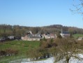
Take a stroll through the village of Melen (Soumagne) along restored old local tracks, through fields or along recently created cycle routes.

Details

16691917
Creation:
Last update:
Last review:
  • Walking
    Activity: Walking
  • ↔
    Distance: 5.40 mi
  • ◔
    Average duration: 2h 45 
  • ▲
    Difficulty: Easy

  • ⚐
    Back to start: Yes
  • ↗
    Ascent: + 328 ft
  • ↘
    Descent: - 308 ft

  • ▲
    Highest point: 948 ft
  • ▼
    Lowest point: 702 ft

Description of the walk

Park in the car-share car park, opposite the restaurant.

(S/E) Make your way to the official start of the route on Avenue de la Résistance, next to No. 529. Take the path that runs alongside the restaurant and cross the Ravel cycle path. Then continue along the path towards Rue Labouxhe. Turn right and go under the motorway bridge. At the roundabout, head left towards Rue Cense aux Bawettes.

(1) When you reach the old farm, turn right and follow Rue Large Voie. At the junction by the local school, go straight on into Cour Lemaire.

(2) At the end of the street, turn right, then immediately left into Rue du Moustier. Walk alongside the meadows, then head to the right until you reach Rue du Centre. Walk down this street until you reach the church, which you’ll pass on your right.

(3) You’ll reach Rue de la Citadelle; follow this until you reach the path on your right, which leads up to Rue Haute, bringing you opposite the local primary school.

(4) At the school, turn right onto Rue Haute, then take the first right onto Rue Reux. After a short distance, turn onto the path on the right. At the bottom of this path, turn left to head back up to Rue du Parc Hauzeur.

(5) At the end of this street, take the path on the left that runs parallel to the Ravel.

(6) When you reach the old Melen railway station, turn left onto Rue Haute and follow it until you reach a farm situated below on the right. Take the access path to this farm and cross the courtyard. Then turn left and head uphill past the fruit trees.

(7) At the top of the hill, turn right and follow Rue Sonkeu. Pass under the Ravel bridge and continue to the regional road.

(8) Cross this road carefully and head towards the nursery. There, turn right, then go under the motorway bridge on the left. Next, take Rue des Aunais on the right. Head towards the first junction.

(9) Turn right to pass through the Joskin site and you’ll reach Rue de Wergofiosse; take this road to the right to reach the car-sharing car park (S/E).

Waypoints

  1. S/E : mi 0 - alt. 919 ft - Carpool car park - Monument et cimetière des fusillés d'août 1914
  2. 1 : mi 0.37 - alt. 909 ft - Cense aux Bawettes - La Cense aux Bawettes
  3. 2 : mi 0.98 - alt. 860 ft - Cour Lemaire junction - La cour des Anges
  4. 3 : mi 1.61 - alt. 709 ft - Rue de la Citadelle
  5. 4 : mi 1.89 - alt. 827 ft - Melen Primary School
  6. 5 : mi 2.82 - alt. 915 ft - Path running alongside the Ravel
  7. 6 : mi 3.15 - alt. 925 ft - Ancienne gare de Melen
  8. 7 : mi 3.88 - alt. 876 ft - Sonkeu Cross
  9. 8 : mi 4.36 - alt. 942 ft - Crossing Rue de la Clef
  10. 9 : mi 4.9 - alt. 922 ft - Passing through the Joskin site
  11. S/E : mi 5.4 - alt. 919 ft - Carpool car park

Worth a visit

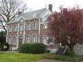
Saint-Job’s Church in Melen.

Reviews and comments

4.8 / 5
Based on 2 reviews

Reliability of the description
5 / 5
Ease of following the route
5 / 5
Route interest
4.5 / 5
idViso*Flo
idViso*Flo

Overall rating : 4.7 / 5

Date of your route : Aug 18, 2025
Reliability of the description : ★★★★★ Very good
Ease of following the route : ★★★★★ Very good
Route interest : ★★★★☆ Good
Very busy route : Yes

The hike crosses the Ravel, a farm and plantations, residential areas with very pretty houses and local businesses.
It can be completed in two stages, reaching marker 1 and marker 5 via the Ravel

Machine-translated

Pierre Alleman
Pierre Alleman

Overall rating : 5 / 5

Date of your route : Dec 04, 2021
Reliability of the description : ★★★★★ Very good
Ease of following the route : ★★★★★ Very good
Route interest : ★★★★★ Very good
Very busy route : Yes

A route on a Saturday morning – very busy… with cars!
A lovely route, despite the damp and overcast weather. One to do again in the spring.
The route description and map are all you need to follow it.
All the more so as the signposting on the ground is perfect, probably because it’s brand new (it hasn’t had time to be tagged, vandalised or torn down).
One small caveat… take care when leaving the large farm further down, as the path is particularly muddy and very slippery.
Thanks to the creator.
I’ve never managed to download the GPX file, even though I downloaded the one for the blackthorn without any trouble. Strange.
Pierre Emile.

Machine-translated

Other walks in the area

For more walks, use our search engine .

The GPS track and description are the property of this route's author. Please do not copy them without permission.