Saint-Aubin-de-Branne Circular Loop

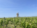
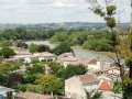
The Saint-Aubin-de-Branne circular path invites you to explore a rolling landscape in the heart of the vineyards. You’ll be able to enjoy magnificent panoramic views and discover heritage sites along the route.

Details

n°46089346
Creation:
Last update:
Last review:
  • Walking
    Activity: Walking
  • ↔
    Distance: 3.89 mi
  • ◔
    Average duration: 2h 00 
  • ▲
    Difficulty: Easy

  • ⚐
    Back to start: Yes
  • ↗
    Ascent: + 285 ft
  • ↘
    Descent: - 276 ft

  • ▲
    Highest point: 259 ft
  • ▼
    Lowest point: 13 ft

Description of the walk

The circular walk starts from the town hall car park.

(S/E) Take the small street running alongside the wall, opposite the town hall car park (fire hydrant). On your left, you’ll see the16th-century Château de l’Heyrisson. At the Stop sign, cross the road and take the path opposite, through the vineyards, until you reach a fork in the woods.

(1) Turn right at the signpost. As you emerge from the woods, turn right and follow the path that starts amongst the vineyards until you reach the tarmac road. Follow it to the right, passing a path on your left, and you’ll come to a second path a few metres before a three-way junction.

(2) Turn left onto the vineyard lane. At the crossroads, keep to the right and walk along the edge of the woods, taking the limestone path on your left.

(3) Continue along this path, then head straight on to the banks of the Dordogne to admire the view.

(4) Retrace your steps to the crossroads at the edge of the woodland.

(3) Turn left and follow the limestone path to the tarmac road. Continue straight on along this road, do the same at the next junction, then, at the right-hand bend in the road, take the limestone path opposite, leading to the hamlet of Le Pin. Continue along the grassy path to the fork, a few metres past the house.

(5) Turn right and carry on until you reach the tarmac road.

(6) Turn left and follow the road until you return to your starting point (S/E).

Waypoints

  1. S/E : mi 0 - alt. 217 ft - Car park near the church - Église Notre-Dame (Saint-Aubin-de-Branne)
  2. 1 : mi 0.49 - alt. 128 ft - Woods, junction
  3. 2 : mi 1.1 - alt. 102 ft - Trail
  4. 3 : mi 1.47 - alt. 49 ft - Limestone path
  5. 4 : mi 1.91 - alt. 13 ft - Dordogne (fleuve)
  6. 5 : mi 3.13 - alt. 95 ft - Turn-off after Le Pin
  7. 6 : mi 3.46 - alt. 210 ft - Tarmac road
  8. S/E : mi 3.89 - alt. 217 ft - Car park near the church - Église Notre-Dame (Saint-Aubin-de-Branne)

Notes

Opposite the car park, you’ll find picnic tables, and there are toilets behind the town hall.

Branne Tourist Information Office:
Route de Cabara
33420 Branne
Tel: +33 (0)5 57 74 90 24
Email: contact@tourisme-castillonpujols.fr
https://www.tourisme-castillonpujols.fr

The Branne Tourist Information Office is open:
June to September: Monday to Friday from 9.30 am to 12.30 pm and from 2 pm to 6 pm; Saturdays from 9.30 am to 12.30 pm.
October to May: Tuesday to Friday from 9.30 am to 12.30 pm.

Worth a visit

The Church of Saint-Aubin (listed as a historic monument in 1925) is the work of the Abbey of Sainte-Croix in Bordeaux. It comprises four bays and a flat chancel enclosed to the east. To the west, a narrow fifth bay serves as the base for the bell tower, which is preceded by a porch.
The two storeys are lit by pointed arched windows with extradosed arches, surmounted by an archivolt decorated with stars and resting on small columns with smooth capitals.
Vertical face moulded with an arch.

(1) Before reaching this crossing point, you will see the 16th-century Château l’Heyrisson on your left; it bears the name of its first owners and consists of a main building, against the southern façade of which stands a pentagonal tower serving as a stairwell (private property, not open to the public).

Reviews and comments

5 / 5
Based on 1 review

Reliability of the description
5 / 5
Ease of following the route
5 / 5
Route interest
5 / 5
marybleu
marybleu

Overall rating : 5 / 5

Date of your route : Apr 07, 2024
Reliability of the description : ★★★★★ Very good
Ease of following the route : ★★★★★ Very good
Route interest : ★★★★★ Very good
Very busy route : No

A very pleasant and lovely little walk.
Saint Aubin comes into view as the path winds on. A very pleasant, undulating area.
Please note that the access route to the Dordogne needs clearing; tall grass and brambles are blocking the path.
Thanks to the Tourist Office for this route.

Machine-translated

Other walks in the area

For more walks, use our search engine .

The GPS track and description are the property of this route's author. Please do not copy them without permission.