Circular walk around Vénosc and La Danchère

Following the Vénéon floods in June 2024, it is no longer possible to complete this route. The paths have been destroyed.

Details

882261
Creation:
Last update:
Last review:
  • Walking
    Activity: Walking
  • ↔
    Distance: 5.03 mi
  • ◔
    Average duration: 3h 35 
  • ▲
    Difficulty: Moderate

  • ⚐
    Back to start: Yes
  • ↗
    Ascent: + 1,447 ft
  • ↘
    Descent: - 1,457 ft

  • ▲
    Highest point: 3,760 ft
  • ▼
    Lowest point: 2,776 ft

Description of the walk

Parking is available in the car park in the village of La Danchère.

(S/E) Head towards the village centre.

(1) Walk past the Saint-Louis Chapel and take the path that descends steeply to the left towards the hamlet of Les Escallons, ignoring the wider path on the right.

(2) Cross the road, take the street between the houses in the hamlet of Les Escallons and turn left. Join a road and follow it to the right.

(3) Before the bridge over the Vénéon, take the wide path on the right, following the riverbank until you reach a junction with the road leading to Vénosc and La Bérarde (D530).

(4) Cross the road (yellow sign for Vénosc, Plan Verney) and take the path marked with a sign for Pied Moutet and Le Sappey. The path climbs steeply in tight hairpin bends to rejoin the track leading from Vénosc to Pied Moutet.

(5) Turn right, towards Ferraret and Vénosc. An easy rocky section with a cable. In the ruined hamlet of Ferraret, continue straight on towards Le Courtil Vénosc. At the entrance to the village, head down the road to the right until you reach the hairpin bend.

(6) Turn left for a few metres, then head down to the right towards the cable car station for Les Deux Alpes and come out onto the road.

(7) Take a path to the right of the car park below and head down towards the Vénéon to cross it via a wooden bridge towards the tree-top adventure park.

(8) When you reach the treetop adventure park, turn right towards the west and La Danchère. Follow the Vénéon on the left bank and pass the ruins of the Argentière mines.

(9) Turn left onto an uphill path and join the Route de la Danchère (signposted). Turn left, passing the old village bread oven and wash house, to return to the car park (S/E).

Waypoints

  1. S/E : mi 0 - alt. 3,225 ft - La Danchère – La Danchère car park
  2. 1 : mi 0.1 - alt. 3,238 ft - Chapel of Saint-Louis - Lauvitel Lodge Danchère
  3. 2 : mi 0.37 - alt. 2,943 ft - Les Escallons
  4. 3 : mi 0.62 - alt. 2,776 ft - Wide path on the right before the bridge
  5. 4 : mi 0.93 - alt. 2,858 ft - D530
  6. 5 : mi 1.38 - alt. 3,757 ft - Junction, turn right
  7. 6 : mi 2.7 - alt. 3,268 ft - In Vénosc, turn right towards the cable car departure point
  8. 7 : mi 2.88 - alt. 3,133 ft - Path to the right of the car park
  9. 8 : mi 3.06 - alt. 3,048 ft - Adventure treetop park, on the right
  10. 9 : mi 4.83 - alt. 3,123 ft - On the left, an ascending path
  11. S/E : mi 5.03 - alt. 3,225 ft - La Danchère car park - Lauvitel Lodge Danchère

Notes

In summer, there are restaurants and bars in Vénosc and at La Danchère.
The route can be walked in either direction, but the descent along the Chemin du Plan Verney is steep.
You can also set off from Vénosc.

Worth a visit

Visit the village of Vénosc.
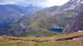
Remarkable views over the Lauvitel and Muzelle valleys, as well as the Plat de la Selle mountain.
Path running alongside the turbulent Vénéon torrent.

Reviews and comments

3.9 / 5
Based on 4 reviews

Reliability of the description
4 / 5
Ease of following the route
4.3 / 5
Route interest
3.5 / 5
noelterry
noelterry

Overall rating : 4.3 / 5

Date of your route : Aug 14, 2021
Reliability of the description : ★★★★☆ Good
Ease of following the route : ★★★★★ Very good
Route interest : ★★★★☆ Good
Very busy route : No

Hike completed on 14/08/21. Please note: between points 8 and 9, the path is closed off by barriers due to the risk of rockfalls! The path is nevertheless continuous and passable, with a 100-metre section over scree. You may choose to take this route AT YOUR OWN RISK. A possible alternative to avoid this area: from point 8, stay on the right bank of the Veneon until the footbridge, then cross back to the left bank to rejoin the original route towards La Danchère. The return journey between La Danchère and Venosc is splendid, with a balcony-style path. The sections with cables are completely safe. A lovely hike.

Machine-translated

CLOCLO 01
CLOCLO 01

Overall rating : 4.7 / 5

Date of your route : Sep 28, 2020
Reliability of the description : ★★★★★ Very good
Ease of following the route : ★★★★★ Very good
Route interest : ★★★★☆ Good
Very busy route : Yes

A lovely walk to VENOSC along the river and through the woods

Machine-translated

jaklin15
jaklin15

Overall rating : 3.7 / 5

Date of your route : Aug 13, 2019
Reliability of the description : ★★★★☆ Good
Ease of following the route : ★★★★☆ Good
Route interest : ★★★☆☆ Average

Please note: this walk is currently (August 2019) virtually impassable and strongly discouraged: the path is closed as it is cut off in several places (between points 5 and 6, and points 8 and 9) by deep ravines caused by rockfalls and, above all, by very unstable and dangerous scree. Apart from that, there are drinking fountains in Venosc and at La Danchère.
Point 9 of the route description: the path climbs up at the ‘Clôt de la Blache’ signpost.

Machine-translated

bernardo2607
bernardo2607

Overall rating : 3 / 5

Date of your route : Jul 22, 2019
Reliability of the description : ★★★☆☆ Average
Ease of following the route : ★★★☆☆ Average
Route interest : ★★★☆☆ Average

Following rockfalls, the route has been altered from Venosc to La Danchère
At the bottom of Venosc, do not turn left at the wooden bridge; instead, turn right.

Machine-translated

Other walks in the area

For more walks, use our search engine .

The GPS track and description are the property of this route's author. Please do not copy them without permission.