Country:
 City:


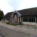
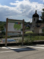
Park in the (free) car park at Thise aerodrome. There is a second option at the church car park for a shorter route.
(S/E) Walk round the aerodrome hangars, cross the playground and reach the departmental road. Follow it to the left, crossing the railway level crossing further on, and continue for about fifty metres.
(1) Cross the road carefully below the level crossing to take the tarmac path leading towards Beaupré Castle through bucolic, countryside scenery. On your left, you’ll see an old building linked to Thise’s history of water management; then take in the lovely view of the château, its entrance porch and its private chapel: on the west side, there are two information boards. Horses and cattle roam freely in the nearby meadows and pastures.
Cross Rue de Beaupré with care and continue straight ahead along the forest path which extends the tarmac road you took earlier. The route, which is very open, presents no particular difficulties and has only a slight incline. Follow the path until you reach the tarmac road known as the Route des Vaux.
(2) Turn right and follow the road uphill to the bend. This bend offers a superb view of the Château de Beaupré estate, towards the alluvial plain, the aerodrome and the southern part of Thise. There is a bench nearby at the bend. Continue to the top of the hill, ignoring a road branching off to the right.
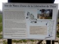
(3) Turn left, following the signs for Notre-Dame de la Libération (car parking available on the left). Continue to the hamlet; there are various farm animals and the riding club nearby. Information boards, detailed maps and a description of the site and the monument are provided for visitors (very clear signposting).
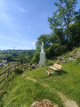
(4) Notre-Dame de la Libération. A beautiful viewpoint over the town, its church and the aerodrome hangars. A modern orientation table offers a lovely 160° panoramic view. Information, detailed maps and a description of the site and the monument are provided for visitors, with very precise signposting.
Once you have finished your visit and taken in the views, head back along the path in the opposite direction to the car park.
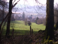
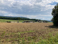
(3) Turn left to pass close to the Morray equestrian centre, taking the left-hand path along the edge of the forest. To the right, open countryside with the communal forest in the background.
(5) Turn left onto a forest track climbing between rows of trees (oaks, chestnut trees, beech trees) until you reach the junction at the top with a section of the nature trail. There are information points with educational panels showcasing some of the forest’s tree species.
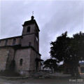
Keeping to the left, follow the path to the next junction, turn left again and let the path lead you gently downhill along a lovely track flanked by an old stone wall. Join the Chemin du Parret and follow it to the outskirts of Thise. Continue along Rue du Parret to the Fontaine des Cygnes and Saint-Hilaire Church.
(6) Continue round the church towards the presbytery; then turn right into Rue du Presbytère opposite the statue of Notre-Dame de la Libération de Thise, which you visited earlier. Follow this road past the junction with Rue des Vaux and then the municipal cemetery (the ‘Carré des Morts pour la France’) until you reach Rue de l’Aérodrome.
Cross the road at the pedestrian crossing and continue at a leisurely pace along the pavement towards the town’s outskirts.
(1) Go straight on until you reach the level crossing, then turn right to cross the children’s playground again and go round the aerodrome hangars to reach the car park (S/E).


 Visorando Member

 Moderate