Circular route around the Sorpt Valley

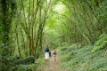
A circular route allowing you to visit the villages of Farges, La Coste, Chartrier-Ferrière and Chasteaux, whilst enjoying the views from the ‘montagne pelée’ or the village of Chasteaux.

Details

4720790
Creation:
Last update:
Last review:
  • Walking
    Activity: Walking
  • ↔
    Distance: 6.98 mi
  • ◔
    Average duration: 4h 10 
  • ▲
    Difficulty: Moderate

  • ⚐
    Back to start: Yes
  • ↗
    Ascent: + 1,083 ft
  • ↘
    Descent: - 1,086 ft

  • ▲
    Highest point: 1,053 ft
  • ▼
    Lowest point: 407 ft
  • ⚐ Country: France
  • ⚐ City: Chasteaux (19600)
  • ⚑
    Start/End: N 45.094618° / E 1.466809°
  • ❏
    IGN map(s): Ref. 2135O
  • Hour-by-hour weather

Photos

Description of the walk

The route starts from the large car park (in the commune of Lissac-sur-Couze) situated near the Soulier de Chasteaux.

(S/E) With your back to the car park, take the road leading to the Soulier to reach the junction with the D154 in the village. Cross the D154 and head slightly to the right towards the street that climbs up (one-way).

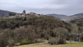
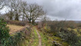
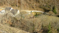
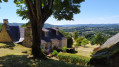
(1) Follow this for a few dozen metres and take the path climbing to the left (do not go back down onto the D154). Initially passable by vehicle, it continues, about a hundred metres further on, along the path climbing to the left which leads to the bare mountain (a beautiful view of the village of Chasteaux with, in the background at the start, the Lac du Causse). Follow this path for about 1.7 km until you reach a junction on the left (at this point, if you were to mistakenly continue for a further 100 m, you would reach the tarmac road leading to Farges).

(2) Take the path on the left which descends to join another path leading uphill to the right (the left-hand branch, which you do not take, descends to a bridge over the Paris–Toulouse railway line). After a bend to the left and then to the right to go round the yard of a small business, you’ll reach a wide track. Turn right to reach a crossroads in the village of Farges

(3) Cross the junction and follow the tarmac road opposite. Continue for about 500 m, keeping to the right.

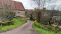
(4) At the crossroads, continue along the path opposite, lined with dry-stone walls, which leads to a bridge over the railway line.

(5) After the bridge, follow the path on the left which leads to the RD19, right next to the railway bridge.

(6) Once again, take the path opposite, which leads to the junction with the D19e1 in the village of La Coste.

(7) From there:
- either turn left and walk through the village of La Coste, turning right at the first junction, then, after 250 m, turn onto the path on the right,
- or, to minimise the tarmac sections, follow the RD19e1 all the way to the right for 100 m and leave it to take a path on the left. This is the option chosen for the route.
The track leads to a junction; turn left again here to eventually join the first route option at a concrete wash house.

(8) Take the path leading away from the village of La Coste, following the mountain bike signposts to the junction with the D154, at the hamlet of Chartrier Ferrière, 1.2 km away.

(9) Take the street opposite towards the town hall and walk through Chartrier Ferrière, perhaps making a detour to see the church via the path on the right after the school.
When you reach the cemetery, take the track on the right, then, 50 metres further on, the Roman road, leaving the access track to La Verderie on your left. Follow this track, ignoring, at the next junction, the path that descends to the right, then, about a hundred metres further on, the path on the left, until you finally reach a Fork in the road.

(10) Turn left, leaving the path on your right that leads back down to Neyragues. At the next crossroads, turn right onto the path leading down towards Merlières. Walk through this hamlet until you reach the RD19.

(11) Head down the local road opposite, then take the road on the left leading to the village of Chasteaux. Keep left after the cemetery and take a moment to admire the historic buildings.

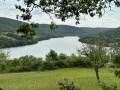
(12) The road then takes a sharp left-hand bend to reach the town hall and the church. At this bend, take a path on the right, which becomes a footpath and leads back down to the hamlet of Le Soulier. You will then rejoin the road you took at the start; follow it to the left towards the Causse lake and return to the large car park at Lac du Causse (S/E).

Waypoints

  1. S/E : mi 0 - alt. 410 ft - Car park at the - Lac du Causse
  2. 1 : mi 0.15 - alt. 420 ft - The hamlet of Le Soulier
  3. 2 : mi 1.31 - alt. 846 ft - Path leading down to the left
  4. 3 : mi 2.06 - alt. 991 ft - The village of Farges
  5. 4 : mi 2.33 - alt. 961 ft - A path lined with dry-stone walls
  6. 5 : mi 2.71 - alt. 794 ft - Bridge over the Paris–Toulouse railway line
  7. 6 : mi 3.1 - alt. 741 ft - Crossing the RD19
  8. 7 : mi 3.53 - alt. 781 ft - The village of La Coste
  9. 8 : mi 3.79 - alt. 732 ft - Washing house
  10. 9 : mi 4.55 - alt. 1,027 ft - D154 – Chartrier Ferrière
  11. 10 : mi 5.48 - alt. 942 ft - Fork -
  12. 11 : mi 6.2 - alt. 656 ft - Cross the RD19 heading towards Chasteaux
  13. 12 : mi 6.72 - alt. 623 ft - Chasteaux. Path towards Le Soulier - Faille géologique de Chasteaux
  14. S/E : mi 6.98 - alt. 410 ft - Lac du Causse car park - Couze (ruisseau) - Affluent de la Vézère

Worth a visit

Starting from the Lac du Causse car park, you cross the Chasteaux geological fault, which is clearly visible in the landscape.
To the left of the road, it is marked by a small cliff that forms the boundary between the vineyards (marl and marly or sandstone limestone) and the woodland (massive oolitic limestone).
On the right, once you’ve crossed the arched bridge over the Couze, you can follow this small cliff face as it rises towards the village of Chasteaux.

Reviews and comments

4.1 / 5
Based on 4 reviews

Reliability of the description
4 / 5
Ease of following the route
4 / 5
Route interest
4.3 / 5
georgette.francon
georgette.francon

Overall rating : 3 / 5

Date of your route : Jul 09, 2021
Reliability of the description : ★★★☆☆ Average
Ease of following the route : ★★★☆☆ Average
Route interest : ★★★☆☆ Average
Very busy route : No

The signposting is very poorly done for people who don’t use a sat-nav

Machine-translated

Celineetfrederic
Celineetfrederic

Overall rating : 5 / 5

Date of your route : Mar 06, 2021
Reliability of the description : ★★★★★ Very good
Ease of following the route : ★★★★★ Very good
Route interest : ★★★★★ Very good
Very busy route : No

A pleasant walk featuring low stone walls, the vegetation of the Causse, wildflowers in the fields and undergrowth, and lovely views of Châteaux and the Montagne Pelée. Ideal in spring

Machine-translated

caraguma1955
caraguma1955

Overall rating : 3.7 / 5

Date of your route : Mar 02, 2021
Reliability of the description : ★★★☆☆ Average
Ease of following the route : ★★★☆☆ Average
Route interest : ★★★★★ Very good
Very busy route : No

A lovely walk, not much road, the paths are very easy to follow, the Corrèze plateau is lovely – we thoroughly enjoyed it. The only downside is that the signposting is a bit sparse at the start of the walk and after Chartrier-Ferrière.
Thank you for these lovely walks.

Machine-translated

RAND19
RAND19

Overall rating : 4.7 / 5

Date of your route : Feb 24, 2021
Reliability of the description : ★★★★★ Very good
Ease of following the route : ★★★★★ Very good
Route interest : ★★★★☆ Good
Very busy route : No

A lovely walk. Thanks for sharing

Machine-translated

Other walks in the area

For more walks, use our search engine .

The GPS track and description are the property of this route's author. Please do not copy them without permission.