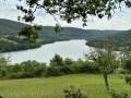
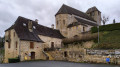
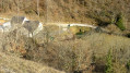
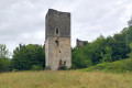
At Lac du Causse

A short, easy walk starting from the Lac des Causses car park. Please note during peak season: it gets very busy and parking can be difficult.

Details

34465044
Creation:
Last update:
Last review:
  • Walking
    Activity: Walking
  • ↔
    Distance: 2.86 mi
  • ◔
    Average duration: 1h 40 
  • ▲
    Difficulty: Moderate

  • ⚐
    Back to start: Yes
  • ↗
    Ascent: + 367 ft
  • ↘
    Descent: - 367 ft

  • ▲
    Highest point: 764 ft
  • ▼
    Lowest point: 410 ft
  • ⚐ Country: France
  • ⚐ City: Chasteaux (19600)
  • ⚑
    Start/End: N 45.095182° / E 1.465317°
  • ❏
    IGN map(s): Ref. 2135O
  • Hour-by-hour weather

Photos

Description of the walk

Park in the Lac du Causse car park.

(S/E) From the car park, follow the road towards the small village of Le Soulier and walk through it, keeping to the left.

(1) On leaving the village, take the Chemin du Puy, which climbs to the left. It is a narrow path that later becomes a white track. Follow it until you come within sight of a housing estate.

(2) Leave the track and turn left, ignoring the path that branches off sharply. The path you should take continues from the track and leads to a road.

(3) Turn right, then immediately left. Continue straight on along the road until you reach a main road; cross it to reach the Chemin du Teil on the opposite side. Follow this until you reach a road, then turn right and then left. Keep to the left. The road turns into a track; follow this for about 500 metres until you spot a path on the left.

(4) Leave the main track, turn left and rejoin the road. Follow it to the left until you reach the village of Lissac-sur-Couze. At the roundabout, go straight on. Follow the road for over 150 m.

(5) Turn left and head uphill along theGR® (red and white markings) to Lac du Causse (S/E).

Waypoints

  1. S/E : mi 0 - alt. 427 ft - Car park - Lac du Causse
  2. 1 : mi 0.33 - alt. 433 ft - Start of the path - Couze (ruisseau) - Affluent de la Vézère
  3. 2 : mi 1.01 - alt. 715 ft - Start of the path
  4. 3 : mi 1.1 - alt. 755 ft - Small road
  5. 4 : mi 1.83 - alt. 715 ft - Junction
  6. 5 : mi 2.28 - alt. 577 ft - GR46
  7. S/E : mi 2.86 - alt. 427 ft - Car park - Lac du Causse

Notes

You can go for a swim at Lac du Causse.

Always be cautious and plan ahead when you're outdoors. Visorando and the author of this route cannot be held responsible for any accidents occurring on this route.

The GR® and PR® markings are the intellectual property of the Fédération Française de Randonnée Pédestre.

Reviews and comments

4.1 / 5
Based on 4 reviews

Reliability of the description
4 / 5
Ease of following the route
4.5 / 5
Route interest
3.8 / 5
isasar
isasar

Overall rating : 3.3 / 5

Date of your route : Dec 29, 2025
Reliability of the description : ★★★☆☆ Average
Ease of following the route : ★★★★☆ Good
Route interest : ★★★☆☆ Average
Very busy route : No

Even in low season, the lake's shores are very popular as soon as the sun comes out.
The hike can be extended by walking around the lake.

Machine-translated

User 23083571

Overall rating : 4.3 / 5

Date of your route : Aug 14, 2025
Reliability of the description : ★★★★☆ Good
Ease of following the route : ★★★★★ Very good
Route interest : ★★★★☆ Good
Very busy route : Yes

A pleasant short hike.

Machine-translated

User 26105687

Overall rating : 4 / 5

Date of your route : Jun 09, 2025
Reliability of the description : ★★★★☆ Good
Ease of following the route : ★★★★☆ Good
Route interest : ★★★★☆ Good
Very busy route : Yes

A very pleasant day with the dog I was looking after. I met other pet owners. I'll definitely do it again!

Machine-translated

Fiona63
Fiona63

Overall rating : 4.7 / 5

Date of your route : Oct 21, 2024
Reliability of the description : ★★★★★ Very good
Ease of following the route : ★★★★★ Very good
Route interest : ★★★★☆ Good
Very busy route : No

A lovely walk with beautiful views of the lake, dotted with architectural highlights!

Machine-translated

Other walks in the area

For more walks, use our search engine .

The GPS track and description are the property of this route's author. Please do not copy them without permission.