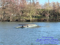
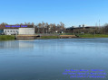
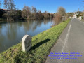
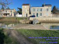
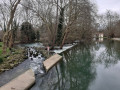
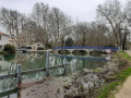
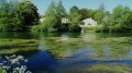
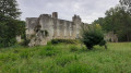
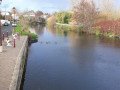
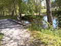
Shore of the Noron lake

A short 7.5 km route along the banks of the Sèvre Niortaise: a walk around the lake, starting from the Noron water sports centre.

Details

68337725
Creation:
Last update:
Last review:
  • Walking
    Activity: Walking
  • ↔
    Distance: 4.59 mi
  • ◔
    Average duration: 2h 05 
  • ▲
    Difficulty: Easy

  • ⚐
    Back to start: Yes
  • ↗
    Ascent: + 16 ft
  • ↘
    Descent: - 16 ft

  • ▲
    Highest point: 49 ft
  • ▼
    Lowest point: 26 ft

Photos

Description of the walk

Start from the car park at the Noron water sports centre.

(S/E) Take the limestone path on the right which runs alongside the Sèvre Niortaise, pass a small island and reach the towpath.

(1) Follow it to the Comporté Lock.

(2) Cross the lock and turn left (Quai Maurice Métayer). Pass under the road bridge (Boulevard de l’Atlantique) and continue to the end of the quay at a small car park.

(3) Continue along the towpath, running alongside Castel Parc, until you reach a fork in the path, approximately 200 metres before the road bridge over the river.

(4) Leave the towpath and head towards the parallel cycle path, then cycle up onto the bridge.

(5) Turn left onto this cycle and footpath, crossing the Sèvre Niortaise.

(6) At the end of the bridge, go down the steps on the left and, at the bottom, turn right (Prairie de Galucher) and follow the Sèvre along the left bank. Then turn right towards the university campus.

(7) Once there, take the left-hand lane at the roundabout and follow the footpath running parallel to the cycle path (Rue Archimède) until you reach the next bridge over the canal (Avenue Pythagore).

(8) Turn left, walk alongside the exhibition centre car park and then cross it to reach the car park at the Noron water sports centre (S/E).


Waypoints

  1. S/E : mi 0 - alt. 33 ft - Car park at the Noron water sports centre - Sèvre Niortaise (fleuve)
  2. 1 : mi 0.27 - alt. 33 ft - Towpath
  3. 2 : mi 1.27 - alt. 33 ft - Comporté Lock - Canal Saint-Martin
  4. 3 : mi 2.69 - alt. 30 ft - Towpath
  5. 4 : mi 3.21 - alt. 30 ft - Junction
  6. 5 : mi 3.35 - alt. 49 ft - Cycle and footpath
  7. 6 : mi 3.43 - alt. 46 ft - Staircase
  8. 7 : mi 3.95 - alt. 33 ft - Niort Campus
  9. 8 : mi 4.39 - alt. 33 ft - Avenue Pythagore
  10. S/E : mi 4.59 - alt. 33 ft - Car park at the Noron water sports centre - Sèvre Niortaise (fleuve)

Notes

It is strongly recommended that all walkers make themselves visible by wearing light-coloured clothing or clothing and accessories (such as armbands) fitted with fluorescent strips by day and reflective strips by night. Published in the Senate Official Journal on 25 March 2004.

Reviews and comments

4.3 / 5
Based on 2 reviews

Reliability of the description
4.5 / 5
Ease of following the route
4.5 / 5
Route interest
4 / 5
JMJ6756
JMJ6756

Overall rating : 4.7 / 5

Date of your route : Apr 05, 2026
Reliability of the description : ★★★★★ Very good
Ease of following the route : ★★★★★ Very good
Route interest : ★★★★☆ Good
Very busy route : Yes

A lovely discovery in the area around Niort

Machine-translated

Bertrand.S
Bertrand.S

Overall rating : 4 / 5

Date of your route : Mar 10, 2025
Reliability of the description : ★★★★☆ Good
Ease of following the route : ★★★★☆ Good
Route interest : ★★★★☆ Good
Very busy route : Yes

This route is very easy; it passes close to part of the town but remains very picturesque.
The elevation gain is ideal for people who are getting back into walking or for those with asthma and reduced lung capacity.
We recommend

Machine-translated

Other walks in the area

For more walks, use our search engine .

The GPS track and description are the property of this route's author. Please do not copy them without permission.