Country:
 City:


Head to Beaulon and park on Place Nouvelle (a triangular public square), next to the chemist’s.
(S/E) Head towards the church along Rue de la Paix, before turning right near the Salle Jean Theveniaux. Once you reach the castle gate, you’ll have a view of the building and the grounds.
(1) Continue along the Route de Chevagnes, skirting the castle grounds on your left. The quiet road curves to the left, crosses the bridge over the Engièvre and ends at the ‘Stop’ sign, where it joins the Chemin de Petro. Turn right until you reach the canal running alongside the Loire, without crossing it.
(2) Just before the bridge, turn left onto the towpath: there is a sign indicating the Mont route.
Pass through the western end of the hamlet of La Noire before joining the D164 at a place called Le Bas des Joncs. Cross the Thiel bridge over the canal.
(3) After the crash barriers, turn right in a 180° turn towards La Reue and La Maison Neuve. Follow the unpaved track, with the canal on your right, ignoring the La Reue estate on your left. The track eventually veers left as it climbs (yellow markings). Keep to the left to avoid entering the private grounds of La Maison Neuve and continue along the edge of the Bois de Mont, keeping it on your right, until you reach the T-junction at the edge of the woodland.
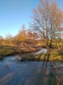
(4) Turn right; the Bois de Mont continues to run to your right. Further on, at a left-hand bend, stay on the main path which leads onto a tarmac road at the southern end of the Étang de Mont, fed by the Engièvre.
(5) Turn left to cross the bridge, then follow the tarmac road carefully and continuously, with a tree plantation on your left. Continue in this way to the hamlet of Le May, a crossroads marked by a wayside cross.
(6) Turn right towards Les Pelletiers. Follow the tarmac road to the right of the cross. Pass the Santigny farm on your right and a pond on your left. Further on, after the 237-metre mark, the path runs alongside a woodland on the right and meadows on the left. Continue to the end of the wooded section.
(7) Turn right (signposted ‘Route de Mont’) onto the grassy path; the same woodland runs to your right. Join a local road at the hamlet of Vacherot. Keep to the right to follow this road as it passes through the hamlet: on the right, there is a lovely view of the Étang de Mont. The road descends, before climbing again towards the canal running alongside the Loire and crossing the bridge you passed earlier.
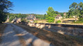
(2) Turn left to head down the gravelly towpath; the canal runs to your left. Follow this path to the Beaulon Lock, at elevation 216.
(8) Turn right and walk along the path running parallel to the D298 to reach the village of Beaulon safely. Cross the roundabout, keeping to the right towards Diou via the D15, and arrive at the Place Nouvelle car park (S/E).

 Tourist office

 Visorando Member
 Easy