Country:
 City:


Park in the car park at Boissy-aux-Cailles cemetery.
(S/E) Head east and walk along the left-hand side of the cemetery. At the corner of the cemetery, carry straight on. At the fork in the road after about 200 metres, keep to the right.
(1) At the T-junction, turn left and you’ll soon come to another junction.
(2) Turn left here, heading due north. At the next junction (marker 113), carry on straight ahead and leave the woodland. Enter the woodland again (marker 120) and continue north, ignoring the paths branching off to the right.
(3) At the junction, turn left onto a path eroded by the rain. Descend the Champlaid Valley, following the red and white markings of the GR®1 and GR®32
(4) At the end of the path, cross a road and follow it to the left, keeping to the right-hand verge: the left-hand verge is blocked by rocks. Take care.
(5) After about 300 m, take the first path on the right, between two fields.
(6) After about 400 m, at a Fork in the road, take the left-hand branch and head up into a woodland. At the top, leave the woodland and you’ll soon reach a small road.
(7) Then turn left (let the GR® trails head off to the right). After a stretch of open ground, head down into a woodland.
(8) When the road curves slightly to the left, leave it and take a path on the left. Walk down along the edge of the woodland until you reach a road.
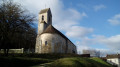
(9) Follow it to the right towards Boissy-aux-Cailles. At the T-junction, carry on straight ahead. Follow Rue Saint-Martin to a junction at the foot of the church of the same name.
(10) Then turn left into Rue du Fief. Walk uphill again to the hamlet known as Le Fief.
(11) Take the path that branches off to the right at a 90° angle. The path remains flat at first, then begins to descend.
(12) At the junction, turn right and, after about thirty metres, turn right again. Head down into the woods. Further on, leave the woods and walk alongside the cemetery. At the corner, turn right to quickly reach the car park (S/E).
 Visorando Member

 Easy
 Difficult