Circular route to the north of Le Poulet via Champ Martin

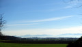
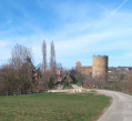
A simple, pleasant walk with lovely scenery, best done from September to the end of April. Take in the spring flowers lining the paths. Best avoided during very hot weather.
To all the walkers following my routes, you’re welcome to post photos, indicating where on the route they were taken.

Details

n°31488245
Creation:
Last update:
Last review:
  • Walking
    Activity: Walking
  • ↔
    Distance: 6.35 mi
  • ◔
    Average duration: 3h 10 
  • ▲
    Difficulty: Moderate

  • ⚐
    Back to start: Yes
  • ↗
    Ascent: + 243 ft
  • ↘
    Descent: - 220 ft

  • ▲
    Highest point: 1,093 ft
  • ▼
    Lowest point: 919 ft

Description of the walk

This route starts from the Poulet neighbourhood to the north of Beaurepaire. There’s space to park three cars in the small square. Alternatively, a little further south of the neighbourhood, you can park along the small roads.

(S/E) Head due south along Chemin du Poulet, negotiate the bend to the right, then turn left at the junction. Continue straight on until you reach the roundabout on the D538.

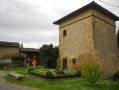
(1) Cross carefully, pass to the left of the bakery and carry on straight towards the two farms opposite. When you reach a junction, the Ferrière farm is on your left.

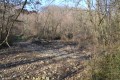
(2) Turn right, go round the back of the Degaud farm, then follow a path that branches off to the right and crosses a stream bed. Continue northwards across the fields, cross the Derroy, then follow the small road alongside the woodland until you reach the junction with the D538.

(3) Turn right and follow the road carefully for about 150 metres, then cross over and turn left onto the Chemin de Rouclavard. Turn right, leaving the small hamlet on your left; turn left at the junction, then left again about a hundred metres further on, heading back up into the woods. At the T-junction, turn left and continue uphill. You’ll reach a junction just before a footbridge.

(4) Turn 90° to the right, follow the edge of the woodland to the T-junction, turn left and then left again onto Chemin de Beaurepaire, heading towards Tourdan for about 200 metres.

(5) Turn right before the edge of the woodland to head back up onto the Châtelard plateau. Continue to the right at the junction, ignoring the path leading down to the left, and carry on to the crossroads.

(6) Turn right for about 200 m, then right again atthe first track. Continue through the woodland and then along the edge of the woodland until you reach the next junction.

(7) Turn left, ignore the path branching off immediately to the left and carry on straight ahead along the same track. Keep going straight south until you reach a tarmac road (Chemin de Rouclavard).

(8) Turn left for about 50 m and turn right at the houses. Ignore the path on the left, then head right towards the copses a few dozen metres further on. You’ll come out onto Route de Beaurepaire.

(9) Turn left, then right at the corner by the clump of trees; head right to follow the Ruisseau des Mats and, further on, join the Chemin du Poulet.

(10) Turn left and enter the Poulet neighbourhood; after the right-hand bend, you’ll reach the small square (S/E).

Waypoints

  1. S/E : mi 0 - alt. 955 ft - Place du Poulet
  2. 1 : mi 0.38 - alt. 955 ft - Roundabout
  3. 2 : mi 0.98 - alt. 932 ft - T-junction
  4. 3 : mi 1.98 - alt. 958 ft - D538 road - Derroy (cours d'eau) - Affluent du Dolon
  5. 4 : mi 2.89 - alt. 965 ft - Crossroads
  6. 5 : mi 3.56 - alt. 1,001 ft - Junction
  7. 6 : mi 4.31 - alt. 1,093 ft - Junction
  8. 7 : mi 4.63 - alt. 1,076 ft - Junction
  9. 8 : mi 5.2 - alt. 984 ft - Rouclavard path
  10. 9 : mi 5.73 - alt. 968 ft - Route de Beaurepaire
  11. 10 : mi 6.22 - alt. 955 ft - Chemin du Poulet
  12. S/E : mi 6.35 - alt. 955 ft - Place du Poulet

Notes

No special kit is required, apart from walking boots if it has rained within the last week.

(3) If it hasn’t rained for at least ten days, you can head straight down along the road, cross the stream bed, then cross the road further on and take the Rouclavard path.

To all the walkers who follow my routes, you’re welcome to post photos, indicating their location along the route.

Worth a visit

There’s a bakery at (1) for anyone who’s forgotten to bring a snack, a coffee or something to drink.

Reviews and comments

3.8 / 5
Based on 2 reviews

Reliability of the description
4 / 5
Ease of following the route
3.5 / 5
Route interest
4 / 5
User 22558487

Overall rating : 4.3 / 5

Date of your route : Oct 26, 2026
Reliability of the description : ★★★★★ Very good
Ease of following the route : ★★★★☆ Good
Route interest : ★★★★☆ Good
Very busy route : No

We parked near the bakery – a group of 20 people with 7 cars.
An easy walk, with plenty of paths.

Machine-translated

gilbert.agnes@orange.fr

Overall rating : 3.3 / 5

Date of your route : Jun 28, 2023
Reliability of the description : ★★★☆☆ Average
Ease of following the route : ★★★☆☆ Average
Route interest : ★★★★☆ Good
Very busy route : No

a detour from Moissieu, a good clear-out

Machine-translated

Other walks in the area

For more walks, use our search engine .

The GPS track and description are the property of this route's author. Please do not copy them without permission.