Circular walk above the vineyards of Ricey-Bas

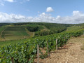
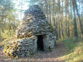
This family-friendly walk can be enjoyed in all seasons without any particular difficulty; it offers the chance to explore a vast expanse of vineyards in the Riceys area, following mostly tarmac-surfaced paths to reach what I call a clearly recognisable pass; a solitary tree and a winegrower’s hut stand out against the horizon, behind which you could descend towards the Sarce valley and the villages of Avirey Lingey and Bagneux-la-Fosse; from the ‘pass’ looking east, there is a sweeping view over the village of Ricey Bas and beyond towards other villages in the Bar region.

Details

n°39577530
Creation:
Last update:
Last review:
  • Walking
    Activity: Walking
  • ↔
    Distance: 6.01 mi
  • ◔
    Average duration: 3h 10 
  • ▲
    Difficulty: Moderate

  • ⚐
    Back to start: Yes
  • ↗
    Ascent: + 456 ft
  • ↘
    Descent: - 446 ft

  • ▲
    Highest point: 1,004 ft
  • ▼
    Lowest point: 571 ft
  • ⚐ Country: France
  • ⚐ City: Les Riceys (10340)
  • ⚑
    Start/End: N 48.004695° / E 4.36944°
  • ❏
    IGN map(s): Ref. 2819SB, 2919SB
  • Hour-by-hour weather

Photos

Description of the walk

The route starts at Ricey-Bas Church, where you can park.

(S/E) With your back to the church forecourt, take Rue de la Cure to see the building of the former Ricey Bas school. Turn left onto the tarmac road leading up towards Les Perrières and continue to the junction with Rue des Perrières.

(1) Turn left onto this road, then leave it to take a path on the right. You’ll reach a Y-junction near a clearing.

(2) Turn slightly to the right and cross the clearing to re-enter the woods. You will then come out onto a wider track.

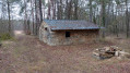
(3) Turn right onto it; 200 metres further on, pass the tarmac road on your right, which leads down to Ricey-bas. Continue along the vineyards. Walk up through the vineyard and pass a winegrowers’ hut, on which there are still some traces of paintings depicting the local winegrowers.

(4) After the hut, leave the track and take the path on the left – partly tarmac-surfaced – which follows the contour line above the vineyard. You’ll come to another tarmac road.

(5) Turn right onto it, continue round the top of the vineyards and carry on until you reach a small mound of earth which hides the entrance to a wooded area and a signposted short walking trail. Take this trail to reach the Y-junction.

(6) Keep to the right, walk along the edge of the woodland and, at the next junction, you’ll find yourself back in the vineyard. Go round the vines by turning right. Then pass a hut and a solitary tree marked ‘mon col’ and, at the edge of a copse, you’ll come to another junction.

(7) Carry on to the right and, following gently descending contour lines, pass between the vines and the woods, then reach a fork in the path where tracks come down from the top of the vineyards.

(8) Turn right to reach a ‘Stop’ sign on the D17.

(9) Cross the road carefully, pass the Les Riceys Fire Station, then head slightly to the right onto Rue du Pont.

(10) Turn left off this street onto the Chemin Rural de la Grande Lande. Follow the Laignes river; at the bridge, turn left and head towards the Pont Cocquart. Cross the bridge to easily reach the car park at Ricey Bas church (S/E).

Waypoints

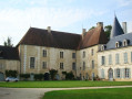
  1. S/E : mi 0 - alt. 574 ft - Car park at Ricey-Bas Church - Château de Ricey-Bas
  2. 1 : mi 0.18 - alt. 610 ft - Rue des Perrières
  3. 2 : mi 0.48 - alt. 741 ft - Access to the vineyard
  4. 3 : mi 0.83 - alt. 797 ft - Trail junction
  5. 4 : mi 1.31 - alt. 912 ft - Trail junction
  6. 5 : mi 1.86 - alt. 919 ft - Woodland and vineyards
  7. 6 : mi 2.62 - alt. 978 ft - Y-junction
  8. 7 : mi 3.26 - alt. 971 ft - Crossroads by the copse
  9. 8 : mi 4.33 - alt. 663 ft - Vineyard crossroads
  10. 9 : mi 5 - alt. 584 ft - D17
  11. 10 : mi 5.28 - alt. 577 ft - On the left after the bridge over the - Laigne (rivière) - Affluent de la Seine
  12. S/E : mi 6.01 - alt. 574 ft - Car park at Ricey-Bas Church

Worth a visit

Reviews and comments

4.7 / 5
Based on 1 review

Reliability of the description
5 / 5
Ease of following the route
5 / 5
Route interest
4 / 5
User 18215772

Overall rating : 4.7 / 5

Date of your route : Aug 12, 2025
Reliability of the description : ★★★★★ Very good
Ease of following the route : ★★★★★ Very good
Route interest : ★★★★☆ Good
Very busy route : No

Machine-translated

Other walks in the area

For more walks, use our search engine .

The GPS track and description are the property of this route's author. Please do not copy them without permission.