Circular route from La Malate to Montfaucon

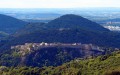
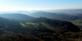
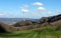
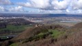
A mixed walk along roads and forest tracks. Descend by road bike to La Malate and climb back up via the castle and the Montfaucon viewpoint. The descent takes you through the Montfaucon woods with views across the whole of the Haut Doubs and the Jura mountains, and even as far as the Alps on a clear day. 

Details

n°75158360
Creation:
Last update:
Last review:
  • Walking
    Activity: Walking
  • ↔
    Distance: 7.88 mi
  • ◔
    Average duration: 4h 40 
  • ▲
    Difficulty: Average

  • ⚐
    Back to start: Yes
  • ↗
    Ascent: + 1,198 ft
  • ↘
    Descent: - 1,181 ft

  • ▲
    Highest point: 1,988 ft
  • ▼
    Lowest point: 801 ft
  • ⚐ Country: France
  • ⚐ City: Montfaucon (Doubs) (25660)
  • ⚑
    Start/End: N 47.232768° / E 6.08196°
  • Accessible from the train station Gare de Morre.
  • ❏
    IGN map(s): Ref. 3323ET
  • Hour-by-hour weather

Description of the walk

Park at the Salle des Fêtes car park in Montfaucon. 

(S/E) Return to Rue de la Vierge and turn right, following it to the junction. Then veer left onto Rue des Vignerons and continue to the D143 roundabout. Cross it on the left using the pedestrian crossing and carry on straight ahead until you reach the start of the left-hand bend. 

(1) Keep to the right to join the Chemin de Chevriot Dessus and pass the last houses. 

(2) Leave the road and head straight on along the track, which curves to the left a little further on before joining Morre at Rue de Saint-Fort.

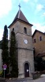
(3) Continue to the right, passing the town hall and the primary school, and carry on for about a hundred metres. 

(4) Turn right onto Rue du Traîne Bâton, which quickly becomes a footpath. Cross a small stream, return to the tarmac and carry on to the junction with the cycle route, facing the River Doubs. 

(5) Turn right, then take the first path on the left to reach the banks of the Doubs and the Chemin de la Malate. Turn right, follow the river as closely as possible and you’ll come out onto Rue de l’Aqueduc. 

(6) Carry on along the road in the same direction, passing a few houses, until you reach the bend marked on the left, with the mast in view. 

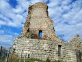
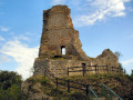
(7) Leave the cycle route by turning right onto the Chemin des Buis and head up towards Montfaucon Castle. 

(8) Turn left towards the viewpoint and follow the main path, ignoring the side paths on either side. You’ll reach a junction with a wider path.

(9) Keep to the right, pass the climbing cliff and reach the viewpoint just before the château. 

(10) Go round the viewpoint on the left, come out onto the access road and follow it, turning right. 

(11) Leave the road by veering to the right to walk alongside the Redoute de Montfaucon and the radio mast, leading to the viewpoint and the car park. 

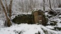
(12) Enjoy the view over the Doubs, then rejoin the access road to the château. Follow it towards the château, then leave it to take a path branching off to the right a few dozen metres from the (11). Follow this path to reach the hunting lodge. 

(13) Continue on until you reach the junction with the Chemin du Mont at the edge of the woods.

(14) Make a short left-right turn to join a narrow tarmac track. Keep to the right at the three-way junction about fifty metres further on, then turn right again to go round the Combe aux Bâtards. Follow this path, which runs through the upper part of the Bois de la Ratte and leads to the first houses in Montfaucon, which you’ll reach at the Rue de la Sablonnière.

(15) Continue left, going down this street to the junction with Rue du Comte de Montbéliard. 

(16) Turn left and follow this street, which takes you straight back to the Salle des Fêtes car park (S/E). 

Waypoints

  1. S/E : mi 0 - alt. 1,568 ft - Salle des Fêtes car park
  2. 1 : mi 0.37 - alt. 1,575 ft - Junction, turn right
  3. 2 : mi 0.59 - alt. 1,437 ft - Exit the route, straight ahead
  4. 3 : mi 0.95 - alt. 1,178 ft - Morre, Rue de Saint-Fort
  5. 4 : mi 1.19 - alt. 1,158 ft - Rue du Traîne Bâton
  6. 5 : mi 1.69 - alt. 817 ft - Road cycle junction, on the right
  7. 6 : mi 2.31 - alt. 807 ft - Rue de l’Aqueduc
  8. 7 : mi 2.72 - alt. 823 ft - Road bike drop-off point, on the right
  9. 8 : mi 3.55 - alt. 1,486 ft - Montfaucon Castle, on the left
  10. 9 : mi 4.11 - alt. 1,690 ft - Junction, turn right
  11. 10 : mi 4.36 - alt. 1,890 ft - Montfaucon Fort, viewpoint
  12. 11 : mi 4.92 - alt. 1,962 ft - Redoute de Montfaucon
  13. 12 : mi 5.15 - alt. 1,959 ft - Viewpoint
  14. 13 : mi 6 - alt. 1,883 ft - Hunting lodge
  15. 14 : mi 6.19 - alt. 1,844 ft - Chemin du Mont
  16. 15 : mi 7.37 - alt. 1,663 ft - Montfaucon, Rue de la Sablonnière
  17. 16 : mi 7.66 - alt. 1,621 ft - Rue du Comte de Montbéliard
  18. S/E : mi 7.88 - alt. 1,568 ft - Salle des Fêtes car park

Notes

Wear sturdy shoes if the weather and ground are wet; walking poles may be useful. 

Worth a visit

Restaurant and bar at La Malate. 

Reviews and comments

4.3 / 5
Based on 2 reviews

Reliability of the description
4 / 5
Ease of following the route
4 / 5
Route interest
5 / 5
jcjcb
jcjcb
• Edited:

Overall rating : 4.3 / 5

Date of your route : Apr 07, 2026
Reliability of the description : ★★★★☆ Good
Ease of following the route : ★★★★☆ Good
Route interest : ★★★★★ Very good
Very busy route : Yes

Stunning views on both sides of the hill.

Machine-translated

Asso Palente
Asso Palente
• Edited:

Overall rating : 4.3 / 5

Date of your route : Oct 14, 2025
Reliability of the description : ★★★★☆ Good
Ease of following the route : ★★★★☆ Good
Route interest : ★★★★★ Very good
Very busy route : No

Superb hike and interesting route. However, having done it twice in three days, to scout it out and lead a group, I noticed a discrepancy in the mileage and elevation gain.
1/ Distance: 14.5 km, which is almost 2 km more
2/ Elevation gain: 430/470 m, a difference of 80/100 m.

That's all for these comments.

Machine-translated

Other walks in the area

For more walks, use our search engine .

The GPS track and description are the property of this route's author. Please do not copy them without permission.