Route of boundary stones starting from Rougemont-le-Château

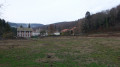
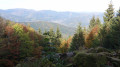
A pleasant walk offering the chance to discover lovely countryside and woodland scenery, as well as some stunning views of the Vosges and the Jura.
The walk is mainly on tarmac roads.
The walk is signposted with a Yellow Ring.

Details

n°1725603
Creation:
Last update:
Last review:
  • Walking
    Activity: Walking
  • ↔
    Distance: 4.00 mi
  • ◔
    Average duration: 2h 00 
  • ▲
    Difficulty: Easy

  • ⚐
    Back to start: Yes
  • ↗
    Ascent: + 148 ft
  • ↘
    Descent: - 141 ft

  • ▲
    Highest point: 1,526 ft
  • ▼
    Lowest point: 1,342 ft

Photos

Description of the walk

Park in the car park by the church in Rougemont-le-Château.

The walk is signposted with a Yellow Ring.

(S/E) Set off to the left and then left again at the roundabout. Turn right after No. 2 Avenue Jean Moulin and take a lovely path between the houses. Cross the River Saint-Nicolas and walk down along its right bank. Continue along Allée Gaston et Victor Ehrard.

(1) At the junction, turn right along Avenue Jean Moulin and follow it into Leval. Continue to the Y-junction with Rue du Pont.

(2) Turn left at the hairpin bend. Continue along this road through the countryside and cross the River Saint-Nicolas again. Reach the junction with the D15.

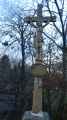
(3) Turn right onto this road. Continue alongside the river. You’ll reach the junction with Rue des Étangs, marked by a beautiful cross. Turn left here and proceed to the junction with Chemin des Rouges Champs.

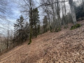
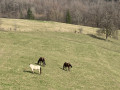
(4) Turn left onto this track. Walk alongside some superb ponds and enter the forest. The tarmac road turns into a stony track. Follow the signposts carefully. The track crosses through the forest and pastures, with well-maintained paths. On leaving the forest, you’ll come to lovely pastures with horses, donkeys and ponies.

(5) Keep a close eye on the signposts to turn right at this junction. Stunning view. Head up the small road. Join the D2 or Rue de Masevaux.

(6) Turn left onto the D2 and follow it to the church and the car park at the start (D//A).

Waypoints

  1. S/E : mi 0 - alt. 1,483 ft - Car park - Église Saint-Pierre (Rougemont-le-Château)
  2. 1 : mi 0.41 - alt. 1,430 ft - Avenue Jean Moulin D25 - Saint-Nicolas (rivière) - Affluent de la Bourbeuse
  3. 2 : mi 1.04 - alt. 1,404 ft - Junction: Rue des Vosges and Rue du Pont
  4. 3 : mi 1.61 - alt. 1,378 ft - Rue Principale D15
  5. 4 : mi 2.22 - alt. 1,348 ft - Chemin des Rouges Champs
  6. 5 : mi 3.21 - alt. 1,476 ft - Crossroads in the middle of the pastures
  7. 6 : mi 3.57 - alt. 1,526 ft - Rue de Masevaux D2
  8. S/E : mi 4 - alt. 1,483 ft - Car park - Église Saint-Pierre (Rougemont-le-Château)

Notes

(4) We arrive at the foothills of the Vosges; the soil is red.

(Between 6 and S/E) As you pass by, don’t miss the information panel and the various old boundary stones on display in front of the community centre.

You can reach the starting point by bus routes 21–32 or 91, getting off at the Bavière stop. For further details, visit the Optymo website

Along the route, you’ll be able to see an exhibition of large photographs of old postcards.

Visorando was provided with information by Mr Chevalley, a volunteer member of Balisage90.
This walk was created by the South Vosges Community of Communes.

Worth a visit

Rougemont-le-Château

Place-name history: Rubeo monte (1105/1234), Rotinberc (1278), Roigemont (1295/1309), Rotenburg (1337), Rotenberg (1366), Rottenbergk mit dem ganzen Rottenbergerthal (1579), Rougemont (1793), Rougemont-le-Château (1893). In German: Rothenberg or Rothenburg.
The village is situated at the foot of the Southern Vosges, at the junction of two ancient Roman roads, one of which linked Langres to Strasbourg, running alongside the Vosges mountain range, whilst the other came from Belfort after passing through Offemont. Late10th century: Count Frédéric II de Ferrette built the fortified castle situated on a rocky outcrop (Montagne des Boules, 736 m above sea level) overlooking the village. Given its small size, it could only accommodate a dozen people. The castle was destroyed in 1375 by the forces of Enguerrand de Coucy. The significant archaeological finds of a military, civil and religious nature uncovered during the excavations are housed in the Belfort Museum.
1913: Rougemont was linked to Belfort by a local railway. This metre-gauge line, which joined the Belfort–Sentheim (Haut-Rhin) line at the Errues junction, played a crucial role during the 1914–1918 conflict.
Source: Wikipedia
Saint-Pierre Church: built between 1853 and 1868 using pink Vosges sandstone from the quarries at Romagny, Leval and Offemont.

The ‘House of Watering Cans’ in Rougemont.
It’s hard not to be captivated by this florist’s shop and the magic of its world. The owner has scattered watering cans all around and across the façade of his shop. It’s a world straight out of Alice in Wonderland (address: 1 Rue Leval, Rougemont-le-Château).

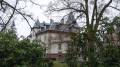
Château Erhard

In 1845, Victor Erhard began building a mechanical weaving mill with 200 looms on a plot of land he had just purchased. The looms were to be powered by a water wheel. From 1847, however, he used a steam engine to act as an auxiliary power source for the wheel. Since 1859, the weaving mill has been supplied by a spinning mill built by the company in Masevaux (68).
The owner’s residence, built of cut stone and rendered sandstone rubble, comprises a basement, a ground floor, a square first floor and an attic floor, with a roof featuring long broken gables, a hipped roof and a half-hipped roof, as well as a pavilion roof, all covered in slate.
The Erhard cotton weaving mill became the Manufacture de Rougemont, then the Filiac small-scale metalworking factory
(Before No. 1) You pass it as you walk along Allée Gaston et Victor Ehrard.
Source: Heritage in Burgundy-Franche-Comté

Leval

Place-name etymology: Thal, Thal zu Brunn, Rothenburger Thal (1628), Leval sous Rougemont (1793)
Following the defeat of 1871, Leval was one of four communes detached from the canton of Masevaux – which remained part of Alsace – to form the canton of Rougemont. The population has changed little over time.
The parishioners of Leval were entirely under the jurisdiction of Angeot until the establishment of the parish of Rougemont-le-Château; they were then divided between Angeot and Rougemont until 1772, when the village was incorporated into the parish of Rougemont.
Source: Wikipedia

Reviews and comments

4.7 / 5
Based on 1 review

Reliability of the description
5 / 5
Ease of following the route
5 / 5
Route interest
4 / 5
Cathy90
Cathy90

Overall rating : 4.7 / 5

Date of your route : Dec 04, 2023
Reliability of the description : ★★★★★ Very good
Ease of following the route : ★★★★★ Very good
Route interest : ★★★★☆ Good
Very busy route : Yes

A very pleasant route in the snow, very easy (apart from one very short, slightly steep descent), alternating between tarmac roads and footpaths, and even a stretch through a pasture.

Machine-translated

Other walks in the area

For more walks, use our search engine .

The GPS track and description are the property of this route's author. Please do not copy them without permission.